Sweetwater County, Wyoming facts for kids
Quick facts for kids
Sweetwater County
|
||
|---|---|---|

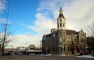
Rock Springs City Hall, 2007
|
||
|
||

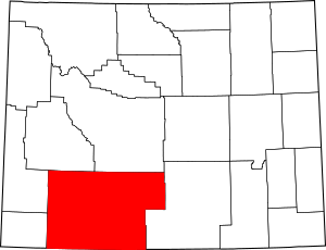
Location within the U.S. state of Wyoming
|
||
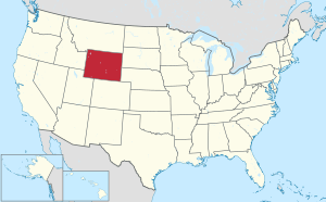
 Wyoming's location within the U.S. |
||
| Country | ||
| State | ||
| Founded | December 17, 1867 | |
| Named for | Sweetwater River | |
| Seat | Green River | |
| Largest city | Rock Springs | |
| Area | ||
| • Total | 10,491 sq mi (27,170 km2) | |
| • Land | 10,427 sq mi (27,010 km2) | |
| • Water | 64 sq mi (170 km2) 0.6%% | |
| Population
(2020)
|
||
| • Total | 42,272 | |
| • Estimate
(2023)
|
41,249 | |
| • Density | 4.02936/sq mi (1.55574/km2) | |
| Time zone | UTC−7 (Mountain) | |
| • Summer (DST) | UTC−6 (MDT) | |
| Area code | 307 | |
| Congressional district | At-large | |
Sweetwater County is a large county located in southwestern Wyoming, United States. It is the biggest county in Wyoming by land area. The county's southern border touches the states of Colorado and Utah.
As of 2020, about 42,272 people lived here. This makes it the fourth-most populated county in Wyoming. The main town and county seat is Green River. The county also includes the areas around Rock Springs and Green River.
Contents
History of Sweetwater County
Sweetwater County has a long and interesting history. It was first created on December 17, 1867. At that time, it was part of the Dakota Territory. The county was formed from a part of Laramie County.
How Sweetwater County Got Its Name
The county was first named Carter County. It was named after Judge W.A. Carter from Fort Bridger. But in 1869, the new government of the Wyoming Territory changed the name. They renamed it Sweetwater County after the Sweetwater River.
Changes to County Borders
Over the years, the size of Sweetwater County changed several times.
- In 1869, some land was given to create Uinta County.
- In 1875, parts of Sweetwater and Carbon counties formed Johnson County.
- In 1884, Sweetwater County lost more land when Fremont County was created.
- Its border with Carbon County was also adjusted in 1886.
- There were other small border changes in 1909, 1911, and 1951.
County Seat Locations
The county seat is the main town where the county government is located.
- From 1867 to 1873, South Pass City was the county seat.
- In 1873, the county seat was moved to Green River, where it remains today.
Geography of Sweetwater County
Sweetwater County is very large. It covers about 10,491 square miles (27,171 square kilometers). Most of this area is land, with only a small part being water. It is bigger than six different U.S. states! It is also the eighth-largest county in the entire United States.
Key Geographic Features
A big part of the Great Divide Basin is located within Sweetwater County. This basin covers the northeast section of the county. The Continental Divide also runs through the county. This is a line where water on one side flows to the Atlantic Ocean, and water on the other side flows to the Pacific Ocean.
Neighboring Counties
Sweetwater County shares borders with many other counties:
- Fremont County (north)
- Carbon County (east)
- Moffat County, Colorado (south)
- Daggett County, Utah (southwest)
- Summit County, Utah (west-southwest)
- Uinta County (southwest)
- Lincoln County (west)
- Sublette County (northwest)
Main Roads and Highways
Several important highways pass through Sweetwater County, connecting it to other areas:
 Interstate 80
 I-80 Bus.
 I-80 Bus.
 U.S. Highway 30
 U.S. Highway 191
 Wyoming Highway 28
 Wyoming Highway 370
 Wyoming Highway 371
 Wyoming Highway 372
 Wyoming Highway 414
 Wyoming Highway 430
 Wyoming Highway 530
 Wyoming Highway 789
Protected Natural Areas
Sweetwater County is home to parts of several protected natural areas. These places help keep nature safe and beautiful.
- Ashley National Forest (part)
- Flaming Gorge National Recreation Area (part)
- Seedskadee National Wildlife Refuge
Population and People
| Historical population | |||
|---|---|---|---|
| Census | Pop. | %± | |
| 1870 | 1,916 | — | |
| 1880 | 2,561 | 33.7% | |
| 1890 | 4,941 | 92.9% | |
| 1900 | 8,455 | 71.1% | |
| 1910 | 11,575 | 36.9% | |
| 1920 | 13,640 | 17.8% | |
| 1930 | 18,165 | 33.2% | |
| 1940 | 19,407 | 6.8% | |
| 1950 | 22,017 | 13.4% | |
| 1960 | 17,920 | −18.6% | |
| 1970 | 18,391 | 2.6% | |
| 1980 | 41,723 | 126.9% | |
| 1990 | 38,823 | −7.0% | |
| 2000 | 37,613 | −3.1% | |
| 2010 | 43,806 | 16.5% | |
| 2020 | 42,272 | −3.5% | |
| 2023 (est.) | 41,249 | −5.8% | |
| US Decennial Census 1870–2000 2010–2020 |
|||
2010 Census Information
In 2010, there were 43,806 people living in Sweetwater County. There were 16,475 households and 11,405 families. The average household had about 2.62 people. The average age of people in the county was 32.8 years old.
Most people in the county were white (88.5%). About 15.3% of the population was of Hispanic or Latino background. Many people had ancestors from Germany (22.4%), England (19.0%), or Ireland (13.0%).
Religion in Sweetwater County
Religion in Sweetwater County, according to ARDA (2020) Catholic Church (21.1%) LDS Church (14.7%) Evangelical Churches (6.7%) Mainline Protestant Churches (1.9%) Orthodox Church (0.1%) Others (0.6%) None* (54.9%)
- The "Nones" category includes people who do not identify with a specific religion. Many of these people still hold spiritual beliefs.
Education in Sweetwater County
Sweetwater County has several school districts that serve its students.
- Sweetwater County School District Number 1
- Sweetwater County School District Number 2
- Carbon County School District 1
Some students in Sweetwater County School District 2 can choose to attend schools in Utah. For example, students from Washam, Wyoming and McKinnon, Wyoming may go to schools in the Daggett School District in Utah.
Sweetwater County is also home to Western Wyoming Community College. This college is located in Rock Springs and offers higher education.
Communities in Sweetwater County
Sweetwater County has several cities, towns, and smaller communities.
Cities
- Green River (the county seat)
- Rock Springs
Towns
Census-Designated Places
These are areas identified by the U.S. Census Bureau for statistical purposes.
- Arrowhead Springs
- Clearview Acres
- Eden
- Farson
- James Town
- Little America
- McKinnon
- North Rock Springs
- Point of Rocks
- Purple Sage
- Reliance
- Table Rock
- Washam
Other Small Communities
These are other places where people live, but they are not officially cities or towns.
- Blairtown
- Creston
- Quealy
- Red Desert
- Riner
- Sweeney Ranch
Ghost Towns
These are towns that used to be active but are now mostly abandoned.
- Bryan
- Linwood (mostly in Utah)
- Table Rock
- Winton
Media in Sweetwater County
Sweetwater County has its own local news sources.
Print Newspapers
- Rock Springs Daily Rocket-Miner
- The Green River Star (a weekly newspaper from Green River)
Online News Websites
You can also find local news online at:
- SweetwaterNOW.com
- wyo4news.com
See also
 In Spanish: Condado de Sweetwater para niños
 | DeHart Hubbard |
 | Wilma Rudolph |
 | Jesse Owens |
 | Jackie Joyner-Kersee |
 | Major Taylor |


