Sublette County, Wyoming facts for kids
Quick facts for kids
Sublette County
|
|
|---|---|

|
|

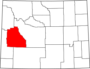
Location within the U.S. state of Wyoming
|
|
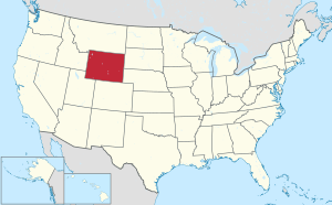
 Wyoming's location within the U.S. |
|
| Country | |
| State | |
| Founded | February 15, 1921(authorized) 1923 (organized) |
| Named for | William Sublette |
| Seat | Pinedale |
| Largest town | Pinedale |
| Area | |
| • Total | 4,936 sq mi (12,780 km2) |
| • Land | 4,887 sq mi (12,660 km2) |
| • Water | 49 sq mi (130 km2) 1.0%% |
| Population
(2020)
|
|
| • Total | 8,728 |
| • Density | 1.76823/sq mi (0.68272/km2) |
| Time zone | UTC−7 (Mountain) |
| • Summer (DST) | UTC−6 (MDT) |
| Congressional district | At-large |
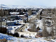
Sublette County is a special area, or 'county,' located in the state of Wyoming, USA. In 2020, about 8,728 people lived here. The main town, where the county government is, is called Pinedale. It is a quiet, countryside county in western Wyoming, right by the Green River.
Contents
History of Sublette County
Sublette County was officially started on February 15, 1921. It was made from parts of Fremont and Lincoln counties. The county government was fully set up by 1923.
Before towns were built, the mountains of western Wyoming were explored by fur trappers and traders. These people caught animals for their fur. Sublette County is named after one of these early explorers, William Lewis Sublette. Today, the county celebrates its fur trade history at the Museum of the Mountain Man in Pinedale.
In the early 1900s, many people living in what is now Sublette County were immigrants. They came from countries like England and Germany. During World War I, most people in the county supported America joining the war. They were known for being friendly towards England. German immigrants in the county also liked England, even though they wanted America to stay out of the war. People from England and Germany in Sublette County got along very well, which was not always common across the country during that time.
Geography and Nature
According to the US Census Bureau, Sublette County covers about 4,936 square miles. Most of this area, about 4,887 square miles, is land. The rest, about 49 square miles, is water.
Neighboring Counties
Sublette County shares borders with these other counties:
- Fremont County to the east
- Sweetwater County to the southeast
- Lincoln County to the southwest
- Teton County to the northwest
Protected Natural Areas
Parts of these national forests are located in Sublette County:
- Bridger National Forest
- Shoshone National Forest
- Teton National Forest
Today, the Bridger National Forest and Teton National Forest are managed together as the Bridger-Teton National Forest. Sublette County includes parts of both these original forests.
People and Population
| Historical population | |||
|---|---|---|---|
| Census | Pop. | %± | |
| 1930 | 1,944 | — | |
| 1940 | 2,778 | 42.9% | |
| 1950 | 2,481 | −10.7% | |
| 1960 | 3,778 | 52.3% | |
| 1970 | 3,755 | −0.6% | |
| 1980 | 4,548 | 21.1% | |
| 1990 | 4,843 | 6.5% | |
| 2000 | 5,920 | 22.2% | |
| 2010 | 10,247 | 73.1% | |
| 2020 | 8,728 | −14.8% | |
| 2023 (est.) | 8,969 | −12.5% | |
| US Decennial Census 1870–2000 2010–2016 |
|||
Population in 2020
In the 2020 United States Census, there were 8,728 people living in Sublette County. There were also 3,337 households, which are groups of people living together in one home.
Population in 2010
In the 2010 United States Census, there were 10,247 people in the county. Most people were white (93.2%). Other groups included American Indian (0.8%), Asian (0.5%), and Black or African American (0.3%). About 6.9% of the population was of Hispanic or Latino background.
Towns and Communities
Towns
Census-Designated Places
These are areas that are like towns but are not officially incorporated as cities or towns:
Unincorporated Community
Education
Children in Sublette County go to schools in two main school districts:
- Sublette County School District 1
- Sublette County School District 9
See also
 In Spanish: Condado de Sublette (Wyoming) para niños
 | Jessica Watkins |
 | Robert Henry Lawrence Jr. |
 | Mae Jemison |
 | Sian Proctor |
 | Guion Bluford |


