Boulder, Wyoming facts for kids
Quick facts for kids
Boulder, Wyoming
|
|
|---|---|

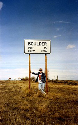
Sign at the edge of the community
|
|

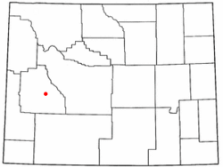
Location of Boulder, Wyoming
|
|
| Country | United States |
| State | Wyoming |
| County | Sublette |
| Area | |
| • Total | 1.9 sq mi (5 km2) |
| • Land | 1.9 sq mi (5 km2) |
| • Water | 0.0 sq mi (0 km2) |
| Elevation | 7,018 ft (2,139 m) |
| Population
(2010)
|
|
| • Total | 170 |
| • Density | 89/sq mi (34.5/km2) |
| Time zone | UTC-7 (Mountain (MST)) |
| • Summer (DST) | UTC-6 (MDT) |
| ZIP code |
82923
|
| Area code(s) | 307 |
| FIPS code | 56-09235 |
| GNIS feature ID | 1585799 |
Boulder is a small community in Sublette County, Wyoming, in the United States. It's known as a census-designated place (CDP), which means it's a special area defined for gathering population information. In 2010, about 170 people lived there.
Contents
Where is Boulder, Wyoming?
Boulder is located in the western part of Wyoming. It sits at coordinates 42.748164 degrees North and -109.712828 degrees West. The community covers a total area of 1.9 square miles (about 4.8 square kilometers), and all of it is land.
What is the climate like in Boulder?
Boulder has a type of weather called a Continental climate. This means it has long, cold, and dry winters. The summers are usually short and warm.
| Climate data for Boulder, Wyoming, 1991–2020 normals, extremes 1989–present | |||||||||||||
|---|---|---|---|---|---|---|---|---|---|---|---|---|---|
| Month | Jan | Feb | Mar | Apr | May | Jun | Jul | Aug | Sep | Oct | Nov | Dec | Year |
| Record high °F (°C) | 49 (9) |
53 (12) |
69 (21) |
77 (25) |
78 (26) |
94 (34) |
94 (34) |
93 (34) |
91 (33) |
81 (27) |
67 (19) |
56 (13) |
94 (34) |
| Mean maximum °F (°C) | 39.7 (4.3) |
42.7 (5.9) |
55.5 (13.1) |
69.5 (20.8) |
77.2 (25.1) |
84.4 (29.1) |
88.9 (31.6) |
87.6 (30.9) |
83.0 (28.3) |
73.5 (23.1) |
58.3 (14.6) |
44.0 (6.7) |
89.6 (32.0) |
| Mean daily maximum °F (°C) | 27.2 (−2.7) |
30.8 (−0.7) |
41.7 (5.4) |
53.1 (11.7) |
62.8 (17.1) |
72.9 (22.7) |
81.5 (27.5) |
80.5 (26.9) |
71.2 (21.8) |
57.9 (14.4) |
41.5 (5.3) |
29.2 (−1.6) |
54.2 (12.3) |
| Daily mean °F (°C) | 9.9 (−12.3) |
13.1 (−10.5) |
25.5 (−3.6) |
36.5 (2.5) |
45.6 (7.6) |
54.3 (12.4) |
61.1 (16.2) |
59.5 (15.3) |
50.8 (10.4) |
38.8 (3.8) |
24.7 (−4.1) |
12.5 (−10.8) |
36.0 (2.2) |
| Mean daily minimum °F (°C) | −7.4 (−21.9) |
−4.6 (−20.3) |
9.3 (−12.6) |
19.9 (−6.7) |
28.4 (−2.0) |
35.7 (2.1) |
40.8 (4.9) |
38.6 (3.7) |
30.3 (−0.9) |
19.7 (−6.8) |
7.9 (−13.4) |
−4.1 (−20.1) |
17.9 (−7.8) |
| Mean minimum °F (°C) | −27.1 (−32.8) |
−24.2 (−31.2) |
−11.5 (−24.2) |
8.1 (−13.3) |
16.6 (−8.6) |
26.1 (−3.3) |
33.1 (0.6) |
29.1 (−1.6) |
20.5 (−6.4) |
6.0 (−14.4) |
−11.2 (−24.0) |
−22.7 (−30.4) |
−31.3 (−35.2) |
| Record low °F (°C) | −44 (−42) |
−38 (−39) |
−29 (−34) |
−8 (−22) |
9 (−13) |
18 (−8) |
25 (−4) |
23 (−5) |
12 (−11) |
−17 (−27) |
−27 (−33) |
−52 (−47) |
−52 (−47) |
| Average precipitation inches (mm) | 0.48 (12) |
0.51 (13) |
0.53 (13) |
0.88 (22) |
1.44 (37) |
1.26 (32) |
0.71 (18) |
0.73 (19) |
1.00 (25) |
0.88 (22) |
0.45 (11) |
0.46 (12) |
9.33 (236) |
| Average snowfall inches (cm) | 6.8 (17) |
7.3 (19) |
5.3 (13) |
4.9 (12) |
1.9 (4.8) |
0.2 (0.51) |
0.0 (0.0) |
0.0 (0.0) |
0.3 (0.76) |
3.6 (9.1) |
4.9 (12) |
6.9 (18) |
42.1 (106.17) |
| Average extreme snow depth inches (cm) | 8.6 (22) |
10.7 (27) |
9.7 (25) |
3.1 (7.9) |
0.9 (2.3) |
0.1 (0.25) |
0.0 (0.0) |
0.0 (0.0) |
0.1 (0.25) |
2.3 (5.8) |
3.1 (7.9) |
6.0 (15) |
11.7 (30) |
| Average precipitation days (≥ 0.01 in) | 6.3 | 6.0 | 5.4 | 6.8 | 8.8 | 6.9 | 5.3 | 5.7 | 6.7 | 5.2 | 5.2 | 6.6 | 74.9 |
| Average snowy days (≥ 0.1 in) | 4.9 | 5.0 | 3.8 | 2.9 | 0.9 | 0.2 | 0.0 | 0.0 | 0.2 | 1.6 | 3.8 | 5.3 | 28.6 |
| Source 1: NOAA | |||||||||||||
| Source 2: National Weather Service | |||||||||||||
Air Quality in Boulder
Since 2008, the air quality in Boulder and nearby areas has sometimes been unhealthy. This is mainly due to something called ground-level ozone. This ozone forms when pollution from things like natural gas drilling mixes with sunlight. The drilling happens in nearby areas like Jonah Field and the Pinedale Anticline.
Education in Boulder
Kids living in Boulder go to public schools managed by Sublette County School District #1.
See also
 In Spanish: Boulder (Wyoming) para niños
 | Chris Smalls |
 | Fred Hampton |
 | Ralph Abernathy |


