Shoshone National Forest facts for kids
Quick facts for kids Shoshone National Forest |
|
|---|---|
|
IUCN Category VI (Managed Resource Protected Area)
|
|
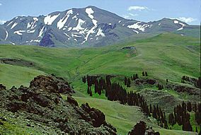
Eagle Peak is the tallest peak in the Absaroka Range
|
|
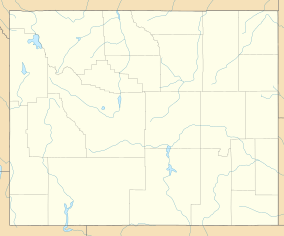
| Location | Park, Fremont, Hot Springs, Sublette, and Teton counties, Wyoming, US |
| Nearest city | Cody, WY |
| Area | 2,469,248 acres (9,992.69 km2) |
| Established | March 3, 1891 |
| Governing body | U.S. Forest Service |
| Website | Shoshone National Forest |
The Shoshone National Forest is super special! It was the very first National Forest in the United States. This huge area covers almost 2.5 million acres (about 10,000 square kilometers) in Wyoming.
It was created way back in 1891 by President Benjamin Harrison. This made it one of the first protected land areas anywhere in the world. Native Americans have lived here for at least 10,000 years. Today, the forest is still wild and beautiful. It's part of the Greater Yellowstone Ecosystem, a massive area of protected lands.
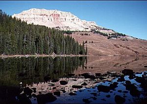
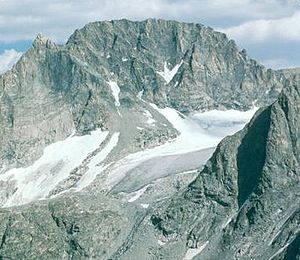
The forest has amazing mountains like the Absaroka, Beartooth, and Wind River Range. Gannett Peak, Wyoming's tallest mountain, is found here. To the west, it borders Yellowstone National Park. The Continental Divide also runs through it.
Shoshone National Forest is home to almost every animal species found in North America. You can see grizzly bears, black bears, wolves, moose, elk, and the largest group of bighorn sheep in the lower 48 states. Its rivers are great for fishing, especially for Yellowstone cutthroat trout. With over 1,300 miles (2,100 km) of trails and 32 campgrounds, there are tons of ways to explore this incredible place.
Contents
A Look at Human History
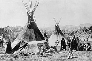
The Shoshone National Forest is named after the Shoshone Indians. Other Native American groups, like the Lakota, Crow, and Northern Cheyenne, also lived here. Scientists have found proof that people have been in this area for at least 10,000 years. The forest offered plenty of food, wood, and shelter.
By the 1840s, Washakie became a leader of the eastern Shoshone. He worked with the U.S. Government to protect tribal lands. Today, part of this land is the Wind River Indian Reservation. It belongs to the Shoshone and Arapahoe Indians.
Ancient Discoveries at Mummy Cave
In 1957, a special place called Mummy Cave was found near the forest. Archeologists dug there in the 1960s. They discovered that people lived in the cave for over 9,000 years! They found ancient stone tools and other items. The oldest things were from about 7,300 BC. They even found the mummified remains of a person from 800 AD. Mummy Cave is a very important historical site.
Early Explorers and Mountain Men
In the early 1800s, brave explorers like John Colter and Jim Bridger visited the forest. Colter was the first known white person to explore this region. He was even part of the famous Lewis and Clark Expedition. Colter survived a grizzly bear attack and a chase by Blackfeet Indians. He shared his discoveries with William Clark.
Later, fur trappers like Manuel Lisa and Jim Bridger explored more of the area. In 1860, the Raynolds Expedition passed through parts of the forest. This expedition included a geologist named Ferdinand Vandeveer Hayden. His work helped show that the forest was a valuable place that needed protection.
Fort Washakie and the Buffalo Soldiers
Before the Wind River Indian Reservation was set up, the U.S. Cavalry built Fort Brown. It was later renamed Fort Washakie. African-American soldiers, known as the Buffalo Soldiers, served here. Chief Washakie is buried at the fort.
Mining and the Great Depression
In the late 1800s, people tried to mine for gold in the forest. It wasn't very successful, and the last mine closed in 1907. Today, you can still pan for gold in some areas without a permit.
During the Great Depression in the 1930s, the Civilian Conservation Corps (CCC) set up camps here. Unemployed men worked for the government. They built roads, hiking trails, and campgrounds. This helped people find jobs and made the forest more accessible for visitors.
How the National Forest Was Created
In 1891, a law called the Forest Reserve Act of 1891 was passed. This law allowed the president to set aside public land for forests. President Benjamin Harrison used this law to create the Yellowstone Timberland Reserve. This was the very first forest reserve in the nation.
In 1902, President Theodore Roosevelt made the reserve much bigger. He then divided it into four separate parts, with Shoshone being the largest. In 1905, the U.S. Forest Service was created. The reserve officially became a National Forest.
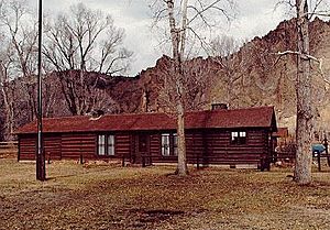
The Wapiti Ranger Station, built in 1903, is west of Cody, Wyoming. It's the oldest surviving ranger station in any national forest. Today, it's a National Historic Landmark.
Managing the Forest
The United States Forest Service manages Shoshone National Forest. This agency is part of the U.S. Department of Agriculture. The forest has five different districts. Its main office and a visitor center are in Cody, Wyoming. There are also offices in Dubois and Lander.
The Forest Service works to protect the forest's resources. They make sure that some materials, like wood for building and paper, can be used sustainably. They also allow some ranching, where cattle and sheep graze. The Forest Service sets rules to prevent overuse of resources. This helps make sure these resources are available for future generations.
Amazing Natural Resources
Shoshone National Forest is a key part of the Greater Yellowstone Ecosystem. This area has over 1,700 different kinds of plants!
Plant Life and Reproduction
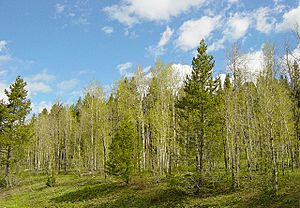
The forest has many different types of plants because its elevation changes so much. Lower areas have sagebrush and grasses. Higher up, you'll find forests of lodgepole pine, Rocky Mountain juniper, and quaking aspen. Even higher, there are subalpine fir, Engelmann spruce, and whitebark pine. Above the tree line, where trees can't grow, you'll see mostly rock and ice.
Some plants are unique to this region, like the whitlow grass and the north fork Easter daisy. They create beautiful white and yellow flowers in spring and summer.
Unfortunately, some plants that aren't native to the area, called exotic species, are causing problems. These include Canada thistle and Musk thistle. They can harm the native plants and animals.
Native insects, like the mountain pine beetle, also affect the trees. These beetles have damaged over 1 million acres (4,000 square kilometers) of forest. The Forest Service uses controlled burns and other methods to manage this problem.
Animal Life and Life Cycle
Shoshone National Forest is home to all 70 mammal species that lived here before settlers arrived. This includes the endangered gray wolf, which returned after a successful program in Yellowstone. In total, over 335 types of wildlife live here. It has the largest group of Bighorn sheep and is one of the last places to find grizzly bears in the lower U.S.
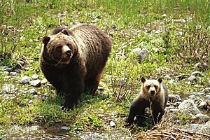
About 700 grizzly bears live in the Greater Yellowstone Ecosystem. The forest is a safe haven for them. To keep people and bears safe, "nuisance bears" are sometimes moved to remote areas. Visitors must store food safely in special containers or vehicles.
Large predators like cougars and wolves also live here. Wolves have formed permanent packs in the forest since the 1990s. Wolverines are rare and hard to spot. The Canada lynx is also a threatened species here. Other meat-eating mammals include coyotes, bobcats, and badgers.
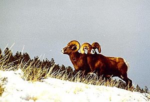
You'll also find plant-eating animals like moose, elk, and mule deer. Moose numbers have been decreasing, but elk and deer are very common. Bighorn sheep and mountain goats live in the rocky, high-up areas. Bison and pronghorn antelope also have healthy populations.
Over 300 kinds of birds visit the forest each year. You might see bald eagles, peregrine falcons, and great blue herons.
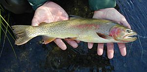
The forest's waters are full of fish, including six types of trout. The Yellowstone cutthroat trout is common in the Greater Yellowstone Ecosystem.
There are also many reptiles, like the prairie rattlesnake at lower elevations. You might see western painted turtles and various lizards. Amphibians like the Columbia spotted frog and boreal toad are important to protect.
Forest managers work hard to keep out invasive species like zebra mussels and New Zealand mud snails. These can harm native fish and waterways.
Wilderness Areas
The forest has four special wilderness areas. These places are kept wild and untouched by human activities like mining or building. They include the North Absaroka, Washakie, Fitzpatrick, and Popo Agie Wildernesses. A small part of the Absaroka-Beartooth Wilderness is also here.
Over half of the Shoshone National Forest is designated as wilderness. This means no roads, buildings, or motorized vehicles are allowed. People can only enter these areas by walking or horseback riding. Hunting and fishing are allowed with the right licenses.
Understanding Forest Fires
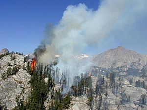
Forest fires are a natural part of the ecosystem. For a long time, people tried to put out all fires quickly. But this led to too much dead wood building up. This extra "fuel" made later fires much worse. In 1937, the Blackwater fire of 1937 tragically killed 15 firefighters in the forest.
Now, fire managers understand that some fires are good for the forest. They help clear out old growth and make way for new plants. Between 1970 and 2012, the forest had about 25 fires each year. Most were started by lightning. The worst year was 1988, when fires from Yellowstone National Park spread into the Shoshone. Today, forest managers use controlled burns and other methods to prevent huge, dangerous fires.
Geography and Geology
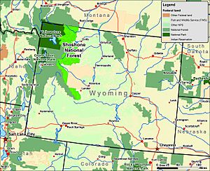
Shoshone National Forest is next to Yellowstone National Park and Bridger-Teton National Forest to the west. The Continental Divide forms the border between Shoshone and Bridger-Teton. To the north, it borders Custer National Forest in Montana.
The forest's elevation goes from 4,600 feet (1,400 meters) near Cody to 13,804 feet (4,207 meters) at the top of Gannett Peak. That's a huge difference!
Mountain Ranges and Their Formation
The forest has three main mountain ranges, each with a different geological story. They are all part of the Rocky Mountains.
The Absaroka Range is in the northern and central parts. Its highest peak is Francs Peak. These mountains were formed by volcanoes about 50 million years ago. They are made of volcanic rocks like andesite. Gold was mined here between 1890 and 1915. The small ghost town of Kirwin is a reminder of that time. Important roads like Sylvan Pass and Togwotee Pass cross these mountains.
In the far north, a small part of the Beartooth Mountains is found. These mountains are made of very old Precambrian granitic rocks. They were pushed up about 70 million years ago. The Beartooth Highway (U.S. Highway 212) crosses Beartooth Pass at over 10,974 feet (3,345 meters).
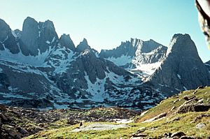
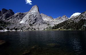
The Wind River Range is in the southern part of the forest. It's also made of ancient granitic rock. Gannett Peak, Wyoming's tallest mountain, is here. This range is very popular with mountain climbers because of its strong rock and many climbing routes. The Cirque of the Towers is a famous climbing spot.
The forest has over 500 lakes and 1,000 miles (1,600 km) of streams and rivers. The Clarks Fork of the Yellowstone River is a special Wild and Scenic River. Its waters flow into the Atlantic Ocean basin.
Glaciers and Climate Change
Shoshone National Forest has more glaciers than any other National Forest in the Rocky Mountains. The forest has 16 named glaciers and 140 unnamed ones, mostly in the Wind River Range.
However, these glaciers have been shrinking for a long time. Since 1850, mountain glaciers around the world have been getting smaller. This is also happening in Shoshone National Forest. For example, Gannett Glacier, the largest single glacier in the U.S. Rocky Mountains, has lost over half its size since 1920.
Scientists study glaciers like Upper Fremont Glacier to learn about past climates. The shrinking of glaciers means less cold water for streams and lakes in the summer. This could affect fish and plants in the forest over time.
Climate
Wyoming is a dry state, but Shoshone National Forest gets a lot more rain and snow because of its mountains. It can get between 15 and 70 inches (38 to 178 cm) of precipitation each year. Higher elevations are colder, with summer highs around 60°F (16°C). Lower areas can be warmer.
Most of the rain and snow falls in winter and early spring. Summers have scattered thunderstorms. Nights are always cool, even in summer, so visitors should bring a jacket. The highest temperature ever recorded was 100°F (38°C) in 1978. The coldest was -49°F (-45°C) in 1972.
Fun Things to Do
Shoshone National Forest welcomes over half a million visitors every year! Two visitor centers offer maps and information. One is near the historic Wapiti Ranger Station, and the other is in Lander, Wyoming.
There are 30 campgrounds where you can park your vehicle. Some have running water and restrooms. A few campgrounds require "hard-sided" camping only, meaning no tents, to protect against grizzly bears.
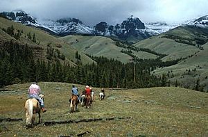
For those who want more quiet, there are over 1,600 miles (2,600 km) of hiking trails. You can go backpacking or horseback riding into remote areas. The Continental Divide Trail and the Nez Perce National Historic Trail both pass through the forest. All-terrain vehicles (ATVs) are allowed on forest roads, but not in wilderness areas.
Hunting and fishing are very popular. Many streams are known as "Blue Ribbon Trout Streams." The Shoshone River and Clarks Fork of the Yellowstone are great places to catch rainbow or Yellowstone cutthroat trout. You need a license from the Wyoming Game and Fish Department.
The southern part of the forest, in the Wind River Range, is a top spot for mountain climbers. It has nine of Wyoming's ten highest peaks. The Cirque of the Towers is especially famous for its many climbing routes.
In winter, you can go cross-country skiing on 48 miles (77 km) of groomed trails. There are also over 300 miles (480 km) of trails for snowmobiling. Togwotee Pass is a great place for winter activities, with lots of snow.
Scenic Drives
Shoshone National Forest has some beautiful roads. The Beartooth Highway (U.S. Highway 212) is a special All-American Road. It goes through the forest and leads to the northeast entrance of Yellowstone National Park.
The Chief Joseph Scenic Byway (Wyoming Highway 296) connects Cody to the Beartooth Highway. It follows the path Chief Joseph and the Nez Perce tribe took in 1877. The Buffalo Bill Cody Scenic Byway (US 14/16/20) also goes through the forest to Yellowstone. Lastly, the Wyoming Centennial Scenic Byway (US 26/287) heads over Togwotee Pass to Grand Teton National Park. These roads offer amazing views!
Staying Safe in the Forest
When visiting Shoshone National Forest, it's important to be aware of potential dangers.
- Bears: Always be careful about bears. Store your food properly and know what to do if you see a bear.
- Weather: The weather can change quickly. Be prepared for snow, even in summer, and very cold nights. Always bring extra layers of clothing.
- Bugs: Bugs can be annoying, especially mosquitoes. Use insect repellent.
- Wildfires: Be careful with campfires, especially during dry times. Check for any wildfire warnings.
- Mountain Climbing: If you're climbing, be aware of falls from steep cliffs and falling rocks. These can be very dangerous. There have been accidents in the past, even for experienced climbers. Always climb with proper gear and knowledge.
The U.S. Forest Service wants everyone to have a safe and fun time. Always tell someone where you are going and when you expect to return.
See also
 In Spanish: Bosque Nacional Shoshone para niños
- List of national forests of the United States
- Tie Hack Historical Monument
 | Jewel Prestage |
 | Ella Baker |
 | Fannie Lou Hamer |


