Nez Perce National Historic Trail facts for kids
Quick facts for kids Nez Perce National Historic Trail |
|
|---|---|
 |
|
| Location | Oregon, Idaho, Wyoming, Montana, USA |
| Nearest city | Lewiston, ID |
| Established | 1986 |
| Governing body | U.S. Forest Service |
| Website | Nez Perce National Historic Trail |
The Nez Perce (Nee-Me-Poo) National Historic Trail is a special path that tells an important story from 1877. It follows the long journey of a large group of Nez Perce people. They traveled this route to find a safe place and avoid being forced to leave their traditional lands.
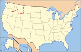
This amazing trail is 1,170 miles (1,883 km) long. It was created in 1986 as part of the National Trails System. The U.S. Forest Service helps manage and protect it. The trail goes through parts of Oregon, Idaho, Wyoming, and Montana. It connects many important places. These places help us remember the events of the Nez Perce War. This conflict happened between June and October 1877. During this time, several groups of Nez Perce tried to avoid the U.S. Cavalry. They hoped to reach Canada, where they could live freely. Many of these sites are part of the Nez Perce National Historical Park. The U.S. National Park Service manages 38 of them. Other sites are cared for by local or state groups.
Contents
The Nez Perce Journey for Freedom
In 1877, about 750 Nez Perce people began a difficult journey. This group included warriors, women, children, and elders. They wanted to stay on their ancestral lands in Idaho. The U.S. Army wanted them to move to a smaller reservation. The Nez Perce had signed a treaty in 1855, the Treaty of Walla Walla. This treaty was with the U.S. Government. But in 1877, they were asked to give up even more land. This went against the original agreement.
A Long and Challenging Path
The Nez Perce decided to try and reach Canada. They hoped to find a place where the U.S. Army had no authority. Along their way, they faced many challenges and conflicts with the 7th Cavalry. Their goals changed as they traveled. First, they were trying to escape difficult situations. These happened when they were first asked to move. Then, they tried to avoid the 7th Cavalry. They wanted to reach a part of the U.S. where they could live their traditional way. Finally, their main goal became reaching Canada.
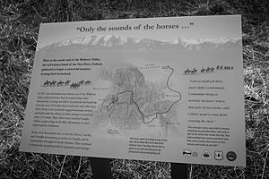
The journey started near Wallowa Lake in eastern Oregon. The Nez Perce traveled east into Idaho. After a conflict at Battle of White Bird Canyon, they crossed Lolo Pass. This took them into Montana. They faced another major challenge at what is now called Big Hole National Battlefield.
Across Mountains and Parks
From there, the Nez Perce continued south and east. They went back into Idaho and then into Wyoming. They entered Yellowstone National Park near West Yellowstone, Montana. The tribe left the park by crossing Sylvan Pass. They then followed the Clarks Fork River back into Montana.
The Nez Perce then headed almost straight north towards Canada. They came very close to reaching their goal. However, they were very tired and hungry. After facing their final challenge north of the Bear Paw Mountains, they decided to stop their journey. This was less than 40 miles (64 km) from the Canada–US border.
Chief Joseph's Leadership
Chief Joseph is well-known for his leadership during this journey. He helped manage the camp and travel. He also took care of the women and children. When the journey ended, Chief Joseph was a main leader. He made the difficult decision to stop. A few members of the tribe did reach Canada. But most were moved to Kansas and Oklahoma for eight years. Later, they were allowed to return to a reservation in Idaho. This was much closer to their ancestral home.
Exploring the Historic Trail Today
The Nez Perce National Historic Trail goes through many different types of land. These include areas managed by the National Park Service. It also crosses National Forests and public lands. These public lands are managed by the Bureau of Land Management.
When the Nez Perce made their journey, Oregon was already a state. But Idaho, Wyoming, and Montana were still territories. The federal government did not manage forest lands back then. However, Yellowstone National Park was created five years before the Nez Perce journey.
Visiting the Trail
The trail also crosses some private property. If you want to visit these areas, it's important to ask permission first. You should always respect local landowners.
Not much of the trail is an actual walking path. But you can follow much of the historic route by driving on nearby roads. Efforts are being made to protect more of the trail. This will allow more visitors to experience it.
Every year, the Chief Joseph Trail Ride takes place. Riders follow parts of this historic trail. It's a great way to remember the Nez Perce journey.
Related Information
 | George Robert Carruthers |
 | Patricia Bath |
 | Jan Ernst Matzeliger |
 | Alexander Miles |


