
Absaroka Range facts for kids
Quick facts for kids Absaroka Range |
|
|---|---|

Absaroka range as seen from west of Livingston, Montana
|
|
| Highest point | |
| Peak | Francs Peak |
| Elevation | 13,153 ft (4,009 m) |
| Dimensions | |
| Length | 150 mi (240 km) |
| Width | 75 mi (121 km) |
| Geography | |

Absaroka Range is shown highlighted in pink on a map of the western United States
|
|
| Country | United States |
| Parent range | Rocky Mountains |
The Absaroka Range is a large group of mountains in the Rocky Mountains in the United States. These mountains stretch about 150 miles (240 km) across the border between Montana and Wyoming. At its widest, the range is about 75 miles across.
The Absaroka Range forms the eastern edge of Yellowstone National Park. It also sits next to Paradise Valley and the Bighorn Basin. To the north, it touches the Beartooth Mountains, and to the south, it meets the Wind River Range. The northern part of the range is near Livingston, Montana.
The tallest mountain in this range is Francs Peak, which is in Wyoming. It stands at 13,153 feet (4,009 meters) high. There are also 46 other peaks in the Absaroka Range that are taller than 12,000 feet (3,658 meters)!
Contents
Where are the Absaroka Mountains?
The Absaroka Range is home to many rivers and streams. The Yellowstone River and its smaller rivers, like the Bighorn River, flow through this area.
Most of the Absaroka Range is protected land. This includes parts of Yellowstone National Park and several wilderness areas. These wilderness areas are special places where nature is kept wild and untouched. Some of these include the Absaroka-Beartooth Wilderness and the Teton Wilderness.
Several national forests also cover parts of the range. These are the Bridger-Teton National Forest, Custer National Forest, Gallatin National Forest, and Shoshone National Forest.
You can drive through parts of the Absaroka Range on certain roads. U.S. Highway 212 goes from Billings, Montana to Yellowstone. This road, called the Beartooth Highway, climbs over Beartooth Pass, which is 10,947 feet (3,337 meters) high. This road is only open during the summer months.
Another road, U.S Route 14/16/20, follows the Shoshone River from Cody through the mountains to the eastern entrance of Yellowstone Park.
History of the Absaroka Range
The Absaroka Range gets its name from the Absaroka Indians. The word "Absaroka" comes from the Hidatsa people. It means "children of the large-beaked bird." The Crow people, however, call these mountains Awaxaawe Báaxxioo, which means "Pointed Mountains [Like Sand Castles]."
John Colter was likely the first European person to visit this area. He probably traveled near the Absaroka mountains in 1807. This was when he was exploring the Yellowstone region. Later explorers, like Gustavus Cheyney Doane and Nathaniel P. Langford, climbed Colter Peak in 1870.
A ship, the USS Absaroka, was even named after this mountain range.
What are the Absaroka Mountains Made Of?
The southern part of the Absaroka Range in Wyoming is mostly made of volcanic rock. As you go further north into Montana, the rocks change. There, you will find more granite and other types of hard rock.
Absaroka Volcanic Area
A large area of volcanic rocks, called the Absaroka Volcanic Province, covers about 8,880 square miles (23,000 square kilometers). This area includes about one-third of Yellowstone National Park. These rocks were formed by ancient volcanoes that erupted a very long time ago. This happened during a period called the Eocene Epoch, which was about 53 to 43.7 million years ago.
Today, you can see the remains of many large, cone-shaped volcanoes in this area. These volcanoes are now extinct, meaning they no longer erupt. Over millions of years, wind and water have worn them down. This erosion allows scientists to study the inside of these ancient volcanoes. It helps them understand how volcanoes work, which is hard to see in active volcanoes. Many terms used today to describe volcanoes were first created by scientists studying these old Absaroka volcanoes.
Gallery
-
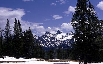
Pilot and Index peaks in the Absaroka Mountains
-
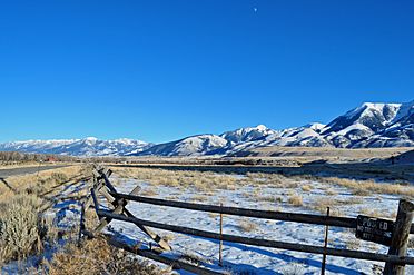
Western face of Absarokas from Paradise Valley (Montana)
-
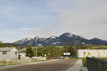
Northern Absaroka range as seen from Livingston, Montana
-
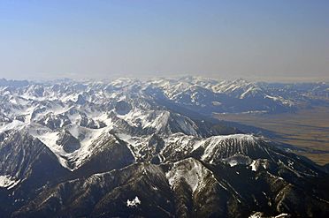
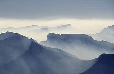
Northwest expanse of Absarokas as viewed from 15,000 feet (4,572 meters) over Livingston, Montana
-
The mountains on August 19, 1988, smoky due to the Yellowstone fires of 1988


See also
 In Spanish: Cordillera Absaroka para niños
