Hot Springs County, Wyoming facts for kids
Quick facts for kids
Hot Springs County
|
||
|---|---|---|

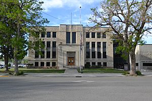
Hot Springs County Courthouse
|
||
|
||

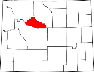
Location within the U.S. state of Wyoming
|
||
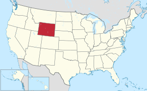
 Wyoming's location within the U.S. |
||
| Country | ||
| State | ||
| Founded | February 21, 1911 (established) 1913 (organized) |
|
| Named for | Hot springs in the area | |
| Seat | Thermopolis | |
| Largest town | Thermopolis | |
| Area | ||
| • Total | 2,006 sq mi (5,200 km2) | |
| • Land | 2,004 sq mi (5,190 km2) | |
| • Water | 2.3 sq mi (6 km2) 0.1%% | |
| Population
(2020)
|
||
| • Total | 4,621 | |
| • Density | 2.3036/sq mi (0.8894/km2) | |
| Time zone | UTC−7 (Mountain) | |
| • Summer (DST) | UTC−6 (MDT) | |
| Congressional district | At-large | |
Hot Springs County is a special area, like a district, in the state of Wyoming in the United States. In 2020, about 4,696 people lived here. This makes it the second smallest county in Wyoming by population. The main town and government center is Thermopolis. The county gets its name from the amazing hot springs found in Hot Springs State Park.
Contents
History of Hot Springs County
Hot Springs County was officially created on February 21, 1911. It was formed using parts of Big Horn, Fremont, and Park counties. The county then became fully organized in 1913.
The name "Hot Springs County" comes from the natural hot springs. These special springs are located in the county's main town, Thermopolis.
Geography and Nature
Hot Springs County covers a total area of about 2,006 square miles. Most of this area, 2,004 square miles, is land. Only a tiny part, about 2.3 square miles, is water. This means the county is almost twice the size of Rhode Island and a bit larger than Delaware. It is the smallest county in Wyoming by land area.
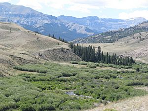
The county is in the southern part of Wyoming's Big Horn Basin. It is surrounded by beautiful mountains. A large part of the Wind River Canyon is in Hot Springs County. The Owl Creek Mountains are to the west, and the Bridger Mountains are to the east. The Bighorn Mountains are around the eastern side, and the Absaroka Range is to the west. A small section of the Shoshone National Forest is also in the western part of the county.
The Wind River Indian Reservation also reaches into the southern part of Hot Springs County.
Neighboring Counties
Hot Springs County shares borders with these other counties:
- Washakie County – to the northeast
- Fremont County – to the south and southwest
- Park County – to the northwest and north
Protected Natural Areas
A part of the Shoshone National Forest is located within Hot Springs County. This is a protected area where nature is preserved.
People and Population
| Historical population | |||
|---|---|---|---|
| Census | Pop. | %± | |
| 1920 | 5,164 | — | |
| 1930 | 5,476 | 6.0% | |
| 1940 | 4,607 | −15.9% | |
| 1950 | 5,250 | 14.0% | |
| 1960 | 6,365 | 21.2% | |
| 1970 | 4,952 | −22.2% | |
| 1980 | 5,710 | 15.3% | |
| 1990 | 4,809 | −15.8% | |
| 2000 | 4,882 | 1.5% | |
| 2010 | 4,812 | −1.4% | |
| 2020 | 4,621 | −4.0% | |
| 2023 (est.) | 4,661 | −3.1% | |
| US Decennial Census 1870–2000 2010–2016 |
|||
Population in 2010
In 2010, there were 4,812 people living in Hot Springs County. These people lived in 2,185 households. About 1,362 of these were families. The county had about 2.4 people per square mile.
Most of the people in the county were white (95.8%). About 1.5% were American Indian. Other groups included Asian, Black, and Pacific Islander people. About 1.5% of people were from two or more races. People of Hispanic or Latino origin made up 2.2% of the population.
Many people had German (30.1%), Irish (15.3%), or English (15.1%) backgrounds. The average age of people in the county was 48.6 years old.
Towns and Communities
Hot Springs County has several towns and smaller communities where people live.
Towns in Hot Springs County
- East Thermopolis
- Kirby
- Thermopolis (This is the county seat, where the main government offices are.)
Census-Designated Places
These are areas that are like towns but are not officially incorporated.
Unincorporated Communities
These are smaller settlements that do not have their own local government.
Ghost Towns
A ghost town is a place where people used to live but have now left.
See also
 In Spanish: Condado de Hot Springs para niños
 | Emma Amos |
 | Edward Mitchell Bannister |
 | Larry D. Alexander |
 | Ernie Barnes |


