Wind River Canyon facts for kids
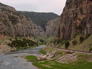
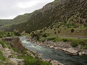
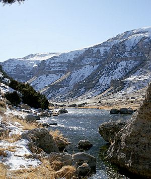
The Wind River Canyon is a beautiful canyon in Wyoming. It was carved by the Wind River over a very long time. This amazing natural wonder is found between the towns of Shoshoni and Thermopolis.
Many people visit the Wind River Canyon, especially those traveling to Yellowstone National Park. You can easily drive through it using U.S. Highway 20 and Wyoming Highway 789. Because it is so special, it was named a Wyoming Scenic Byway in 2005. This means it's a great place to enjoy the views!
Contents
Exploring Wind River Canyon
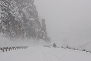
Driving through the Wind River Canyon is an exciting adventure. U.S. Highway 20 and Wyoming Highway 789 go right through the canyon. Sometimes, the road is level with the river at the bottom. This scenic drive gives you amazing views of the canyon walls. You can also see cool rock formations like Chimney Rock.
The canyon is very deep, reaching about 760 meters (2,500 feet) in some places. The land changes quite a bit here. There is about a 90-meter (300-foot) difference in height between the Bighorn Basin and the Wind River Basin.
Where the Canyon Begins and Ends
The southern part of the canyon is close to the Boysen Dam. This dam is part of Boysen State Park. The canyon also has some homes along the highway. A Burlington Northern Santa Fe train line runs through it too.
The northern end of the canyon is a special place called the Wedding of the Waters. This is where the Wind River officially changes its name to the Bighorn River. The scenic drive continues for a few more miles through Thermopolis. It finally ends at T Hill, which is on the north side of town in Hot Springs State Park.
The Wind and Bighorn Rivers both flow north. They start from Boysen Reservoir, go through the canyon, and then pass through Thermopolis. From there, they continue their journey north.
How Wind River Canyon Was Formed
The Wind River Canyon is a fantastic place to learn about geology. It shows many different layers of rock found in Wyoming. You can even see signs along the road that point out these different rock types.
The canyon was created by the Wind River. The river was already flowing in its path before the Owl Creek Mountains started to rise. Over the last two million years, the mountains slowly lifted up from flat land. But the river kept cutting down through the rock. This created what is called a water gap.
A Look at the Rocks
As you travel from south to north through the canyon, you will see many interesting rock features. First, you pass through an area with many complex faults. Then, the canyon gets narrower as it goes into older, Precambrian rocks. You will even drive through three road tunnels here.
After the tunnels, the rock layers tilt downwards. You will see tall cliffs made of Madison Limestone, Bighorn Dolomite, and different kinds of sandstone. The very northern part of the canyon cuts through red sandstone. This red rock is part of the Chugwater Formation.
 | George Robert Carruthers |
 | Patricia Bath |
 | Jan Ernst Matzeliger |
 | Alexander Miles |


