Wind River Basin facts for kids
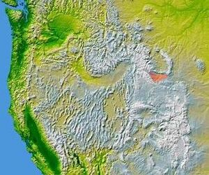
The Wind River Basin, also known as the Shoshone Basin, is a large, bowl-shaped area in the middle of Wyoming, United States. It's a bit dry, like a semi-desert. This basin is surrounded by tall mountains on all sides. To the west, you'll find the Wind River Range. To the north are the Absaroka Range and the Owl Creek Mountains.
To the east, the Casper Arch separates the Wind River Basin from the Powder River Basin. South of the basin is the Sweetwater Uplift, which includes the Granite Range.
Contents
How the Basin Formed
The Wind River Basin was formed over millions of years. It's a type of valley that sinks down because of the weight of nearby mountains. These mountains were created during a time called the Laramide Orogeny, when the Earth's crust moved a lot.
Layers of Rock and Sediment
Underneath the basin, there are many layers of rock and sediment. These layers are like pages in a history book, telling us about the Earth's past.
- Ancient Seas: The basin holds about 10,000 to 12,000 feet (3,000 to 3,700 meters) of rock layers. Most of these layers were laid down by ancient seas during the Paleozoic and Mesozoic Eras. These eras happened hundreds of millions of years ago.
- Ancient Lakes and Rivers: Later, during the Eocene Epoch (about 56 to 34 million years ago), over 18,000 feet (5,500 meters) of new sediments were added. These came from large lakes and rivers that once filled parts of the basin.
- Recent Deposits: After the Eocene, another 3,000 feet (900 meters) of sediments were deposited. This happened as the basin slowly lifted up in the late Tertiary period.
Oil and Natural Gas
The rock layers within the Wind River Basin are very important because they contain lots of petroleum (oil) and natural gas. These are valuable energy sources.
Oil and Gas Fields
The basin has more than 60 different oil and gas fields. These fields often hold oil and gas in "traps" within the rock layers. These traps are like natural underground containers.
- Main Oil Layers: Some of the main rock layers that hold oil and gas include:
* The Tensleep Sandstone from the Pennsylvanian period. * The Phosphoria Formation from the Permian period. * The Muddy Creek and Frontier sandstones from the Cretaceous period.
First Oil Discovery
The very first oil strike in the Wind River Basin happened in 1884. This was at a place called the Dallas dome, in the western part of the basin. This discovery was a big deal because it was the first time oil was produced commercially in Wyoming.
Towns and Rivers
Several towns are located within the Wind River Basin. The main towns include Riverton, Shoshoni, and Lander.
Much of the Wind River Basin is part of the Wind River Indian Reservation. This is the home of the Eastern Shoshone and Northern Arapaho tribes. The basin's water mostly drains into the Wind River and its smaller streams.
 | Kyle Baker |
 | Joseph Yoakum |
 | Laura Wheeler Waring |
 | Henry Ossawa Tanner |


