Wind River (Wyoming) facts for kids
Quick facts for kids Wind River |
|
|---|---|

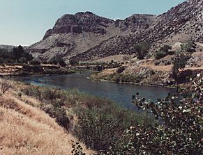
Wind River Canyon downstream from Boysen Dam
|
|

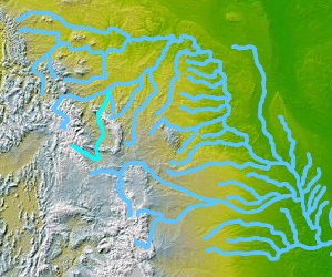
The Wind-Bighorn rivers
|
|
| Other name(s) | Wild River, Bighorn River |
| Country | United States |
| State | Wyoming |
| Cities | Dubois, Crowheart, Johnstown, Riverton |
| Physical characteristics | |
| Main source | Two Ocean Mountain Wind River Range, Teton County 9,760 ft (2,970 m) 43°44′50″N 110°04′27″W / 43.74722°N 110.07417°W |
| River mouth | Bighorn River Wedding of the Waters, Hot Springs County 4,472 ft (1,363 m) 43°34′52″N 108°12′44″W / 43.58111°N 108.21222°W |
| Length | 185 mi (298 km) |
| Basin features | |
| Basin size | 7,730 sq mi (20,000 km2) |
| Tributaries |
|
The Wind River is a major river located in the state of Wyoming in the United States. It is actually the upper part of a longer river known as the Bighorn River. The Wind River flows for about 185 miles (298 km). Because they are connected, people sometimes refer to them together as the Wind/Bighorn River.
Where the Wind River Flows
The Wind River begins high up in the Rocky Mountains. Its source is Wind River Lake, which is near a place called Togwotee Pass. As it flows, the river collects water from many smaller streams on the northeast side of the Wind River Range.
The river then travels southeast across the Wind River Basin. It also passes through the Wind River Indian Reservation. Near the town of Riverton, the Wind River joins another river called the Little Wind River. Upstream from this meeting point, locals often call it the Big Wind River.
From Wind River to Bighorn River
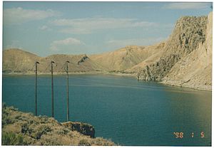
After joining the Little Wind River, the Wind River turns northward. It flows through a narrow passage in the Owl Creek Mountains. Here, the river is blocked by the Boysen Dam, which creates a large lake called Boysen Reservoir.
The Wind River officially changes its name to the Bighorn River at a special spot called the Wedding of the Waters. This place is on the north side of the beautiful Wind River Canyon. It's like the river gets a new name for the next part of its journey!
 | Mary Eliza Mahoney |
 | Susie King Taylor |
 | Ida Gray |
 | Eliza Ann Grier |


