Washakie County, Wyoming facts for kids
Quick facts for kids
Washakie County
|
|
|---|---|

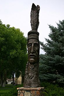
Indian Totem in Worland
|
|

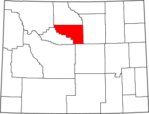
Location within the U.S. state of Wyoming
|
|
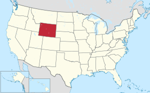
 Wyoming's location within the U.S. |
|
| Country | |
| State | |
| Founded | February 21, 1911 (authorized) 1913 (organized) |
| Named for | Chief Washakie |
| Seat | Worland |
| Largest city | Worland |
| Area | |
| • Total | 2,243 sq mi (5,810 km2) |
| • Land | 2,239 sq mi (5,800 km2) |
| • Water | 4.2 sq mi (11 km2) 0.2%% |
| Population
(2020)
|
|
| • Total | 7,685 |
| • Density | 3.4262/sq mi (1.3229/km2) |
| Time zone | UTC−7 (Mountain) |
| • Summer (DST) | UTC−6 (MDT) |
| Congressional district | At-large |
Washakie County is a county in the state of Wyoming in the United States. In 2020, about 7,685 people lived there. The main town and county seat (where the county government is) is Worland.
Contents
History of Washakie County
Washakie County was first created on February 21, 1911. It was originally going to be called "Hanover County." However, before the law passed, its name was changed to Washakie County. It was named after Chief Washakie, who was a very important leader of the Shoshone people. Chief Washakie was known for being a friend and ally of the U.S. Government. The county officially started working in 1913.
Geography of Washakie County
Washakie County covers a total area of about 2,243 square miles. Most of this area, about 2,239 square miles, is land. The rest, about 4.2 square miles, is water. This means only a tiny part (0.2%) of the county is water.
Counties Near Washakie County
Washakie County shares its borders with several other counties.
- Big Horn County is to the north.
- Johnson County is to the east.
- Natrona County is to the southeast.
- Fremont County is to the south.
- Hot Springs County is to the west.
- Park County is to the northwest.
Protected Natural Areas
Part of the Bighorn National Forest is located within Washakie County. This is a large area of protected land with forests and mountains.
Population of Washakie County
The number of people living in Washakie County has changed over the years. Here's a quick look at the population from different years:
| Historical population | |||
|---|---|---|---|
| Census | Pop. | %± | |
| 1920 | 3,106 | — | |
| 1930 | 4,109 | 32.3% | |
| 1940 | 5,858 | 42.6% | |
| 1950 | 7,252 | 23.8% | |
| 1960 | 8,883 | 22.5% | |
| 1970 | 7,569 | −14.8% | |
| 1980 | 9,496 | 25.5% | |
| 1990 | 8,388 | −11.7% | |
| 2000 | 8,289 | −1.2% | |
| 2010 | 8,533 | 2.9% | |
| 2020 | 7,685 | −9.9% | |
| 2023 (est.) | 7,710 | −9.6% | |
| US Decennial Census 1870–2000 2010 |
|||
In 2010, there were 8,533 people living in the county. Most people in the county were white (91.4%). About 13.6% of the population was of Hispanic or Latino background. The average age of people in the county was about 41.8 years old.
Communities in Washakie County
Washakie County has one city, one town, and several smaller, unincorporated communities.
City in Washakie County
- Worland is the largest city and the county seat.
Town in Washakie County
- Ten Sleep is a smaller town.
Unincorporated Communities
These are smaller places that do not have their own local government like cities or towns.
- Airport Road
- Big Trails
- Mc Nutt
- South Flat
- Washakie Ten
- West River
- Winchester
See also
 In Spanish: Condado de Washakie para niños
 | Aurelia Browder |
 | Nannie Helen Burroughs |
 | Michelle Alexander |

