Natrona County, Wyoming facts for kids
Quick facts for kids
Natrona County
|
||
|---|---|---|

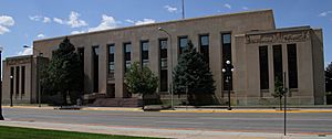
Natrona County Courthouse in Casper
|
||
|
||

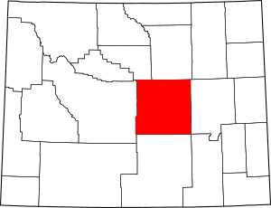
Location within the U.S. state of Wyoming
|
||
 Wyoming's location within the U.S. |
||
| Country | ||
| State | ||
| Named for | Natron deposits | |
| Seat | Casper | |
| Largest city | Casper | |
| Area | ||
| • Total | 5,376 sq mi (13,920 km2) | |
| • Land | 5,340 sq mi (13,800 km2) | |
| • Water | 35 sq mi (90 km2) 0.7%% | |
| Population
(2020)
|
||
| • Total | 79,955 | |
| • Density | 14.8726/sq mi (5.7423/km2) | |
| Time zone | UTC−7 (Mountain) | |
| • Summer (DST) | UTC−6 (MDT) | |
| Congressional district | At-large | |
Natrona County is a county located in the state of Wyoming, USA. It is home to nearly 80,000 people, making it the second-largest county in Wyoming by population. The main city and county seat is Casper.
Natrona County is also part of the Casper, WY Metropolitan Statistical Area. This means Casper is a central city for the surrounding area. In 2010, the very center of Wyoming's population was found right here in Natrona County, near a place called Alcova.
Contents
History of Natrona County
Early Days and Native Americans
Long before settlers from Europe arrived, the lands of Natrona County were home to many Native American tribes. These included the Cheyenne, Arapaho, Shoshone, and Sioux peoples. They lived a nomadic life, moving across the land.
First Explorers
In 1812, an explorer named Robert Stuart traveled through this area. He was looking for a good route for trading posts. Stuart discovered the South Pass Route, which crosses the Continental Divide. This is a high point where rivers on one side flow to the Atlantic Ocean and rivers on the other side flow to the Pacific. Stuart's group built the first simple hut in the area near what is now Bessemer Bend.
Later, in 1840, a priest named Father Pierre-Jean De Smet visited the area. He shared Christian teachings with the Native American tribes. He famously carved his name into a large rock called Independence Rock. He called it "The Register of the Desert." Other explorers, like John C. Frémont in 1843, also left their marks on this rock.
Becoming a County
The first European-American settlements in the Casper area began in the late 1800s. Natrona County was officially created on March 9, 1888, by the Wyoming Territory government. It was then fully organized in 1890. The land for the new county was taken from Carbon County.
The county got its name from the large amounts of a mineral called natron found in the area. Natron is a natural soda ash. George Mitchell, who was the first mayor of Casper, said that his friend Cy Iba suggested the name. In 1909, Natrona County gained more land from Fremont County. The county's borders were slightly changed in 1911 and 1931, giving it the shape it has today.
Geography of Natrona County
Natrona County covers a large area. It is about 5,376 square miles in total. Most of this area, about 5,340 square miles, is land. Only a small part, about 35 square miles, is water.

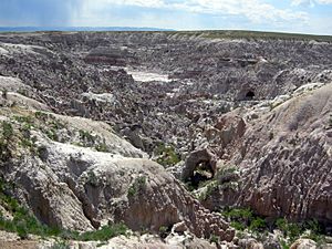
Cool Places to See
Natrona County has several interesting natural features:
Neighboring Counties
Natrona County shares its borders with several other counties:
- Johnson County to the north
- Converse County to the east
- Albany County to the southeast
- Carbon County to the south
- Fremont County to the west
- Washakie County to the northwest
Main Roads and Travel
Many important roads run through Natrona County:
 Interstate 25
 I-25 Bus.
 U.S. Highway 20
 U.S. Highway 26
 U.S. Highway 87
 U.S. Highway 287
 Wyoming Highway 220
 Wyoming Highway 251
 Wyoming Highway 252
 Wyoming Highway 253
 Wyoming Highway 256
 Wyoming Highway 257
 Wyoming Highway 258
 Wyoming Highway 259
 Wyoming Highway 387
 Wyoming Highway 487
For getting around, you can use:
- Casper Area Transit (local buses)
- Express Arrow (longer distance travel)
Geology and Natural Resources
Natrona County is famous for its large deposits of the mineral Natron. This is why the county was given its name! Natron is a type of soda ash. A huge amount of the natron used by industries in America comes from Wyoming because it is very pure.
Protected Natural Areas
Parts of these important natural areas are found in Natrona County:
- Medicine Bow National Forest
- Pathfinder National Wildlife Refuge
People of Natrona County
Population Over Time
The number of people living in Natrona County has changed a lot over the years:
| Historical population | |||
|---|---|---|---|
| Census | Pop. | %± | |
| 1890 | 1,094 | — | |
| 1900 | 1,785 | 63.2% | |
| 1910 | 4,766 | 167.0% | |
| 1920 | 14,635 | 207.1% | |
| 1930 | 24,272 | 65.8% | |
| 1940 | 23,858 | −1.7% | |
| 1950 | 31,437 | 31.8% | |
| 1960 | 49,623 | 57.8% | |
| 1970 | 51,264 | 3.3% | |
| 1980 | 71,856 | 40.2% | |
| 1990 | 61,226 | −14.8% | |
| 2000 | 66,533 | 8.7% | |
| 2010 | 75,450 | 13.4% | |
| 2020 | 79,955 | 6.0% | |
| 2023 (est.) | 79,941 | 6.0% | |
| US Decennial Census 1870–2000 2010–2020 |
|||
In 2010, there were 75,450 people living in Natrona County. The population density was about 14 people per square mile. This means that on average, 14 people lived in every square mile of land. The average age of people in the county was about 36.8 years old.
Communities in Natrona County
Cities
- Casper is the largest city and the county seat.
Towns
Other Communities
There are also many smaller communities that are not officially cities or towns.
Census-designated places
These are areas that the U.S. Census Bureau counts separately:
- Alcova
- Antelope Hills
- Bessemer Bend
- Brookhurst
- Casper Mountain
- Hartrandt
- Homa Hills
- Meadow Acres
- Mountain View
- Powder River
- Red Butte
- Vista West
Other small communities
Education in Natrona County
All the schools in Natrona County are part of the Natrona County School District Number 1. This district makes sure that students across the county get a good education.
See also
 In Spanish: Condado de Natrona para niños
 | George Robert Carruthers |
 | Patricia Bath |
 | Jan Ernst Matzeliger |
 | Alexander Miles |


