Carbon County, Wyoming facts for kids
Quick facts for kids
Carbon County
|
||
|---|---|---|
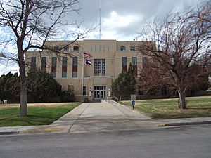
Carbon County Courthouse in Rawlins
|
||
|
||
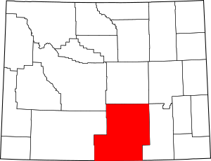
Location within the U.S. state of Wyoming
|
||
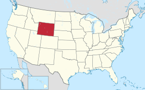 Wyoming's location within the U.S. |
||
| Country | ||
| State | ||
| Founded | December 16, 1868 | |
| Named for | Coal deposits | |
| Seat | Rawlins | |
| Largest city | Rawlins | |
| Area | ||
| • Total | 7,964 sq mi (20,630 km2) | |
| • Land | 7,898 sq mi (20,460 km2) | |
| • Water | 66 sq mi (170 km2) 0.8%% | |
| Population
(2020)
|
||
| • Total | 14,537 | |
| • Density | 1.82534/sq mi (0.70477/km2) | |
| Time zone | UTC−7 (Mountain) | |
| • Summer (DST) | UTC−6 (MDT) | |
| Congressional district | At-large | |
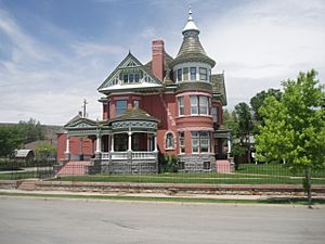
Carbon County is a county located in the state of Wyoming in the United States. In 2020, about 14,537 people lived here. The main town and county seat (where the county government is) is Rawlins. The southern border of Carbon County touches the northern border of Colorado.
Contents
History of Carbon County
Carbon County was created in 1868. It was one of the first five counties in what was then called Dakota Territory.
Early Land Claims
Before it became part of Wyoming, this area was claimed by different groups. It was once part of the Spanish Empire. Later, it was part of the Republic of Texas (from 1835 to 1845) and then the State of Texas until 1852. After that, Texas gave up its claims to this northern part of the land to the U.S. government.
Forming the County
Carbon County was officially organized on December 16, 1868. It was formed from a part of Laramie County in Dakota Territory. When the government for Wyoming Territory was set up on May 19, 1869, Carbon County became one of its counties.
Why "Carbon" County?
In 1868, the Union Pacific Railroad started the first coal mine in Carbon County. The county was named "Carbon" because of the large amounts of coal found there.
Changes to County Borders
Over time, Carbon County's size changed.
- In 1875, some land was taken from Carbon County to create Johnson County.
- In 1888, more land was used to create Natrona County.
- After these changes, the county's borders stayed mostly the same, with only small adjustments made in 1911.
Local Leaders
People from Carbon County have served in Wyoming's state government. For example, members of the Trowbridge and O'Toole families, who were ranchers, represented the county in the Wyoming House of Representatives and the Wyoming State Senate for many years.
Geography of Carbon County
Carbon County is a large area. It covers about 7,964 square miles. Most of this (7,898 square miles) is land, and a smaller part (66 square miles) is water. It is the third-largest county in Wyoming by its total area.
The Continental Divide runs through Carbon County. This is a line that separates which way rivers flow – either towards the Pacific Ocean or towards the Atlantic Ocean.
Main Roads
 Interstate 80
 U.S. Highway 30
 U.S. Highway 287
Neighboring Counties
Carbon County shares borders with several other counties:
- To the west: Sweetwater County
- To the northwest: Fremont County
- To the north: Natrona County
- To the northeast: Converse County
- To the east: Albany County
- To the southeast: Jackson County, Colorado (in Colorado)
- To the south: Routt County, Colorado (in Colorado)
- To the southwest: Moffat County, Colorado (in Colorado)
Protected Areas and Historic Sites
Carbon County is home to parts of important natural and historical places:
- Fort Fred Steele State Historic Site
- Medicine Bow National Forest (part of it)
- Pathfinder National Wildlife Refuge (part of it)
People of Carbon County
| Historical population | |||
|---|---|---|---|
| Census | Pop. | %± | |
| 1870 | 1,368 | — | |
| 1880 | 3,438 | 151.3% | |
| 1890 | 6,857 | 99.4% | |
| 1900 | 9,589 | 39.8% | |
| 1910 | 11,282 | 17.7% | |
| 1920 | 9,525 | −15.6% | |
| 1930 | 11,391 | 19.6% | |
| 1940 | 12,644 | 11.0% | |
| 1950 | 15,742 | 24.5% | |
| 1960 | 14,937 | −5.1% | |
| 1970 | 13,354 | −10.6% | |
| 1980 | 21,896 | 64.0% | |
| 1990 | 16,659 | −23.9% | |
| 2000 | 15,639 | −6.1% | |
| 2010 | 15,885 | 1.6% | |
| 2020 | 14,537 | −8.5% | |
| 2023 (est.) | 14,334 | −9.8% | |
| US Decennial Census 1870–2000 2010–2016 |
|||
2010 Census Information
In 2010, there were 15,885 people living in Carbon County. There were 6,388 households, and 4,109 families.
- About 88.8% of the people were white.
- About 16.8% of the people were of Hispanic or Latino background.
- The average age of people in the county was about 38.9 years old.
- The median income for a household was around $56,565 per year. This means half of the households earned more than this, and half earned less.
Small Communities
These are places that are not officially towns but have a group of homes:
- Arlington
- Ryan Park
Communities in Carbon County
City
- Rawlins (This is the largest city and the county seat.)
Towns
- Baggs
- Dixon
- Elk Mountain
- Encampment
- Hanna
- Medicine Bow
- Riverside
- Saratoga
- Sinclair
Unincorporated Communities
These are smaller communities that are not officially organized as cities or towns:
- Arlington
- Leo
- McFadden
- Muddy Gap
- Savery
- Walcott
- Woodedge
- Fort Steele
See also
 In Spanish: Condado de Carbon (Wyoming) para niños
 | Sharif Bey |
 | Hale Woodruff |
 | Richmond Barthé |
 | Purvis Young |


