Johnson County, Wyoming facts for kids
Quick facts for kids
Johnson County
|
||
|---|---|---|

|
||
|
||

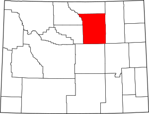
Location within the U.S. state of Wyoming
|
||
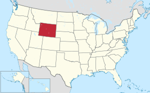
 Wyoming's location within the U.S. |
||
| Country | ||
| State | ||
| Founded | December 8, 1875 (authorized) 1881 (organized) |
|
| Seat | Buffalo | |
| Largest city | Buffalo | |
| Area | ||
| • Total | 4,175 sq mi (10,810 km2) | |
| • Land | 4,154 sq mi (10,760 km2) | |
| • Water | 20 sq mi (50 km2) 0.5%% | |
| Population
(2020)
|
||
| • Total | 8,447 | |
| • Estimate
(2023)
|
8,759 |
|
| • Density | 2.0232/sq mi (0.78117/km2) | |
| Time zone | UTC−7 (Mountain) | |
| • Summer (DST) | UTC−6 (MDT) | |
| Congressional district | At-large | |
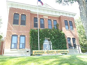
Johnson County is a county located in the north central part of Wyoming. In 2020, about 8,447 people lived here. The main town and county seat is Buffalo. Kaycee is the only other official town in the county. Johnson County is found southeast of the Bighorn Mountains. Major highways like Interstate 25 and Interstate 90 pass through it. The Powder River also flows north through the eastern part of the county.
Contents
History of Johnson County
Johnson County was first created on December 8, 1875. It was originally called Pease County. It was formed from parts of Albany, Carbon, and Sweetwater Counties. The county officially started operating in 1881. It was first named after Dr. E. L. Pease. However, in 1879, the county's name was changed to Johnson. This new name honored E. P. Johnson, who was a lawyer from Cheyenne.
Over the years, parts of Johnson County were used to create other counties. In 1888, Sheridan County was formed from some of Johnson County's land. Then, in 1890, Big Horn County was created. It used land from Johnson County, along with parts of Fremont County and Sheridan County.
From 1889 to 1893, Johnson County was the site of a big conflict known as the Johnson County War. During this time, large cattle ranchers wanted to control the limited land and water resources. They hired people to fight against smaller settlers and homesteaders who were trying to make a living there.
In 1911, the borders of Johnson County were slightly changed. These changes also affected nearby Crook, Natrona, and Weston Counties. The new borders followed official land survey lines.
Johnson County Flag
The flag of Johnson County looks a bit like the ikurriña, which is the flag of the Basque Country. This is because many Basque people have lived in the county since Jean Esponda was born in Baigorri.
Geography of Johnson County
Johnson County covers a total area of about 4,175 square miles. Most of this, about 4,154 square miles, is land. The remaining 20 square miles, or 0.5%, is water.
Neighboring Counties
- Sheridan County (north)
- Campbell County (east)
- Converse County (southeast)
- Natrona County (south)
- Washakie County (west)
- Big Horn County (northwest)
Main Roads
Public Transportation
- Express Arrow
- Jefferson Lines
Protected Natural Areas
- Bighorn National Forest (part of it is in Johnson County)
Population Information
| Historical population | |||
|---|---|---|---|
| Census | Pop. | %± | |
| 1880 | 637 | — | |
| 1890 | 2,357 | 270.0% | |
| 1900 | 2,361 | 0.2% | |
| 1910 | 3,453 | 46.3% | |
| 1920 | 4,617 | 33.7% | |
| 1930 | 4,816 | 4.3% | |
| 1940 | 4,980 | 3.4% | |
| 1950 | 4,707 | −5.5% | |
| 1960 | 5,475 | 16.3% | |
| 1970 | 5,587 | 2.0% | |
| 1980 | 6,700 | 19.9% | |
| 1990 | 6,145 | −8.3% | |
| 2000 | 7,075 | 15.1% | |
| 2010 | 8,569 | 21.1% | |
| 2020 | 8,447 | −1.4% | |
| 2023 (est.) | 8,759 | 2.2% | |
| US Decennial Census 1870–2000 2010–2016 |
|||
In 2010, there were 8,569 people living in Johnson County. Most people were white (96.5%). About 1.1% were American Indian, and smaller percentages were Asian or Black. About 3.2% of the population was of Hispanic or Latino background. Many people had German, Irish, or English ancestors.
The average age of people in Johnson County was about 44.8 years old.
Towns and Communities
City
- Buffalo (This is the main town, also called the county seat)
Town
Other Communities (Unincorporated)
These are smaller places that are not officially organized as cities or towns.
- Hazelton
- Linch
- Mayoworth
- Saddlestring
- Sussex
See also
In Spanish: Condado de Johnson (Wyoming) para niños
 | Selma Burke |
 | Pauline Powell Burns |
 | Frederick J. Brown |
 | Robert Blackburn |


