Weston County, Wyoming facts for kids
Quick facts for kids
Weston County
|
||
|---|---|---|

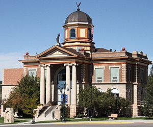
Weston County Courthouse in Newcastle
|
||
|
||

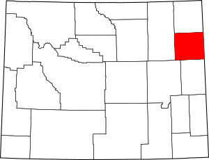
Location within the U.S. state of Wyoming
|
||
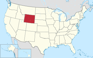
 Wyoming's location within the U.S. |
||
| Country | ||
| State | ||
| Founded | March 12, 1890 | |
| Named for | Jefferson B. Weston | |
| Seat | Newcastle | |
| Largest city | Newcastle | |
| Area | ||
| • Total | 2,400 sq mi (6,216 km2) | |
| • Land | 2,398 sq mi (6,211 km2) | |
| • Water | 1.9 sq mi (4.9 km2) 0.08%% | |
| Population
(2020)
|
||
| • Total | 6,838 | |
| • Estimate
(2023)
|
6,808 |
|
| • Density | 2.85/sq mi (1.10006/km2) | |
| Time zone | UTC−7 (Mountain) | |
| • Summer (DST) | UTC−6 (MDT) | |
| Congressional district | At-large | |
Weston County is a county located in the state of Wyoming, USA. In 2020, about 6,838 people lived there. The main town and county seat is Newcastle. The eastern edge of Weston County touches the western border of South Dakota.
Contents
History of Weston County
Weston County was created on March 12, 1890. This happened when the government of the Wyoming Territory decided to take a part of land from Crook County to form a new county.
The county was named after Jefferson B. Weston. He was a geologist and a surveyor. In 1887, Jefferson Weston and Frank Mondell found a lot of coal near Newcastle. This discovery was important because it led to a railroad being built through the area.
In 1911, another county called Campbell County was formed. It was made from parts of both Weston County and Crook County. Since then, the borders of Weston County have stayed the same.
Geography of Weston County
Weston County covers a total area of about 2,400 square miles. Most of this area, about 2,398 square miles, is land. The rest, about 1.9 square miles, is water.
Neighboring Counties
Weston County shares its borders with several other counties:
- Crook County – to the north
- Lawrence County, South Dakota – to the northeast
- Pennington County, South Dakota – to the east
- Custer County, South Dakota – to the southeast
- Niobrara County – to the south
- Converse County – to the southwest
- Campbell County – to the west
Main Roads in Weston County
Several important highways pass through Weston County:
Protected Natural Areas
Parts of two national protected areas are located in Weston County:
- Black Hills National Forest
- Thunder Basin National Grassland
Population of Weston County
The population of Weston County has changed over the years. Here's how many people have lived there during different census years:
| Historical population | |||
|---|---|---|---|
| Census | Pop. | %± | |
| 1890 | 2,422 | — | |
| 1900 | 3,203 | 32.2% | |
| 1910 | 4,960 | 54.9% | |
| 1920 | 4,631 | −6.6% | |
| 1930 | 4,673 | 0.9% | |
| 1940 | 4,958 | 6.1% | |
| 1950 | 6,733 | 35.8% | |
| 1960 | 7,929 | 17.8% | |
| 1970 | 6,307 | −20.5% | |
| 1980 | 7,106 | 12.7% | |
| 1990 | 6,518 | −8.3% | |
| 2000 | 6,644 | 1.9% | |
| 2010 | 7,208 | 8.5% | |
| 2020 | 6,838 | −5.1% | |
| 2023 (est.) | 6,808 | −5.5% | |
| US Decennial Census 1870–2000 2010 |
|||
In 2010, there were 7,208 people living in Weston County. There were 3,021 households, which are groups of people living together. The average age of people in the county was about 42 years old.
Towns and Communities
Weston County has a few different types of communities.
Cities
- Newcastle is the only city and is the county seat.
Towns
- Upton is another town in the county.
Census-Designated Places
These are areas that are like towns but are not officially incorporated as cities or towns:
Other Places
These are smaller communities or areas within the county:
- Buckhorn
- Clareton
- Four Corners
See also
 In Spanish: Condado de Weston (Wyoming) para niños
 | Anna J. Cooper |
 | Mary McLeod Bethune |
 | Lillie Mae Bradford |


