Custer County, South Dakota facts for kids
Quick facts for kids
Custer County
|
||
|---|---|---|

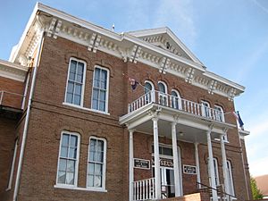
Custer County Courthouse
|
||
|
||

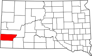
Location within the U.S. state of South Dakota
|
||
 South Dakota's location within the U.S. |
||
| Country | ||
| State | ||
| Founded | 1875 (created) 1877 (organized) |
|
| Named for | George Armstrong Custer | |
| Seat | Custer | |
| Largest city | Custer | |
| Area | ||
| • Total | 1,559 sq mi (4,040 km2) | |
| • Land | 1,557 sq mi (4,030 km2) | |
| • Water | 2.1 sq mi (5 km2) 0.1% | |
| Population
(2020)
|
||
| • Total | 8,318 | |
| • Estimate
(2023)
|
9,117 |
|
| • Density | 5.3355/sq mi (2.0600/km2) | |
| Time zone | UTC−7 (Mountain) | |
| • Summer (DST) | UTC−6 (MDT) | |
| Congressional district | At-large | |
Custer County is a county located in the state of South Dakota in the United States. In 2020, about 8,318 people lived here. The main town and county seat is Custer.
The county was officially created in 1875 and organized in 1877. It was named after a famous general, George Armstrong Custer. Custer County is special because it's home to two of the longest caves in the United States: Jewel Cave National Monument and Wind Cave National Park.
Contents
Exploring Custer County's Geography
Custer County is located on the western side of South Dakota. Its western border touches the state of Wyoming. The Cheyenne River flows along the upper eastern part of the county. Other creeks like Battle Creek and Spring Creek also flow through the area, joining the Cheyenne River.
The land in Custer County is quite mountainous, especially in the west. The land generally slopes downwards towards the east. The lowest point is about 2,461 feet (750 meters) above sea level. The highest point is a mountain peak on the northern border, reaching about 6,657 feet (2,029 meters) above sea level.
Custer County covers a total area of about 1,559 square miles (4,038 square kilometers). Most of this is land, with only a small amount (about 2.1 square miles or 5.4 square kilometers) being water.
Main Roads and Highways
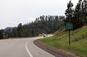
Many important roads help people travel through Custer County. These include:
Neighboring Counties
Custer County shares its borders with several other counties:
- Pennington County - to the north
- Oglala Lakota County - to the southeast
- Fall River County - to the south
- Niobrara County, Wyoming - to the southwest
- Weston County, Wyoming - to the west
Parks and Protected Areas
Custer County is home to many beautiful natural areas, including:
- Black Hills National Forest (part of it)
- Black Elk Wilderness (part of it)
- Buffalo Gap National Grassland (part of it)
- Custer State Park
- Jewel Cave National Monument
- Wind Cave National Park
People of Custer County
| Historical population | |||
|---|---|---|---|
| Census | Pop. | %± | |
| 1880 | 995 | — | |
| 1890 | 4,891 | 391.6% | |
| 1900 | 2,728 | −44.2% | |
| 1910 | 4,458 | 63.4% | |
| 1920 | 3,907 | −12.4% | |
| 1930 | 5,353 | 37.0% | |
| 1940 | 6,023 | 12.5% | |
| 1950 | 5,517 | −8.4% | |
| 1960 | 4,906 | −11.1% | |
| 1970 | 4,698 | −4.2% | |
| 1980 | 6,000 | 27.7% | |
| 1990 | 6,179 | 3.0% | |
| 2000 | 7,275 | 17.7% | |
| 2010 | 8,216 | 12.9% | |
| 2020 | 8,318 | 1.2% | |
| 2023 (est.) | 9,117 | 11.0% | |
| U.S. Decennial Census 1790-1960 1900-1990 1990-2000 2010-2020 |
|||
In 2020, the census counted 8,318 people living in Custer County. There were 3,794 households and 2,552 families. The population density was about 5.3 people per square mile.
According to the 2010 census, there were 8,216 people. Most residents (94.2%) were white, and about 2.9% were Native American. People of Hispanic or Latino origin made up 2.2% of the population. Many residents have German, Irish, English, or Norwegian backgrounds.
The average age of people in Custer County was about 50.3 years old in 2010. The average income for a household was around $46,743 per year.
Towns and Communities
Custer County has one main city and several smaller towns and communities.
City
- Custer (This is the county seat, where the county government is located.)
Towns
- Buffalo Gap (Population: 131)
- Fairburn (Population: 60)
- Hermosa (Population: 382)
- Pringle (Population: 109)
Unincorporated Communities
These are smaller places that are not officially organized as towns:
Schools in Custer County
Children in Custer County attend schools in these districts:
- Custer School District 16-1
- Elk Mountain School District 16-2
- Hot Springs School District 23-2
See also
 In Spanish: Condado de Custer (Dakota del Sur) para niños
 | Leon Lynch |
 | Milton P. Webster |
 | Ferdinand Smith |


