Hiland, Wyoming facts for kids
Quick facts for kids
Hiland, Wyoming
|
|
|---|---|
| Country | United States |
| State | Wyoming |
| County | Natrona |
| Elevation | 6,004 ft (1,830 m) |
| Time zone | UTC-7 (Mountain (MST)) |
| • Summer (DST) | UTC-6 (MDT) |
| ZIP codes |
82638
|
| GNIS feature ID | 1609103 |
Hiland is a very small place in Wyoming, a state in the western United States. It's known as an unincorporated community. This means it doesn't have its own local government, like a city or town does. Instead, it's managed by the larger Natrona County.
Contents
Where is Hiland Located?
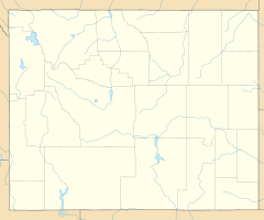
Hiland is found in the western part of Natrona County. It sits along two important roads, U.S. Route 20 and U.S. Route 26, which run together through the area. Hiland is located west of Casper, which is the main city and county seat of Natrona County. A county seat is like the capital city for a county.
Hiland's Elevation
Hiland is quite high up! Its elevation is 6,004 feet (about 1,830 meters) above sea level. This makes it a notable spot in the landscape.
How Hiland Got Its Name
Hiland has had a few different names over the years. When it was first started, it was called Woolton. Later, the spelling changed to Wolton.
The Railroad Connection
The name Hiland came about because this spot was the highest point along the Chicago and Northwestern Railroad line in Wyoming. In 1914, most of the people living in Wolton moved to a new place called Arminto. Arminto became the new railhead, which means it was the main point where the railroad connected to other transportation or services. The few people who stayed behind decided to rename their community Hiland.
Hiland Today
Even though the Hiland post office closed in 2014, the area still uses the ZIP code 82638. As of 2014, Hiland was a very small community, with just a couple of buildings.
 | Isaac Myers |
 | D. Hamilton Jackson |
 | A. Philip Randolph |


