
Daggett County, Utah facts for kids
Quick facts for kids
Daggett County
|
|
|---|---|

Daggett County Courthouse in Manila, May 2008
|
|

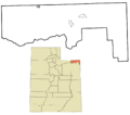
Location within the U.S. state of Utah
|
|
 Utah's location within the U.S. |
|
| Country | |
| State | |
| Founded | January 7, 1918 |
| Named for | Ellsworth Daggett |
| Seat | Manila |
| Largest town | Manila |
| Area | |
| • Total | 721 sq mi (1,870 km2) |
| • Land | 697 sq mi (1,810 km2) |
| • Water | 24 sq mi (60 km2) 3.3% |
| Population
(2020)
|
|
| • Total | 935 |
| • Density | 1.2968/sq mi (0.5007/km2) |
| Time zone | UTC−7 (Mountain) |
| • Summer (DST) | UTC−6 (MDT) |
| Congressional district | 3rd |
Daggett County is a county located in the northeastern part of Utah, a state in the United States. In 2020, only 935 people lived there. This makes it the county with the fewest people in all of Utah. The main town and county seat is Manila. The county was named after Ellsworth Daggett, who was Utah's first surveyor-general. A small town called Dutch John, which is close to the borders of Colorado and Wyoming, became an official town in 2016.
Contents
History of Daggett County
The area that is now Daggett County was once home to several Native American tribes. Groups like the Comanche, Shoshoni, and Ute tribes used the Brown's Park area. Other tribes, such as the Blackfoot and Navajo, also visited this region.
Why Daggett County Was Formed
In the 1800s, people living in the northern part of Uintah County faced a big problem. Their county seat, Vernal, was only about 50 miles away. However, the roads were very dangerous and the mountains made travel difficult. Because of this, residents had to travel a very long way, sometimes up to 800 miles! They had to take stagecoaches and trains through Wyoming or other parts of Utah just to reach their county seat.
This long and difficult journey made it hard for people to do important business. So, in 1917, the voters in Uintah County decided to create a new county. This new county would be on the northern side of the Uinta Mountains. On January 7, 1918, the act to create Daggett County was approved. Manila was chosen as its county seat. A small change was made to the county's borders in 1919, but they have stayed the same ever since.
Geography and Nature
Daggett County is located in the lower northeastern corner of Utah. Its northern border touches Wyoming, and its eastern border meets Colorado.
Mountains and Rivers
The main natural features of the county are the Uinta Mountains. These mountains are in the southwestern part of the county and form part of its southern border. The Green River also flows through the county. It has carved a deep canyon in the east-central area. In 1958, the United States Bureau of Reclamation built the Flaming Gorge Dam on the Green River. This dam created the large Flaming Gorge Reservoir, which started filling with water in 1964.
The land in Daggett County generally slopes down towards the north and east. The highest point in the county is on a mountain crest along its southern border. This spot is about 12,276 feet (3,742 meters) above sea level.
Size and Land Ownership
Daggett County covers a total area of 721 square miles (1,867 square kilometers). Most of this area, 697 square miles (1,805 square kilometers), is land. The remaining 24 square miles (62 square kilometers) is water. This makes it the fourth-smallest county in Utah by land area. More than 90% of the land in Daggett County is owned by the federal government.
Main Roads
- U.S. Route 191
- Utah State Route 43
- Utah State Route 44
Neighboring Counties
- Sweetwater County, Wyoming - to the north
- Moffat County, Colorado - to the east
- Uintah County - to the south
- Duchesne County - to the southwest
- Summit County - to the west
Protected Natural Areas
- Ashley National Forest (part)
- Browns Park Waterfowl Area
- Flaming Gorge National Recreation Area (part)
Lakes and Springs
Daggett County has many beautiful lakes and springs, including:
- Big Springs
- Browne Lake
- Flaming Gorge Reservoir (part)
- Greens Lakes
- Lamb Lakes
- Long Park Reservoir
- Red Lake
- Sheep Creek Lake
- Spirit Lake (part)
- Tepee Lakes
People of Daggett County
| Historical population | |||
|---|---|---|---|
| Census | Pop. | %± | |
| 1920 | 400 | — | |
| 1930 | 411 | 2.8% | |
| 1940 | 564 | 37.2% | |
| 1950 | 364 | −35.5% | |
| 1960 | 1,164 | 219.8% | |
| 1970 | 666 | −42.8% | |
| 1980 | 769 | 15.5% | |
| 1990 | 690 | −10.3% | |
| 2000 | 921 | 33.5% | |
| 2010 | 1,059 | 15.0% | |
| 2020 | 935 | −11.7% | |
| US Decennial Census 1790–1960 1900–1990 1990–2000 2010–2018 2020 |
|||
2020 Census Information
In 2020, the 2020 United States census counted 935 people living in Daggett County. This means there were about 1.3 people per square mile.
Most people in the county, about 94.2%, were White. About 3.1% of the people were Hispanic or Latino.
The population was made up of 54.55% males and 45.45% females. About 23.4% of the people were under 18 years old. The average age was 47.6 years.
There were 392 households in the county. A household is a group of people living together. Most households, 71.9%, were families. About 29.3% of all households had children under 18. Most homes, 82.4%, were owned by the people living in them.
The average income for a household in Daggett County was $74,911. For families, the average income was $100,833. A very small number of people, 3.3%, lived below the poverty line.
Education Levels
For adults 25 years or older in Daggett County:
- 42.5% had a high school diploma.
- 38.8% had some college education or an associate degree.
- 10.2% had a bachelor's degree.
- 4.5% had a graduate or professional degree.
Ancestry
In 2016, the largest groups of people based on their family origins were:
- 35.4% English
- 9.2% Scots-Irish
- 8.8% German
- 8.3% Irish
- 7.9% American
- 7.2% Dutch
- 5.5% Danish
Economy and Travel
The businesses in Daggett County mainly serve tourists and people visiting the Flaming Gorge National Recreation Area. You can find a small general store, gas stations, cafes, motels, and places to rent rafts. Some businesses offer guided fishing trips on the Flaming Gorge Reservoir and the Green River. The county's economy mostly relies on tourism, managing government land, and ranching. There are no railroads in Daggett County.
Communities in Daggett County
Towns
- Dutch John
- Manila (the county seat)
Other Communities
- Flaming Gorge (a census-designated place)
Past Communities
Education in Daggett County
There is one school district in the county: Daggett School District.
Images for kids
-
Map of Daggett County communities

See also
 In Spanish: Condado de Daggett para niños
