Great Divide Basin facts for kids
Quick facts for kids Great Divide Basin |
|
|---|---|

The Great Divide Basin is an endorheic drainage basin on the Continental Divide in the United States.
|
|
| Floor elevation | 6,500 ft (2,000 m) |
| Area | 3,959 sq mi (10,250 km2) |
| Geography | |
| Country | United States |
| State | Wyoming |
| Region | Red Desert |
The Great Divide Basin is a special area of land in the Red Desert of Wyoming. What makes it unique is that any rain or snow that falls here never reaches an ocean. Instead, the water stays within the basin, either sinking into the ground or evaporating.
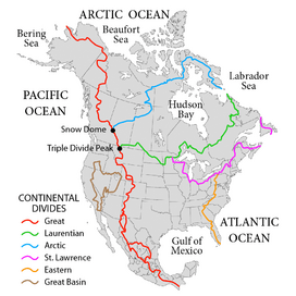
This type of area is called an endorheic basin. It's like a giant bowl where water collects but has no outlet to the sea. The Great Divide Basin sits right next to the Continental Divide. This divide usually separates rivers that flow to the Pacific Ocean from those that flow to the Atlantic.
To the south and west, water flows to the Green River, which eventually reaches the Pacific Ocean. To the north and east, water flows to the North Platte, which ends up in the Atlantic Ocean. The Great Divide Basin is a "closed" system right in the middle of these two major river systems.
Contents
Exploring the Great Divide Basin's History
Even though the Great Divide Basin offered a fairly easy way to cross the Continental Divide, its dry conditions and lack of water made it tough for early pioneers. In the 1870s, it was known as the Saline Plain because of its salty, dry ground.
Because of these challenges, famous trails like the Oregon Trail and the Overland Trail went around the basin. The Oregon Trail went north over South Pass. The Overland Trail went south over Bridger Pass.
However, when the first transcontinental railroad was built, the Union Pacific decided to lay its tracks right through the southern part of the basin. Later, major highways like the Lincoln Highway, U.S. 30, and Interstate 80 followed a similar path.
Today, the basin is still very empty. The only town there is Wamsutter, which had about 451 people in 2010.
If you drive west on Interstate 80, you'll enter the Great Divide Basin about 7 miles west of Rawlins. There's even a highway sign that marks this as a crossing of the Continental Divide. The highest point on I-80 within the basin is about 7,130 feet high. This spot was once thought to be the Continental Divide during the days of the Lincoln Highway.
Further west, I-80 finally leaves the Great Divide Basin. It then enters the much larger Great Basin, which is another huge area where water doesn't reach the ocean.
Understanding the Basin's Geology
The Great Divide Basin is part of a bigger area called the Greater Green River Basin. It was formed a long time ago, between the Late Cretaceous and Early Eocene periods. During this time, a geological feature called the Rock Springs Uplift helped separate the Great Divide Basin from the main Green River Basin.
Discovering the Basin's Geography
While we often think of it as one big area, the Great Divide Basin is actually made up of several smaller connected basins. These include areas around Circle Bar Lake, Frewen Lake, Lost Creek Lake, Red Lake, and Separation Lake. The hills and ridges between these smaller basins have sometimes made it tricky to figure out the exact path of the Continental Divide.
The western edge of the basin includes the Lucite Hills, with notable peaks like Black Rock Butte. You can also find flat, salty areas called Alkali Flat and Greasewood Flat. In the central western part, there are sand dunes. The southern part of the western basin has features like Red Desert Flat.
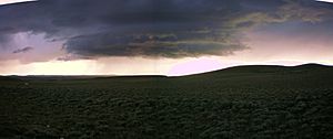
The basin is a high desert landscape. It features sand dunes, tall cliffs called bluffs, and alkali flats. You might see small trees in ravines and occasional shrubs.
Wildlife and Resources of the Basin
The Great Divide Basin is home to many animals. You can find various birds, pronghorn, mule deer, and wild horses. There's even a special desert elk herd that lives here.
Underneath the ground, the basin holds valuable resources. It has uranium ore deposits and many wells that produce oil and natural gas. People have debated whether to use these resources or to protect parts of the basin as wilderness areas.
See also
 In Spanish: Great Divide Basin para niños
 | Emma Amos |
 | Edward Mitchell Bannister |
 | Larry D. Alexander |
 | Ernie Barnes |


