
Lincoln Highway facts for kids
Quick facts for kids
|
|
|---|---|
 |
|
| Route information | |
| Length | 3,389 mi (5,454 km) |
| Existed | 1913–present |
| Major junctions | |
| West end | Lincoln Park in San Francisco, CA |
| East end | Times Square in New York, NY |
| Location | |
| States: | California, Nevada, Utah, Wyoming, Colorado, Nebraska, Iowa, Illinois, Indiana, Ohio, West Virginia, Pennsylvania, New Jersey, New York |
| Highway system | |
| Auto trails
|
|


The Lincoln Highway was one of the very first roads built for cars to travel all the way across the United States. It was thought up in 1912 by a businessman named Carl G. Fisher from Indiana. The highway was officially opened on October 31, 1913.
The Lincoln Highway stretched from Times Square in New York City on the East Coast to Lincoln Park in San Francisco, California, on the West Coast. When it first opened, it went through 13 states. Later, in 1928, its path changed a little, adding West Virginia. So, in total, the highway passed through 14 states, 128 counties, and more than 700 cities and towns over its history.
When it was first measured in 1913, the Lincoln Highway was about 3,389 miles (5,454 km) long. Over the years, the road was improved and its path was straightened many times. By 1924, it had become shorter, about 3,142 miles (5,057 km). If you count all the different paths the highway took over time, its total length was about 5,872 miles (9,450 km).
The Lincoln Highway was eventually replaced by newer, numbered roads. This happened after the U.S. Numbered Highway System was created in 1926. Most of the Lincoln Highway became part of U.S. Route 30 from Pennsylvania to Wyoming. Later, in the 1950s, the Interstate Highway System was built. Much of the Lincoln Highway's route was then taken over by Interstate 80, which is now the main road from the New York City area to San Francisco.
Exploring the Lincoln Highway's Path (1928–1930)
The Lincoln Highway changed its route several times. The final path, used from 1928 to 1930, followed many roads that are still used today. For example, parts of U.S. Route 30 in the East and Interstate 80 in the West follow the old Lincoln Highway.
You can find parts of the Lincoln Highway in these areas:
- In New York City, it started on 42nd Street near Times Square.
- It went under the Hudson River through the Holland Tunnel to Jersey City, New Jersey. (The Lincoln Tunnel opened later, so it wasn't part of the original highway).
- It continued through New Jersey on roads like U.S. Route 1/9 Truck, New Jersey Route 27, and U.S. Route 206.
- In Pennsylvania, it followed U.S. Route 1 to Philadelphia.

- From Philadelphia, it largely followed U.S. Route 30 across Pennsylvania, a small part of West Virginia, and then through Ohio and Indiana to Aurora, Illinois. (Today, many parts of US 30 have new bypasses, so you might need to drive through old town centers to follow the original route).
- In Illinois, it used Illinois Route 31, Illinois Route 38, and Illinois Route 2.
- Then, it went back to U.S. Route 30 across western Illinois, Iowa, Nebraska, and Wyoming to Granger, Wyoming.
- From Granger, it followed Interstate 80 through western Wyoming and Utah to West Wendover, Nevada.
- In Nevada, it used U.S. Route 93 Alternate and U.S. Route 93 to Ely, Nevada, and then U.S. Route 50 (also called “The Loneliest Road in America”) across Nevada.
- When crossing the Sierra Nevada mountains into California, there were two main routes:
- A northern route using Interstate 80 and old U.S. Route 40 over Donner Pass.
- A southern route using U.S. Route 50 around Lake Tahoe and over Johnson Pass.
- In California, it followed old U.S. Route 40 (now partly Interstate 80) to Berkeley, California.
- From Berkeley, travelers took a ferry across San Francisco Bay to San Francisco. (Today, you would use the San Francisco–Oakland Bay Bridge to cross the bay).
- Finally, in San Francisco, the highway followed several city streets like Hyde Street, North Point Street, Van Ness Avenue, and California Street to reach its end at Lincoln Park.


The Highway's Story
The Lincoln Highway was America's first national tribute to President Abraham Lincoln. It was created nine years before the Lincoln Memorial in Washington, D.C., was even finished! This first car road across America brought lots of good things to the towns and villages along its path. People often called it "The Main Street Across America."
The idea for the Lincoln Highway came from the "Good Roads Movement," which wanted better roads everywhere. The success of the Lincoln Highway showed how important good roads were. It inspired many other long-distance roads, like the Yellowstone Trail and the Dixie Highway. Many of these named roads were later replaced by the United States Numbered Highways system in 1926. Most of the 1928 Lincoln Highway route became U.S. Route 30.
Most importantly, the Lincoln Highway helped inspire the Federal Aid Highway Act of 1956. This law led to the building of the Interstate Highway System. President Dwight D. Eisenhower was a big supporter of this. He had been part of a military convoy that crossed the country on the Lincoln Highway in 1919. That trip showed him how much America needed better roads. Today, Interstate 80 is the highway that most closely follows the original Lincoln Highway route. In some western states, like Wyoming and Utah, parts of I-80 are even built right on top of the old Lincoln Highway.
The Lincoln Highway Association was first started in 1913 to plan and promote the road. It was started again in 1992 and now works to find, protect, and make it easier for people to visit the remaining parts of the old highway.
How the Idea Started
In 1912, most travel between states happened by train. Roads were mostly local and not very good, especially in the countryside. Many states didn't even have laws to fund big road projects.
At that time, America had about 2.2 million miles (3.5 million km) of rural roads, but only a small part of them (less than 9%) had "improved" surfaces like gravel or stone. Long-distance roads were seen as a luxury for rich people who could spend weeks driving.
But more and more people wanted better roads. Carl G. Fisher, a successful businessman who made headlights for early cars and helped build the Indianapolis Motor Speedway, believed that good roads were key to cars becoming popular. In 1912, he started pushing his idea for a highway that would go all the way across the country.
At a meeting in Indianapolis, he suggested building a "rock highway" from coast to coast by May 1, 1915. He thought it would cost about $10 million. He told his friends, "Let's build it before we're too old to enjoy it!" Within a month, his friends promised $1 million. Even famous people like former President Theodore Roosevelt and inventor Thomas Edison helped out. The current President, Woodrow Wilson, who loved driving, also gave money.
Fisher and his friends decided to name the road after Abraham Lincoln, one of Fisher's heroes. They had to wait a bit because another group had already reserved the name for a different project. But when that project didn't happen, the name "Lincoln Highway" became available.
On July 1, 1913, the Lincoln Highway Association (LHA) was officially formed. Its main goal was to create a continuous, improved highway from the Atlantic to the Pacific Ocean, free for everyone to use. The LHA also wanted the Lincoln Highway to be an example. Fisher hoped it would "stimulate...the building of enduring highways everywhere." Henry Bourne Joy, president of Packard Motor Car Company, became the LHA president. This made sure it wasn't seen as just one person's idea.
The first part of the Lincoln Highway to be finished was in New Jersey, connecting Newark to Jersey City. It was opened on December 13, 1913.
Lincoln Statues Along the Way
To get people excited about the highway, Carl Fisher ordered statues of Abraham Lincoln. These statues, called The Great Emancipator, were placed in important spots along the road. One of these statues was given to Henry Joy in 1914. It's now at the D-bar-A Scout Ranch in Michigan. Another Lincoln statue is at the entrance of Lincoln Park (Jersey City).
Choosing the Route
The LHA needed to figure out the best and most direct way from New York City to San Francisco. In the eastern part of the country, there were already many roads, so choosing the path was easier.
To find a route in the West, the LHA sent out a "Trail-Blazer" tour. On July 1, 1913, 17 cars and two trucks left Indianapolis. For 34 days, they faced challenges like mud pits in Iowa, sand drifts in Nevada and Utah, overheated engines, and flooded roads. But they were also cheered on by excited people in every town hoping to be on the new highway. The tour finally arrived in San Francisco for a big parade.
After the tour, on September 14, 1913, the official route was announced. The LHA leaders wanted the straightest path possible, so the 3,389-mile (5,454 km) route didn't always follow exactly where the Trail-Blazers had gone. Many towns that had welcomed the tour were disappointed they weren't chosen for the highway.
Less than half of the chosen route was already a good road. As parts were improved over time, the highway actually became shorter by about 250 miles (400 km). Some parts of the Lincoln Highway followed very old, historic paths, like:
- A road built by Dutch settlers in New Jersey before 1675.
- The 1796 Lancaster Turnpike in Pennsylvania.
- An old British military trail from 1758 in Pennsylvania.
- An ancient Indian trail in Ohio.
- Sections of the Mormon Trail, Overland Trail, and Pony Express.
- The Donner Pass crossing of the Sierra Nevada mountains, named after the famous Donner Party.
The LHA officially opened the route on October 31, 1913. Towns along the highway celebrated with bonfires, fireworks, concerts, and parades. This event was a big step for road building in America.
Getting the Word Out
The LHA was very good at getting people to talk about the highway. They used publicity and promotion to spread the word.
They told everyone when famous people like Theodore Roosevelt and Thomas Edison contributed money. They even made sure President Woodrow Wilson's small donation was publicized, giving him "Highway Certificate #1."
One of the most touching donations came from a group of Native Alaskan children in Anvik, Alaska. Their teacher told them about Abraham Lincoln and the highway. They collected 14 pennies and sent them to the LHA with a note. The LHA shared pictures of the coins and the letter, and it was printed in many newspapers.
The LHA also made sure that newspapers covered the "Trail-Blazer" tour. They even asked religious leaders across the country to talk about Abraham Lincoln in their sermons on the Sunday after the highway's dedication.
A very important event for the highway was the Transcontinental Motor Convoy in 1919. This was a U.S. Army convoy that traveled from Washington, D.C., to San Francisco, following the Lincoln Highway for much of the way. Even though bridges broke and vehicles got stuck in mud, the convoy was cheered in towns all across the country. The LHA used the convoy's struggles to show why America needed better main roads. This helped get more support for building highways with local and federal money.
One of the soldiers in that convoy was Lieutenant Colonel Dwight D. Eisenhower. He remembered this trip so well that it influenced his "Grand Plan" for highways in 1954. This plan led to the creation of the Interstate Highway System in 1956.
Carl Fisher's original idea was that car companies and private donations would pay for the highway. But this idea was soon changed. The LHA mostly used its money for publicity and to encourage people to travel on the highway. They also lobbied government officials to support building the road with public funds.
Traveling in the Early Days
According to the Lincoln Highway Association's 1916 guide, a trip from the Atlantic to the Pacific on the Lincoln Highway was "something of a sporting proposition." It could take 20 to 30 days! To do it in 30 days, you'd need to drive about 18 miles (29 km) per hour for 6 hours a day, and only during daylight. The trip was estimated to cost about $5 per person per day, including food, gas, and oil. Car repairs would add to the cost.
Gas stations were rare in many areas, so drivers were told to fill up their tanks whenever they could. Drivers were also advised to walk through water before driving through it to check how deep it was. The list of recommended equipment included chains, a shovel, an axe, jacks, spare tires, tools, and, of course, Lincoln Highway flags for your car! The guide also gave this wise advice: "Don't wear new shoes."
You didn't need firearms, but west of Omaha, Nebraska, full camping gear was suggested. The guide warned against drinking salty water that could cause bad cramps. In some remote areas, the guide even told you how to get help. For example, near Fish Springs, Utah, it said, "If trouble is experienced, build a sagebrush fire. Mr. Thomas will come with a team. He can see you 20 miles off."
Special "Seedling Miles" and the "Ideal Section"
The Lincoln Highway Association didn't have enough money to build huge parts of the road. But starting in 1914, they sponsored "seedling mile" projects. These were short sections of very well-built road. The idea was to show how good these permanent roads could be and to get public support for the government to build more of them. The LHA even got donations of materials from cement companies.
The first seedling mile was built in 1914 west of Malta, Illinois. After learning from experience, the LHA created a plan for an "ideal section" of road. This section was designed to handle traffic for 20 years into the future. Experts decided it should have:
- A wide road area (110 feet or 34 meters).
- A concrete road 40 feet (12 meters) wide and 10 inches (250 mm) thick.
- Curves that were wide and banked for cars going 35 miles (56 km) per hour.
- No railroad crossings or advertising signs.
- A walking path for people.
The most famous "ideal section" was 1.3 miles (2.1 km) long, built between Dyer and Schererville in Indiana. It was built in 1922 and 1923 with money from the government and a large donation from a rubber company president. Magazines and newspapers called it a "vision of the future." Highway officials from all over the country visited it. This "ideal section" is still used today and is so well-built that you might not even notice it unless you see the marker nearby.
The Rise of Numbered Highways
By the mid-1920s, there were about 250 "national auto trails" like the Lincoln Highway. Some were major routes, but many were shorter.
In 1925, the government started to take more control over road building. Federal and state officials created the Joint Board on Interstate Highways. This board suggested a new system of United States Numbered Highways. This new system would make the old named trails less important. The LHA was still very influential, so the government asked for their support for the new numbering plan.
The LHA would have preferred to keep the Lincoln Highway name for the whole route. But they cared more about the bigger plan for better roads. They knew the name "Lincoln Highway" was already well-known. The government promised that, as much as possible, the Lincoln Highway would be given the number 30 for its entire length.
The states approved the new numbering system in November 1926. The Lincoln Highway was split among several numbers. The route between Philadelphia and Granger, Wyoming, became U.S. Route 30. East of Philadelphia, it became part of U.S. Route 1. West of Salt Lake City, parts became U.S. Route 40 and U.S. Route 50.
On September 1, 1928, the LHA had its last big event. Groups of Boy Scouts placed about 2,400 concrete markers along the route. These markers officially dedicated the highway to Abraham Lincoln. Each concrete post had the Lincoln Highway symbol, a direction arrow, and a bronze medal with Lincoln's face, saying, "This Highway Dedicated to Abraham Lincoln."
Even when the LHA stopped operating, some parts of the Lincoln Highway were still unpaved. But by 1938, on the highway's 25th anniversary, the last unpaved section was being built.
25th Anniversary and Beyond
On July 3, 1938, the 25th Anniversary of the Lincoln Highway was celebrated with a nationwide radio broadcast. Carl Fisher's message was read, saying that the Lincoln Highway had shown how important good roads were for the country. He hoped this anniversary would make millions of people realize how vital roads are for America's well-being and defense.
Carl Fisher passed away in 1939. On June 29, 1956, President Dwight D. Eisenhower signed the Federal Aid Highway Act of 1956, which started the building of the Interstate Highway System. The new Interstate 80, which goes from New York to San Francisco, largely followed a different path than the old Lincoln Highway.
Even today, the Lincoln Highway is remembered:
- In New Jersey, parts of US 1/9 and New Jersey Route 27 are still called the Lincoln Highway.
- Some parts of U.S. Route 30 still use the name.
- Many city streets along the route are named Lincoln Way or Lincolnway.
- A few of the 3,000 Boy Scout markers can still be found. Some communities are even putting new ones up.
- A section near Omaha, Nebraska, paved with original brick, has been saved.
- A bridge in Tama County, Iowa, still has "Lincoln Highway" spelled out on its railings.
- Restaurants, motels, and gas stations often have Lincoln-related names.
- A monument to Henry B. Joy, the first president of the LHA, stands near Wamsutter, Wyoming.
- Near Laramie, at Sherman Summit, there's a huge bronze statue of Lincoln. It was built in 1959 to mark the highest point of the Lincoln Highway.
The Lincoln Highway Association Today
The Lincoln Highway Association started up again in 1992. Its goal is to find, protect, and make it easier to visit the remaining parts of the Lincoln Highway and its historic sites. The association publishes a magazine, holds yearly conferences, and has a national tourist center in Franklin Grove, Illinois.
Modern-Day Tours
People still love to travel the Lincoln Highway!
- In 2003, the Lincoln Highway Association sponsored a 90th Anniversary Tour. About 35 old and new cars traveled the route, trying to follow as much of the original highway as possible. Boy Scout troops held ceremonies along the way.
- In 2013, for the highway's 100th anniversary, over 270 people in 140 cars took part in two tours. They started in New York City and San Francisco and met in the middle at Kearney, Nebraska. The cars ranged from 1913 to 2013 models. A big parade in Kearney had 12,500 people watching!
- In 2015, another tour celebrated the 100th anniversary of a famous 1915 tour led by Henry B. Joy. This tour had 103 people in 55 cars and traveled from Detroit to San Francisco.
Mapping the Highway
In 2012, the Lincoln Highway Association's mapping committee finished a huge project. They researched and mapped the entire Lincoln Highway and all its different paths, which totaled over 5,872 miles (9,450 km). This project took more than 20 years! The association now has an online map that shows the whole highway, including its markers, monuments, and interesting places.
Roadside Giants
In the early days of the Lincoln Highway, business owners wanted to attract drivers. So, some of them built huge, quirky buildings in fun shapes! Examples include a 2.5-story coffee pot in Bedford, Pennsylvania, or the Shoe House near York, Pennsylvania. These are known as the "Roadside Giants" of the Lincoln Highway.
In 2008, a project helped high school students create new "Roadside Giants" along the Lincoln Highway Heritage Corridor. These included:
- A 12-foot (3.7 m) tall 1920s Packard Car and Driver.
- A 25-foot (7.6 m) tall, 4,900-pound (2,200 kg) gas pump from the 1940s.
- An 1,800-pound (820 kg) "Bicycle Built for Two."
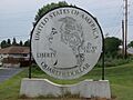
- A giant quarter coin, weighing almost a ton.
- A detailed 1921 Selden pick-up truck.
- The world's largest teapot, 12 feet (3.7 m) tall and 44 feet (13 m) wide.
The Lincoln Highway in Pop Culture
The Lincoln Highway has appeared in many books, songs, and movies over the years.
Books and Stories
- In 1914, Effie Gladding wrote Across the Continent by the Lincoln Highway, one of the first books about traveling across America by car. She wrote about how much she loved seeing the red, white, and blue markers that showed they were on the right road.
- In 1916, famous etiquette expert Emily Post drove across the country on the Lincoln Highway for a magazine story. Her book was called By Motor to the Golden Gate.
- In 1927, Frederic Van de Water wrote The Family Flivvers to Frisco, a funny story about him, his wife, and their six-year-old son camping their way to San Francisco in a Model T Ford.
- In 1951, Clinton Twiss wrote The Long, Long Trailer, a funny memoir about traveling in a trailer on the Lincoln Highway. This book later became a popular movie starring Desi Arnaz and Lucille Ball.
- Many other authors have written books about the Lincoln Highway, sharing its history, maps, and interesting places.
Music and Songs
- In 1914, a band song called the "Lincoln Highway March" was written.
- In 1921 and 1922, other marches also called "Lincoln Highway" were composed.
- In 1928, the song "Golden Gate" by Al Jolson mentioned the highway.
- In 1937, the song "God's Country" from a musical included the line: "Hey there, neighbor, goin' my way? / East or west on the Lincoln Highway?"
- In the 1940s, a radio show about the highway had a theme song called "When You Travel the Great Lincoln Highway."
- Woody Guthrie's song "Hard Traveling" from 1944 included the line "I've been walking that Lincoln Highway / I thought you knowed."
- In 1974, the song "Old Thirty" by Bill Fries called the highway "the Mighty Lincoln Highway."
- Many other songs have been written about the Lincoln Highway, celebrating its history and beauty.
Radio and TV Shows
- In 1940, NBC Radio started a show called Lincoln Highway, which told stories about life along the route. Famous actors appeared on the show.
- In 2008, PBS showed a documentary film called A Ride Along the Lincoln Highway.
- In 2010, the TV show Boardwalk Empire showed a character traveling on the Lincoln Highway in 1920.
- In 2014, Wyoming PBS released an award-winning documentary called 100 Years on the Lincoln Highway, which explored the highway's route and history in Wyoming.
Movies
- In 1919, a silent film called The Lincoln Highwayman was made. It was about a masked bandit who caused trouble for drivers on the highway in California.
- In 1924, the Ford Motor Company made a silent film called Fording the Lincoln Highway. It showed the 10-millionth Model T car on a promotional tour along the highway.
- In 2016, a documentary called 21 Days Under the Sky followed four friends riding motorcycles on the Lincoln Highway from San Francisco to New York.
Images for kids
-
The oversized quarter at the entrance to Down River Golf Course
-
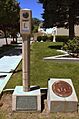
Lincoln Highway marker in Carson City, Nevada
-
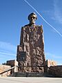
Lincoln Highway Monument in Wyoming
-
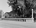
Lincoln Highway bridge in Tama, Iowa
-
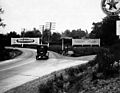
"Lincoln Highway near Pennsylvania Tunnel" near Fallsington, Pennsylvania
-
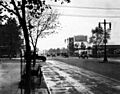
September 1920 photo near the intersection of Broad Street and Northeast Boulevard (now known as Roosevelt Boulevard) in Philadelphia
-
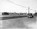
Essex and Hudson Lincoln Highway in Jersey City, New Jersey
-

Carl Graham Fisher, 1909
-
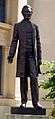
The Great Emancipator on display in Detroit, Michigan.


See also
 In Spanish: Autopista Lincoln para niños
