Dixie Highway facts for kids
Quick facts for kids
Dixie Highway |
|
|---|---|
| Chicago–Miami Expressway Canada–Miami Expressway Macon–Jacksonville Expressway |
|
 |
|
| Route information | |
| Length | 5,786 mi (9,312 km) |
| Existed | 1915–present |
| Western division | |
| North end | Chicago, Illinois |
| South end | Miami, Florida |
| Eastern division | |
| North end | Sault Ste. Marie, Michigan |
| South end | Miami, FL |
| Central division | |
| North end | Macon, Georgia |
| South end | Jacksonville, Florida |
| Location | |
| States: | Michigan, Illinois, Indiana, Ohio, Kentucky, Tennessee, North Carolina, Georgia, South Carolina, Florida |
| Highway system | |
| Auto Trails
|
|
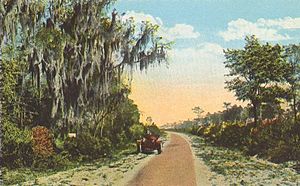
The Dixie Highway was a very important United States automobile road system. It was first planned in 1914 to connect the Midwest with the Southern United States. This highway was part of a bigger plan called the National Auto Trail system. It was built and grew between 1915 and 1929.
The idea for the Dixie Highway came from the Lincoln Highway, which was the first road to cross the United States. A businessman named Carl G. Fisher was a big supporter of both projects. The Dixie Highway was managed by the Dixie Highway Association. Many people, businesses, local towns, and states helped pay for it. At first, the U.S. federal government didn't do much. But after 1920, they started giving more money. In 1927, the Dixie Highway Association stopped, and the government took over the road. Parts of it became part of the U.S. Route system.
You could easily spot the Dixie Highway because it had a special mark. This mark was a red stripe with the white letters "DH". Usually, there was a white stripe above and below it. This logo was often painted on telephone poles.
Contents
Building the Dixie Highway
The idea for the Dixie Highway began in December 1914 in Chattanooga, Tennessee. Carl G. Fisher, who also helped with the Lincoln Highway, was behind it. On April 3, 1915, leaders from different states met in Chattanooga. They each chose two people to plan the road from Chicago to Miami.
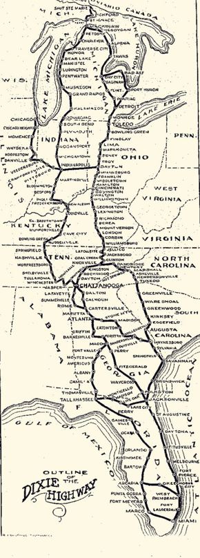
To serve more towns, the planners decided on a split route on May 22, 1915. The road started in Chicago and went south through Danville, Illinois. Then it turned east to Indianapolis. From Indianapolis, it split into two main paths.
- The western path went south through Louisville and Nashville to Chattanooga, Tennessee.
- The eastern path went east from Indianapolis to Dayton, Ohio. Then it turned south through Cincinnati, Lexington, Kentucky, and Knoxville, Tennessee, also ending in Chattanooga.
There were also other choices for routes between Chattanooga and Atlanta, and again between Atlanta and Macon, Georgia. From Macon, the western path went south to Tallahassee, Florida before turning east. The eastern path from Macon to Jacksonville, Florida was planned later. From Jacksonville, the road followed the east coast south to Miami, Florida.
The planners also decided to add Michigan to the project. They extended a branch of the eastern route from Dayton north to Detroit through Toledo. Michigan agreed to build a loop road around its lower part. This loop went through Toledo, South Bend, Indiana, Mackinaw City, and Detroit. Detroit became the northern end of the eastern route.
Main Routes of the Dixie Highway
The Dixie Highway was not just one road. It was a network of connected roads. Here are the main parts:
Western Route: Chicago to Miami
This route connected Chicago, Illinois, to Miami, Florida. It passed through cities like Indianapolis in Indiana; Louisville and Nashville in Kentucky and Tennessee; Atlanta, Macon, and Albany in Georgia; and Tallahassee, Gainesville, and Orlando in Florida. Today, parts of this route are still used as Illinois Route 1, U.S. Route 41, and U.S. Route 27, among others.
Eastern Route: Michigan to Florida
This route connected Sault Ste. Marie, Michigan, to Miami, Florida. It went through cities like Detroit in Michigan; Toledo, Dayton, and Cincinnati in Ohio; Lexington in Kentucky; Knoxville and Chattanooga in Tennessee; Atlanta and Savannah in Georgia; and Jacksonville and West Palm Beach in Florida. Many parts of this route are now U.S. Route 23, U.S. Route 25, and U.S. Route 1.
Central and Carolina Routes
- The Central route was a shorter way between Macon, Georgia, and Jacksonville, Florida. It helped travelers get to Miami faster.
- The Carolina route offered a shorter path between Knoxville, Tennessee, and Waynesboro, Georgia. It went through cities like Asheville in North Carolina and Greenville in South Carolina. Today, this route is mostly U.S. Route 25.
Where is the Dixie Highway Today?
|
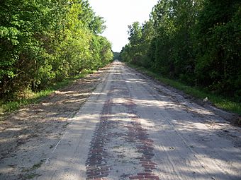
Dixie Highway-Hastings, Espanola and Bunnell Road
|
|
 |
|
| Location | Flagler and St. Johns counties, Florida, USA |
|---|---|
| Nearest city | Hastings and Espanola |
| Area | 72.7 acres (29.4 ha) |
| Built | 1916 |
| Architect | Wilson, James Y.; McCrary Engineering Company |
| NRHP reference No. | 05000311 |
| Added to NRHP | April 20, 2005 |
After the U.S. Highway System was created, many parts of the Dixie Highway became new U.S. Routes. For example, much of the eastern route became U.S. Route 25. Later, major highways like Interstate 75 were built, often running next to or replacing parts of the old Dixie Highway.
Even today, the name "Dixie Highway" is still used in many places. You can find streets named "Dixie Highway" or "Old Dixie Highway" in towns across the states it once crossed. In some cities in Florida, it runs right next to U.S. Route 1. In Kentucky, parts of U.S. Highway 31W are still called "Dixie Highway."
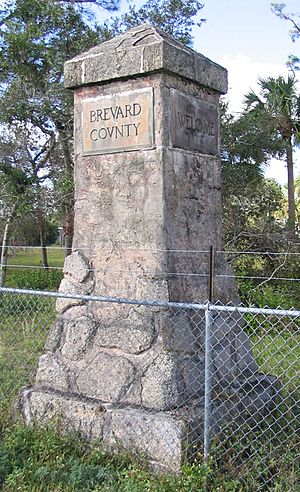
There are also special markers along the route. In western North Carolina, seven bronze plaques were placed in the late 1920s to mark the Dixie Highway. You can find these in towns like Asheville and Hendersonville. There are also monuments in Ohio and Florida.
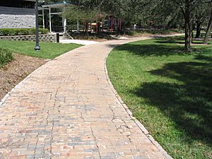
A special part of the original brick Dixie Highway, known as the Dixie Highway-Hastings, Espanola and Bunnell Road, is in Florida. It's also called the "Old Brick Road." This section was added to the National Register of Historic Places in 2005. Another brick section exists in Maitland, Florida.
The name "Dixie Highway" has caused some discussion. Some people feel the name connects to a difficult time in history, including slavery. Because of this, some communities have considered changing the name of roads that still use "Dixie Highway."
Fun Facts and Legacy
The Dixie Highway wasn't just a road; it also inspired music! Several songs have been written about it:
- "Dixie Highway" by Walter Donaldson and Gus Kahn
- "On the Dixie Highway" by Leo Friedman
- "Dixie Highway" by the band Journey
- "Dixie Highway" by Alan Jackson
- "Old Dixie Highway" by Roger Alan Wade
- The song "Darlington County" by Bruce Springsteen also mentions the highway.
The Dixie Highway was a big step in connecting different parts of the United States. It helped people travel more easily and brought communities closer together.
Images for kids
 | Charles R. Drew |
 | Benjamin Banneker |
 | Jane C. Wright |
 | Roger Arliner Young |


