Bridger Pass facts for kids
Quick facts for kids Bridger Pass |
|
|---|---|
| Bridger's Pass Name origin: Jim Bridger |
|

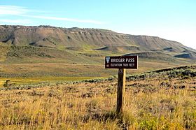
Hiking along Bridger Pass Road in the Divide Basin
|
|
| Elevation | 7,532 ft (2,296 m) |
| Traversed by | Stansbury Expedition Overland Trail |
| Range | Sierra Madre (Wyoming) |
| Coordinates | 41°33′02″N 107°26′05″W / 41.5505°N 107.4347°W |
|
Bridger's Pass
|
|
| Nearest city | Rawlins, Wyoming |
| Area | less than one acre |
| Built | 1850 |
| NRHP reference No. | 70000669 |
| Added to NRHP | April 28, 1970 |
Bridger Pass is a mountain pass located in Carbon County, Wyoming. It sits right on the Continental Divide of the Americas. This means it's a spot where water on one side flows to the Pacific Ocean, and water on the other side flows to the Atlantic Ocean. The pass is also near a unique area called the Great Divide Basin. Here, the Continental Divide seems to split, creating a large basin where water doesn't flow to either ocean but stays within the basin.
Contents
A Path Through History
Bridger Pass has been an important route for travelers for a long time.
Early Explorers
The first recorded crossing of Bridger Pass happened during the Stansbury Expedition. This group was returning east from an exploration trip to Utah. They were guided by a famous mountain man named Jim Bridger, who knew the area well. The pass was later named after him.
The Overland Trail
About ten years after the Stansbury Expedition, Bridger Pass became a regular part of the Overland Trail. This trail was a major route for pioneers and stagecoaches traveling across the American West. It followed the path that Stansbury and Bridger had described.
To help travelers, the Bridger Stage Station was built near the pass. This station provided a place for people to rest and change horses. The Overland Trail was used a lot between 1860 and 1869. However, its use declined when the First Transcontinental Railroad was completed. The railroad offered a much faster way to travel, making the stagecoach lines less necessary.
Bridger Pass Today
Today, Bridger Pass is still an important landmark, especially for hikers.
The Continental Divide Trail

The official route of the Continental Divide Trail uses Bridger Pass Road. This trail is a long hiking path that follows the Continental Divide through North America. Hikers use Bridger Pass to cross the Great Divide Basin between Battle Pass and Rawlins, Wyoming.
Challenges for Hikers
One of the main challenges for hikers in this area is finding fresh water. The water in the Great Divide Basin is often brackish. This means it's salty and not safe to drink. Hikers need to plan carefully and carry enough water when they travel through this section.
 | Isaac Myers |
 | D. Hamilton Jackson |
 | A. Philip Randolph |


