Red Desert (Wyoming) facts for kids
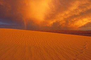
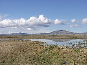
The Red Desert is a high, dry area in south-central Wyoming, USA. It's a mix of desert and sagebrush plains, covering about 9,320 square miles. This special place has unique features like the Great Divide Basin, where water doesn't flow out to the ocean. It also has the Killpecker Sand Dunes, which are the biggest "living" sand dunes in the United States. In the 1800s, famous trails like the Oregon Trail, California Trail, and Mormon Trail crossed the Continental Divide nearby. Today, a busy highway, Interstate 80, cuts through the southern part of the desert.
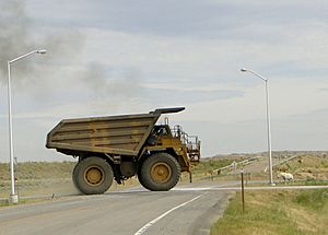
Most of the Red Desert is public land, managed by the U.S. Bureau of Land Management (BLM). This area is rich in important natural resources like oil, natural gas, uranium, and coal. About 84% of the Red Desert has been changed by oil and gas drilling or mining.
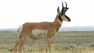
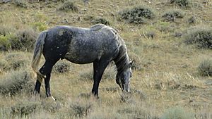
Even though water and plants are scarce, the Red Desert is full of wildlife. It's home to the largest group of migrating pronghorn in the lower 48 states. A rare herd of desert elk, thought to be the world's biggest, also lives here. Ponds that form from melting snow in summer attract many migrating birds, like ducks, trumpeter swans, and white pelicans. Herds of wild horses roam freely, protected by a special law from 1971. Long ago, bison were common, and you can sometimes find their skulls and horns.
Contents
Geography of the Red Desert
Water in the Desert
Water has played a huge role in shaping the Red Desert, even though it doesn't rain much here. Long ago, ancient rivers and a giant lake called Lake Gosiute filled this basin. They left behind many layers of sediment, some as deep as 20,000 feet!
Lake Gosiute first appeared about 50 million years ago. Over four million years, the lake's water levels went up and down many times. At its largest, Lake Gosiute covered about 15,000 square miles, reaching into Utah. Sometimes, the lake dried up completely.
When Lake Gosiute dried, it left behind a lot of salty minerals and thick organic mud. The salty parts became a valuable mineral called trona. The mud turned into coal-bed methane gas, coal, and the world's largest known oil-shale deposit. These energy sources make the Red Desert a key area for natural gas production in Wyoming today.
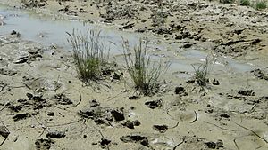
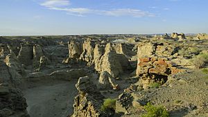
The Red Desert's current water system includes salty lakes and ponds. These can be muddy flats in wet years or completely dry during droughts. Small streams, mostly fed by melting snow and summer thunderstorms, carve out deep ditches called arroyos. These small changes, repeated over millions of years, along with wind, have created the desert's rugged landscape of buttes, tall rock formations, gulches, and flat areas.
The Continental Divide splits around the Red Desert, forming the Great Divide Basin. This means no surface water from this basin flows out to the oceans. Water also comes from seeps and springs on mountains and buttes, feeding small streams like Jack Morrow Creek. While the water inside the basin is temporary, the desert is bordered by the Green River to the west and the North Platte River to the east.
Killpecker Sand Dunes
The Killpecker Sand Dunes stretch about 55 miles east from the Green River Basin. They cross the Continental Divide and cover about 109,000 acres. These "living" dunes, which are some of North America's largest, exist because of two main reasons:
- The Big Sandy and Little Sandy Rivers, northeast of Rock Springs, Wyoming, collected huge amounts of sand when glaciers melted from the Wind River Mountains.
- Strong westerly winds over the last 20,000 years have pushed this sand eastward across the continental divide to where it is now.
These sand dunes are very important because they store snowmelt and rain. This water supports plants and wildlife. Water sinks deep into the sand, safe from the sun and wind that would make it evaporate. Plants like sagebrush can then reach this stored water. A few tough plant species can grow on the active dunes, including:
- Blowout grass, Indian rice grass, needle-and-thread grass, prairie sandweed, rusty lupine, salina wildrye, sand lovegrass, sand muhly, sandhill muhly, and scurfpea.
These plants help to hold the sand in place by slowing down the wind near the ground. Over time, as more plants grow, the dunes can become stable.
Many small creatures live in the dunes, such as dune beetles, shrews, white-footed mice, and kangaroo rats. These small animals attract predators like owls, eagles, and bobcats. Also, temporary ponds form in the low spots between the dunes during summer. These ponds are like oases, attracting migrating shore birds, waders, and large animals like elk. Cattle, sheep, and wild horses also visit these ponds. The fresh water also provides a home for aquatic animals like salamanders and freshwater shrimp.
Some parts of the Killpecker Sand Dunes, about 10,500 acres, are open for off-road vehicles. Drivers must be careful to avoid the freshwater ponds.
Plant and Wildlife in the Red Desert
At first glance, the Red Desert looks dry and empty. But it's actually home to about 350 different kinds of animals and over 1,000 plant species! The sagebrush plains and grasslands support 40,000 to 50,000 pronghorn antelope, which is the largest migrating herd in the lower forty-eight states. Mule deer and the world's largest desert elk herd also live here.
What the desert lacks in dense animal habitats, it makes up for in its vast open spaces. The Red Desert is the largest unfenced area in the continental United States. Almost three-quarters of the area is covered by sagebrush grassland.
Sagebrush is a vital habitat for many animals, from pronghorn that eat it all year to tiny insects. However, oil and gas roads, drilling, and mining can limit this habitat. Sagebrush also provides cover for animals like elk and the pygmy rabbit. Elk rely on tall sagebrush near Steamboat Mountain for shelter during spring when their calves are born, and for shade in the hot summer. Sagebrush also acts like a living snow fence. Windblown snow piles up behind the bushes in winter, storing moisture that slowly releases into the soil in late spring and early summer.
The Red Desert's unique environment means it has a wide variety of wildlife. Predators like coyotes, and sometimes mountain lions, swift foxes, and kit foxes, are attracted by the many mammals they can hunt. Animals like pocket gophers, badgers, sage grouse, sage sparrows, and the sage thrasher are found in the sagebrush habitat. Many animals in the Red Desert live underground. White-tailed prairie dogs, Great Basin spadefoot toads, tiger salamanders, pygmy rabbits, and sagebrush lizards all dig burrows to protect themselves from the desert's extreme weather and predators. Similarly, the burrowing owl nests underground, often in burrows dug by prairie dogs. Migrating summer birds like the white-faced ibis and white pelican can be seen at snowmelt ponds and temporary wetlands.
High above the desert floor, the Ferris Mountains and Green Mountains form the northeast edge of the Red Desert. These mountains have a cooler, forest-like environment, reaching as high as 10,037 feet at Ferris Peak. They are home to snowshoe hares, red squirrels, and small groups of bighorn sheep. The high elevation attracts elk and mule deer in the summer. Prairie falcons, northern harriers, and other birds of prey fly along the mountain ridges and canyon rims, looking for food like migratory mountain plovers, which are small ground birds.
The mountain plover is one of three species in the Red Desert protected by the Endangered Species Act. The bald eagle and the black-footed ferret are also on this list. However, bald eagles are rarely seen in the desert because there aren't many streams or lakes with fish. Black-footed ferrets, which eat prairie dogs, are also very rare.
People and the Red Desert
Scientists believe people have lived in the Red Desert for 12,000 years. Amazing ancient rock art, called petroglyphs, can be found at places like the Boars Tusk and Seedskadee. Researchers think these carvings tell stories about people's lives, ceremonies, or spiritual beliefs. The Black Art petroglyph in the Red Desert might be 11,500 years old, making it possibly the oldest rock art on the continent.
The Red Desert was also a meeting place and trading spot for Native American tribes like the Blackfeet, Crows, and Shoshone. Rock art from these times, especially along the Green River, shows a mix of different Indian cultures. Other ancient Native American tools, over 10,000 years old, have been found in the Killpecker Sand Dunes, often near bison bones.
Generations of American families also left their mark on the desert as they traveled west on pioneer trails starting in the 1840s. About 350,000 pioneers and their wagon trains passed through Wyoming between 1841 and 1868. You can still see the impact they had on the land today. In some places, like Guernsey, wagon wheels wore deep ruts into solid sandstone. Most trail ruts are not as dramatic, but they still show the history of people traveling across the land.
Historic stagecoach trails from the 1800s are also part of the Red Desert's story. The Overland Stage, for example, later shifted its route to cross southern Wyoming. You can still see stagecoach ruts in many places, including north of Baggs. A short gold rush in the mountains north of the Red Desert in 1867 led to stage and freight services from Point of Rocks on the Union Pacific Railroad up to South Pass City. You can find parts of the Oregon, California, Mormon, and Pony Express trails, along with old tools and fossils.
In 1869, the First transcontinental railroad connected the eastern and western parts of the nation, and its route went through the Red Desert. Building this railroad was a huge challenge. The Red Desert's lack of water was a big problem for the steam locomotives. The Union Pacific Company solved this by drilling deep wells to find reliable water. Some of these railroad wells, like the one at Wamsutter, still provide much-needed water today for residents and the many oil and gas workers who live in temporary camps.
After the railroad was finished, new trade routes appeared. One example is the New Fork Wagon Road, which ran 80 miles from Rock Springs, Wyoming, to New Fork. This road connected isolated ranches and settlements. Freighters at the time would hitch up to 18 horses to pull five wagons at once, showing how much cargo was moved.
The Union Pacific Railroad helped create towns along its route, like Wamsutter. Later, in 1913, the Lincoln Highway connected these towns. This coast-to-coast highway also crossed the Red Desert. Nearly 50 years later, in 1956, Interstate 80 replaced the Lincoln Highway as America's main cross-country road. Today, Interstate 80 carries about 11,000 vehicles across the desert daily. This four-lane highway divides the desert into a north and south part, which affects how wildlife migrates.
Other roads from the time of westward expansion branched off from railroad stops like Point of Rocks, Green River, and Bryan. These trade routes linked distant mining towns, ranches, and military posts. You can still see signs of these early routes, like old stage stations and freighter camps, in areas such as Freighter's Gap.
Today, a network of dirt and gravel roads crisscrosses the desert. These are used by modern freighters hauling supplies for oil fields. One energy company, BP, reported that its service people in the Wamsutter gas field travel about 800,000 miles per month. The number of natural gas wells has grown rapidly, with over 2,000 wells expected to be working in the Wamsutter gas field by 2020. This gas field covers an area about 55 miles long and 35 miles wide in the Red Desert. New drilling technology allows many wells to be grouped on one drilling pad, which helps reduce the impact on the land. However, the BLM expects energy development to continue expanding in the Red Desert, including in the Jack Morrow Hills area, which is about 600,000 acres near South Pass.
|
 | Roy Wilkins |
 | John Lewis |
 | Linda Carol Brown |


