
Rock Springs, Wyoming facts for kids
Quick facts for kids
Rock Springs, Wyoming
|
||
|---|---|---|

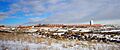
Panorama of downtown Rock Springs, looking southeast from grant Street
|
||
|
||

Location of Rock Springs in Sweetwater County, Wyoming.
|
||

Rock Springs, Wyoming
Location in the United States
|
||
| Country | United States | |
| State | Wyoming | |
| County | Sweetwater | |
| Rock Springs | 1888 | |
| Area | ||
| • Total | 19.75 sq mi (51.16 km2) | |
| • Land | 19.75 sq mi (51.16 km2) | |
| • Water | 0.00 sq mi (0.00 km2) | |
| Elevation | 6,388 ft (1,947 m) | |
| Population
(2020)
|
||
| • Total | 23,526 | |
| • Density | 1,146.81/sq mi (442.78/km2) | |
| Time zone | UTC−7 (Mountain (MST)) | |
| • Summer (DST) | UTC−6 (MDT) | |
| ZIP Codes |
82901, 82902, 82942
|
|
| Area code(s) | 307 | |
| FIPS code | 56-67235 | |
| GNIS feature ID | 1593588 | |

Rock Springs is a city in Sweetwater County, Wyoming, United States. In 2020, about 23,526 people lived there. This makes it the fifth largest city in Wyoming. It is also the biggest city in Sweetwater County.
Rock Springs is known as the "Home of 56 Nationalities." This is because many immigrants came from all over the world. They came to work in the coal mines. These mines provided fuel for the Union Pacific Railroad's steam engines. Every summer, the city celebrates its diverse culture with "International Day." This festival at Bunning Park features foods, costumes, and traditions from the ancestors of the city's residents.
The city is home to Western Wyoming Community College. It also hosts Wyoming's Big Show, a yearly event with a carnival and concerts. This event takes place at the Sweetwater County Events Complex. Rock Springs is in an area rich in energy, with many oil and natural gas wells.
Contents
History of Rock Springs
Rock Springs got its name from a natural spring. This spring was in the northern part of town. Some people thought a lost Pony Express rider found it. But the spring was known even before 1860. The Overland Stage station was also nearby. The spring later disappeared because of coal mining. An 'S' was added to the name, making it "Rock Springs."
Water supply was a challenge for Rock Springs for many years. In the early days, people had to haul water from other places. Mining operations sometimes stopped the water flow. In 1887, a water pipe was built from the Green River. It was finished in 1888, bringing a steady water supply to the city.
Rock Springs has a very diverse history. Locals used to call it the "57 Variety Town." The first immigrants were brought by the railroad and coal companies. Many people from Wales and Britain came first. Later, people from Ireland, Black Americans, and refugees from the Southern United States also arrived. Many Scandinavian people came too, often recruited by the Mormon church.
A sad event happened on September 2, 1885. It was called the Rock Springs Massacre. White miners attacked Chinese miners. This was due to strong anti-Chinese feelings at the time. There are still old coal mining towns outside Rock Springs today.
On June 10, 1892, the Rock Springs National Bank opened. It was located on Main Street. The first building was made of sandstone. It was designed by Mayor H.H. Edgar. In 1907, the bank moved to C Street. John Hay Sr. led the bank through tough times like the Great Depression and World War II. His son, John Hay Jr., took over in 1947. He managed the bank during Wyoming's big energy boom in the 1970s. John Hay Sr. had another son, Archibald (Archie) Hay. Archie was killed in France during World War I in 1918. An American Legion post was named "Archie Hay Post" in his memory.
Rock Springs was featured on the TV show 60 Minutes in 1977. This was about some issues within the city government. A follow-up show, City Confidential, was filmed 20 years later.
Geography and Climate
Rock Springs covers about 19.34 square miles (50.1 square kilometers) of land.
Weather in Rock Springs
Rock Springs has a semi-arid climate. This means it has cold, snowy winters and warm summers. It doesn't get a lot of rain or snow. The most precipitation usually happens in mid-spring and early fall. Summers and winters are drier.
In December, the average high temperature is about 33.2°F (0.7°C). The average low is about 12.4°F (-10.9°C). In July, the average high is about 86.3°F (30.2°C). The average low is about 52.5°F (11.4°C).
On average, there are about 14.7 days each year when the temperature reaches 90°F (32°C) or higher. There are also about 183.6 nights when the temperature drops to 32°F (0°C) or lower. About 11.5 nights each year see temperatures of 0°F (-18°C) or lower. The hottest temperature ever recorded was 98°F (37°C) on July 13, 2002. The coldest was -37°F (-38°C) on January 12, 1963.
The city gets about 10.45 inches (265 mm) of precipitation each year. It snows about 61.7 days a year. The most snow in one year was 79.7 inches (202 cm) in 1995.
| Climate data for Rock Springs, Wyoming (Rock Springs Airport), 1991–2020 normals, extremes 1948–present | |||||||||||||
|---|---|---|---|---|---|---|---|---|---|---|---|---|---|
| Month | Jan | Feb | Mar | Apr | May | Jun | Jul | Aug | Sep | Oct | Nov | Dec | Year |
| Record high °F (°C) | 55 (13) |
60 (16) |
72 (22) |
79 (26) |
90 (32) |
96 (36) |
98 (37) |
96 (36) |
91 (33) |
83 (28) |
66 (19) |
58 (14) |
98 (37) |
| Mean maximum °F (°C) | 43.6 (6.4) |
47.1 (8.4) |
61.1 (16.2) |
71.2 (21.8) |
79.8 (26.6) |
87.9 (31.1) |
92.5 (33.6) |
90.5 (32.5) |
84.4 (29.1) |
73.9 (23.3) |
58.6 (14.8) |
45.9 (7.7) |
93.1 (33.9) |
| Mean daily maximum °F (°C) | 34.6 (1.4) |
37.9 (3.3) |
48.6 (9.2) |
56.8 (13.8) |
67.3 (19.6) |
78.6 (25.9) |
86.3 (30.2) |
84.4 (29.1) |
75.0 (23.9) |
61.3 (16.3) |
44.7 (7.1) |
33.2 (0.7) |
59.1 (15.0) |
| Daily mean °F (°C) | 23.5 (−4.7) |
26.5 (−3.1) |
36.0 (2.2) |
43.1 (6.2) |
52.3 (11.3) |
61.9 (16.6) |
69.4 (20.8) |
67.6 (19.8) |
58.1 (14.5) |
46.3 (7.9) |
32.7 (0.4) |
22.8 (−5.1) |
45.0 (7.2) |
| Mean daily minimum °F (°C) | 12.4 (−10.9) |
15.1 (−9.4) |
23.4 (−4.8) |
29.5 (−1.4) |
37.4 (3.0) |
45.2 (7.3) |
52.5 (11.4) |
50.7 (10.4) |
41.2 (5.1) |
31.4 (−0.3) |
20.7 (−6.3) |
12.4 (−10.9) |
31.0 (−0.6) |
| Mean minimum °F (°C) | −7.9 (−22.2) |
−5.4 (−20.8) |
7.3 (−13.7) |
16.0 (−8.9) |
25.5 (−3.6) |
34.3 (1.3) |
45.5 (7.5) |
42.8 (6.0) |
29.6 (−1.3) |
15.9 (−8.9) |
2.7 (−16.3) |
−6.6 (−21.4) |
−14.3 (−25.7) |
| Record low °F (°C) | −37 (−38) |
−29 (−34) |
−12 (−24) |
2 (−17) |
14 (−10) |
26 (−3) |
35 (2) |
33 (1) |
5 (−15) |
−10 (−23) |
−13 (−25) |
−29 (−34) |
−37 (−38) |
| Average precipitation inches (mm) | 0.45 (11) |
0.43 (11) |
0.61 (15) |
1.07 (27) |
1.88 (48) |
0.82 (21) |
0.92 (23) |
0.89 (23) |
1.17 (30) |
1.03 (26) |
0.66 (17) |
0.52 (13) |
10.45 (265) |
| Average snowfall inches (cm) | 6.1 (15) |
5.8 (15) |
4.4 (11) |
1.9 (4.8) |
0.5 (1.3) |
0.0 (0.0) |
0.0 (0.0) |
0.0 (0.0) |
0.0 (0.0) |
2.3 (5.8) |
3.8 (9.7) |
6.5 (17) |
31.3 (79.6) |
| Average precipitation days (≥ 0.01 in) | 4.4 | 4.7 | 4.2 | 5.6 | 8.8 | 4.8 | 4.1 | 4.8 | 5.5 | 5.0 | 4.0 | 5.8 | 61.7 |
| Average snowy days (≥ 0.1 in) | 3.7 | 3.5 | 2.5 | 0.6 | 0.3 | 0.0 | 0.0 | 0.0 | 0.0 | 0.7 | 2.5 | 5.0 | 18.8 |
| Source 1: NOAA | |||||||||||||
| Source 2: National Weather Service | |||||||||||||
Population Changes Over Time
| Historical population | |||
|---|---|---|---|
| Census | Pop. | %± | |
| 1870 | 40 | — | |
| 1880 | 763 | 1,807.5% | |
| 1890 | 3,406 | 346.4% | |
| 1900 | 4,363 | 28.1% | |
| 1910 | 5,778 | 32.4% | |
| 1920 | 6,456 | 11.7% | |
| 1930 | 8,440 | 30.7% | |
| 1940 | 9,827 | 16.4% | |
| 1950 | 10,857 | 10.5% | |
| 1960 | 10,371 | −4.5% | |
| 1970 | 11,657 | 12.4% | |
| 1980 | 19,458 | 66.9% | |
| 1990 | 19,050 | −2.1% | |
| 2000 | 18,708 | −1.8% | |
| 2010 | 23,036 | 23.1% | |
| 2020 | 23,526 | 2.1% | |
Rock Springs in 2010
In 2010, there were 23,036 people living in Rock Springs. There were 8,762 households and 5,849 families. The city had about 1,191 people per square mile.
Most people (86.4%) were White. Other groups included African American (1.4%), Native American (0.8%), and Asian (1.1%). About 16.4% of the population was Hispanic or Latino.
About 35.8% of households had children under 18. Nearly half (49.9%) were married couples. The average household had 2.57 people. The average family had 3.07 people.
The average age in the city was 31.5 years old. About 26.4% of residents were under 18. About 8.1% were 65 or older. The population was 52.1% male and 47.9% female.
Arts and Culture in Rock Springs

Rock Springs hosts several fun events. These include the International Festival, the Blues and Brews Festival, and the Wyoming Chocolate Festival. There is also the Rod and Rails Festival. In the summer months (July, August, and September), the city holds a big county fair called Wyoming's Big Show.
The city has two public libraries: Rock Springs Library and White Mountain Library. They are part of the Sweetwater County Library System. The Rock Springs Library is a historic Carnegie Library. It has been expanded and now includes an art gallery. This gallery is home to an original painting by the famous artist Norman Rockwell.
Education in Rock Springs


Public schools in Rock Springs are part of Sweetwater County School District #1. The elementary schools include Desert View, Northpark, Overland, Pilot Butte, Sage, Stagecoach, Walnut, and Westridge. Students then go to Rock Springs Junior High School. For high school, they attend Rock Springs High School. There are also two alternative schools: Black Butte High School and Roosevelt Learning Center.
Western Wyoming Community College is a college located in Rock Springs.
Media and News
Online News
Rock Springs has two local news websites. These are SweetwaterNOW.com and Wyo4news.com.
Newspapers
The city has two print newspapers. They are the Rock Springs Daily Rocket-Miner and the Green River Star. The Green River Star is a weekly newspaper published in Green River.
Radio Stations
Many radio stations serve Rock Springs. Some of these include KRKK, KSIT, KQSW, KMRZ-FM, KYCS, KZWB, KFRZ, and KUGR.
Television Channels
All television stations in Rock Springs are relays or satellites of stations from other places.
| Channel | Callsign | Network | Notes |
| 13 | KGWR-TV | CBS/ABC | Satellite of KGWC-TV, Casper, Wyoming |
| 28 | K28JU-D | PBS | relay of Wyoming PBS |
Transportation in Rock Springs
Major Roads
Several important highways pass through Rock Springs:
- I-80
- US 30 (Dewar Drive)
- US 191
- WYO 370 (Baxter Road/Airport Road)
- WYO 376 (Circumferential Highway/Rock Springs Beltway)
- WYO 430 (Hampshire Street Parkway)
Air Travel
Rock Springs is served by the Southwest Wyoming Regional Airport.
Railroads
The Union Pacific railroad serves Rock Springs.
Local Buses
STAR Transit provides bus service within Rock Springs. It also offers limited service to nearby Reliance and Green River.
Sister City
Rock Springs has one sister city:
- Skofja Loka, Slovenia
Famous People from Rock Springs
Many notable people have connections to Rock Springs:
- Adam Archuleta – A safety for the St. Louis Rams and Chicago Bears football teams.
- Earl W. Bascom – A rodeo champion, cowboy artist, and Hollywood actor.
- Texas Rose Bascom – A rodeo performer and Hollywood actress.
- Paul Brothers – A football player.
- Butch Cassidy – A famous outlaw who once worked in a butcher shop in Rock Springs.
- Bruce Collins (basketball) – A basketball player drafted by the Portland Trail Blazers.
- Edward Crippa – A U.S. Senator from Wyoming.
- Mickey Daniels – An actor who appeared in many movies in the 1930s.
- Boyd Dowler – A wide receiver for the Green Bay Packers and Washington Redskins football teams.
- John Frullo – A member of the Texas House of Representatives.
- Paul Gosar – A member of the U.S. House of Representatives for Arizona.
- Pete Gosar – A Democratic politician and brother of Paul Gosar.
- Robert Holding – Launched the first of Grand America Hotels & Resorts near Rock Springs.
- Joe Legerski – Head coach of the Wyoming Cowgirls basketball team.
- Andrew Manatos – An assistant who helped pass important laws like the Civil Rights Bills.
- Florabel Muir – A syndicated columnist and Hollywood screenwriter.
- Teno Roncalio – A Democratic politician and U.S. Representative.
- Jack Snow – A wide receiver for the Los Angeles Rams football team.
- J.J. Syvrud – A football player.
- John Wendling – A football player for the Buffalo Bills and Detroit Lions.
- Spencer West – A motivational speaker and disability advocate.
- Todd Parr – An author, illustrator, animator, and television producer.
- Kenilynn S. Zanetti – A politician.
Images for kids
-
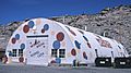
Wonder Bread store in Rock Springs, 2004
-
Rock Springs Coal sign
-
Western Wyoming Community College, December 2007
See also
 In Spanish: Rock Springs (Wyoming) para niños
