Banner County, Nebraska facts for kids
Quick facts for kids
Banner County
|
|
|---|---|

Banner County Courthouse in Harrisburg
|
|
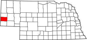
Location within the U.S. state of Nebraska
|
|
 Nebraska's location within the U.S. |
|
| Country | |
| State | |
| Founded | 1888 |
| Seat | Harrisburg |
| Largest community | Harrisburg |
| Area | |
| • Total | 746 sq mi (1,930 km2) |
| • Land | 746 sq mi (1,930 km2) |
| • Water | 0.2 sq mi (0.5 km2) 0.02%% |
| Population
(2020)
|
|
| • Total | 674 |
| • Estimate
(2022)
|
660 |
| • Density | 0.9035/sq mi (0.3488/km2) |
| Time zone | UTC−7 (Mountain) |
| • Summer (DST) | UTC−6 (MDT) |
| Congressional district | 3rd |
Banner County is a county located in the western part of Nebraska, a state in the Great Plains region of the United States. In 2020, about 674 people lived there. The main town, or county seat, is Harrisburg. There are no big cities in Banner County.
If you look at Nebraska's license plates, Banner County is shown by the number 85. This is because it had the 85th largest number of registered vehicles when the system started in 1922.
Banner County is also part of the Scottsbluff area, which is a group of nearby towns and counties that are connected economically.
Contents
History of Banner County
When Nebraska became a state in 1867, the entire western part of the state, called the Nebraska Panhandle, was one big county. In 1870, the southern half of this area became Cheyenne County.
As more and more settlers arrived, the county was divided again in 1888. The eastern part became Deuel County. The middle part became today's Cheyenne County. And the western part was split into Kimball, Scotts Bluff, and Banner Counties.
The people who named Banner County believed it would become the best county in the state, like a "banner" or a bright star.
When the county was first set up, a small town called Ashford was chosen as the temporary county seat. But four communities wanted to be the permanent county seat: Ashford, Harrisburg, Freeport, and Banner. After two special elections, Harrisburg was finally chosen.
Early Settlers and Farming
At first, cattle ranchers settled in the area because of the good pastures in the Pumpkin Creek valley. In the late 1880s, many new settlers arrived, claiming land through the Homestead Act. By 1890, almost every piece of land was claimed.
However, a big drought hit in 1893 and 1894. This made many new settlers leave. The number of farms dropped by more than half. The land that was left empty was then used again by ranchers, who raised both crops and cattle.
In 1904, the Kinkaid Act allowed homesteaders to claim larger areas of land, up to 640 acres (259 ha). This brought a new wave of settlers. But even these larger plots were often not enough to support a family, so many of these claims were eventually sold to bigger cattle ranchers.
The county's growth was also slow because there were no railroads nearby. The closest train lines were 11 miles (18 km) south in Kimball and 8 miles (13 km) north in Gering. Roads were also very basic, mostly just dirt roads in 1921. This made it hard for farmers to get their crops to markets.
Water and Farming
Banner County does not get much rain. The average rainfall is only about 14.3 inches (36 cm) per year. Because of this, farmers started using irrigation. The first irrigation well was drilled in the late 1920s, and many more followed. By the late 1900s, large center-pivot irrigation systems were used across much of the county.
By 2000, there were about 500 irrigation wells in the Pumpkin Creek area. All this water pumping, along with dry weather, caused the Pumpkin Creek to stop flowing above ground by 1993. It also lowered the groundwater levels. In 2001, the local water authority stopped new wells from being drilled and limited how much water existing farms could use.
Missile Silos
In the early 1960s, intercontinental ballistic missiles (ICBMs) were placed in western Nebraska, Wyoming, and Colorado. These missiles were based at Warren Air Force Base near Cheyenne, Wyoming. From 1960 to 1963, 90 Atlas missile sites were built in Nebraska. Building these sites and improving the roads helped the economy in western Nebraska.
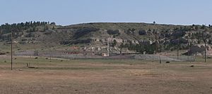
Starting in 1963, the Atlas missiles were replaced by Minuteman missiles. These new missiles used solid fuel and were launched from underground silos. In the 1970s, there were 82 Minuteman III sites in the Panhandle, and 20 of them were located in Banner County.
Geography
Banner County covers about 746 square miles (1,932 km²). Most of it is land, with only a tiny bit of water.
The county used to be a flat area sloping down from the Rocky Mountains. Over a long time, rivers and streams like Pumpkin Creek carved out the land. Now, much of the county is lower than the original flat plains.
Banner County has four main types of land:
- The low, flat valley of Pumpkin Creek, which makes up about 40% of the county.
- A higher flat area in the southern part of the county. Some parts are smooth, while others have deep valleys.
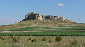
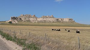
- The Wildcat Hills, which are steep, rocky hills in the northwestern part.
- A small part of the North Platte River valley in the northeastern corner.
Neighboring Counties
Banner County shares borders with these counties:
- Scotts Bluff County - north
- Morrill County - east
- Cheyenne County - southeast
- Kimball County - south
- Laramie County, Wyoming - west (in Wyoming)
- Goshen County, Wyoming - northwest (in Wyoming)
Main Roads
- Nebraska Highway 88 – This road goes generally east to west, from Bridgeport to La Grange, Wyoming. It passes north of Harrisburg.
- Nebraska Highway 71 – This road goes north to south, from Kimball to Gering. It passes east of Harrisburg.
Population
| Historical population | |||
|---|---|---|---|
| Census | Pop. | %± | |
| 1890 | 2,435 | — | |
| 1900 | 1,114 | −54.3% | |
| 1910 | 1,444 | 29.6% | |
| 1920 | 1,435 | −0.6% | |
| 1930 | 1,676 | 16.8% | |
| 1940 | 1,403 | −16.3% | |
| 1950 | 1,325 | −5.6% | |
| 1960 | 1,269 | −4.2% | |
| 1970 | 1,034 | −18.5% | |
| 1980 | 918 | −11.2% | |
| 1990 | 852 | −7.2% | |
| 2000 | 819 | −3.9% | |
| 2010 | 690 | −15.8% | |
| 2020 | 674 | −2.3% | |
| 2022 (est.) | 660 | −4.3% | |
| US Decennial Census 1790-1960 1900-1990 1990-2000 2010 |
|||
Banner County's population was highest in 1890 with 2,435 people. Since then, the number of people living there has slowly gone down. It is now one of the counties in Nebraska with the fewest people.
In 2000, there were 819 people living in the county. Most people were White (95.85%). About 5.62% of the population was Hispanic or Latino. Many residents had German (31.2%), English (14.4%), or American (14.1%) backgrounds.
The average age in the county in 2000 was 40 years old. About 28.8% of the people were under 18.
Economy
About 60% of Banner County is used for farming. Farmers mainly grow winter wheat and use land for grazing cattle. They also grow crops like corn, beans, sugar beets, potatoes, sunflowers, and millet.
Because of less groundwater and droughts, some farmers are now getting help to switch from irrigated farming (using extra water) to dryland farming (relying only on rain).
Oil was found in Banner County in 1919, but it was too deep to get out easily back then. Oil production started in 1951 and was highest in 1960. By 2009, fewer wells were active. However, new oil discoveries in Colorado have made people interested in exploring for oil in the Niobrara shale, which is under western Nebraska. In 2010, selling rights to drill for oil in Banner and Kimball counties brought in record high prices.
Education
Banner County has one school district. There is a K–12 school in Harrisburg, which means it teaches students from kindergarten all the way through 12th grade. In 2017, about 151 students were enrolled at the school.
Community
Main Community
Harrisburg is the only community in Banner County and is also its county seat. It is one of only two county seats in Nebraska that is not officially an incorporated city or town.
See also
 In Spanish: Condado de Banner para niños
 | Chris Smalls |
 | Fred Hampton |
 | Ralph Abernathy |


