Chugwater, Wyoming facts for kids
Quick facts for kids
Chugwater, Wyoming
|
|
|---|---|

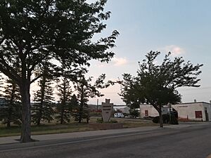
Chugwater welcome sign
|
|

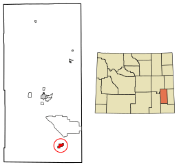
Location of Chugwater in Platte County, Wyoming.
|
|
| Country | United States |
| State | Wyoming |
| County | Platte |
| Area | |
| • Total | 3.06 sq mi (7.93 km2) |
| • Land | 3.06 sq mi (7.93 km2) |
| • Water | 0.00 sq mi (0.00 km2) |
| Elevation | 5,295 ft (1,614 m) |
| Population
(2020)
|
|
| • Total | 175 |
| • Density | 65.69/sq mi (25.36/km2) |
| Time zone | UTC−7 (Mountain (MST)) |
| • Summer (DST) | UTC−6 (MDT) |
| ZIP code |
82210
|
| Area code(s) | 307 |
| FIPS code | 56-14165 |
| GNIS feature ID | 1609180 |
| Website | http://www.chugwater.com/ |
Chugwater is a small town in Platte County, Wyoming, United States. In 2020, about 175 people lived there. This town is located in the High Plains. It is about 45 miles north of Cheyenne and 25 miles south of Wheatland.
Contents
History of Chugwater
The Chugwater area was visited by some of the first Western explorers. This was because it was close to Fort Laramie. Explorers like Stephen Watts Kearny came through in 1845. Cattle were first kept in the valley for winter as early as 1859.
Early Explorers in the Valley
In 1870, the Hayden Expedition traveled through what they called "the valley of the Chug." A famous painter, Sanford Robinson Gifford, was with them. He drew Chugwater Bluff and later painted a large picture of it.
The expedition's photographer, William Henry Jackson, wrote in his journal about the area. He noted that the Chugwater valley was a good place for cattle to spend the winter. He described the tall sandstone cliffs that looked like old castle walls.
First Settlers and the Railroad
The first settler in the valley was James Bordeaux. He opened a general store in 1868. His store was at a crossroads where roads led to Cheyenne, Fort Fetterman, and Fort Laramie.
In 1884, the Swan Land and Cattle Co. was started. Then, in 1886, the Cheyenne and Northern Railway was built. It connected areas north of Cheyenne in Wyoming. The town of Chugwater grew mainly because of this cattle company and the railroad.
How the Town Was Established
Engineers from the Swan Land and Cattle Co. planned and laid out the town of Chugwater in 1886. The town grew slowly at first. A Masonic Hall was built in 1904, and the Grant Hotel opened in 1912.
After a dry period in the early 1900s, many early settlers left. But some stayed, and the town officially became a town in 1919. Even in the 1940s, Chugwater was a railroad stop. Cattle were loaded onto trains here to be sent east.
Clayton Danks, who was the model for Wyoming's state symbol (the Bucking Horse and Rider), worked near Chugwater. The famous bucking horse he rode in 1909 was named Steamboat. Steamboat was born in Chugwater in 1896.
Why is it Called Chugwater?
Some historians say the name "Chugwater" comes from a Mandan Native American story. It's about a bison hunt. In the story, hunters drove bison over cliffs. When the animals hit the ground, they made a "chugging" sound. Since a stream was nearby, the place was called "the water at the place where the buffalo chug."
Steamboat, the Famous Horse
The famous black horse named "Steamboat" is the model for the bucking horse and rider on Wyoming license plates. He came from a ranch near Chugwater. When he was young, Steamboat hurt his nose. This made him make a whistling sound like a steamboat when he bucked.
Steamboat was first ridden at a rodeo in 1909 by Clayton Danks. Danks was a ranch hand in the Chugwater area. Steamboat lived for many years south of Chugwater near Cheyenne. The Wyoming license plate logo, showing Steamboat with Danks, is the longest-running license plate design in the world.
The famous horse died in 1914. He is buried in Frontier Park in Cheyenne. He is the only horse to be honored this way. In 1975, Steamboat was added to the National Cowboy Hall of Fame. In 1979, he joined the Pro Rodeo Hall of Fame. Steamboat and Danks are also on the logo for the University of Wyoming and on the Wyoming state quarter.
Geography and Climate
Chugwater is located at 41°45′21″N 104°49′32″W / 41.75583°N 104.82556°W. The town covers an area of about 3.06 square miles (7.93 square kilometers), all of it land.
| Climate data for Chugwater, Wyoming (1991–2020 normals, extremes 1900–2019) | |||||||||||||
|---|---|---|---|---|---|---|---|---|---|---|---|---|---|
| Month | Jan | Feb | Mar | Apr | May | Jun | Jul | Aug | Sep | Oct | Nov | Dec | Year |
| Record high °F (°C) | 73 (23) |
76 (24) |
80 (27) |
87 (31) |
94 (34) |
104 (40) |
110 (43) |
101 (38) |
98 (37) |
89 (32) |
77 (25) |
73 (23) |
110 (43) |
| Mean maximum °F (°C) | 59.4 (15.2) |
61.8 (16.6) |
69.9 (21.1) |
77.7 (25.4) |
85.8 (29.9) |
92.7 (33.7) |
97.5 (36.4) |
95.1 (35.1) |
90.1 (32.3) |
80.5 (26.9) |
69.9 (21.1) |
58.9 (14.9) |
97.9 (36.6) |
| Mean daily maximum °F (°C) | 41.2 (5.1) |
42.4 (5.8) |
51.4 (10.8) |
58.0 (14.4) |
67.6 (19.8) |
79.6 (26.4) |
87.7 (30.9) |
85.8 (29.9) |
76.9 (24.9) |
62.4 (16.9) |
50.1 (10.1) |
41.0 (5.0) |
62.0 (16.7) |
| Daily mean °F (°C) | 29.7 (−1.3) |
29.9 (−1.2) |
37.7 (3.2) |
44.2 (6.8) |
53.6 (12.0) |
63.9 (17.7) |
71.3 (21.8) |
69.4 (20.8) |
60.4 (15.8) |
47.2 (8.4) |
37.2 (2.9) |
29.4 (−1.4) |
47.8 (8.8) |
| Mean daily minimum °F (°C) | 18.2 (−7.7) |
17.4 (−8.1) |
24.1 (−4.4) |
30.3 (−0.9) |
39.5 (4.2) |
48.3 (9.1) |
55.0 (12.8) |
53.0 (11.7) |
43.8 (6.6) |
31.9 (−0.1) |
24.3 (−4.3) |
17.7 (−7.9) |
33.6 (0.9) |
| Mean minimum °F (°C) | −9.0 (−22.8) |
−8.2 (−22.3) |
2.2 (−16.6) |
13.5 (−10.3) |
24.6 (−4.1) |
34.5 (1.4) |
42.7 (5.9) |
41.3 (5.2) |
26.6 (−3.0) |
12.5 (−10.8) |
0.7 (−17.4) |
−10.7 (−23.7) |
−20.1 (−28.9) |
| Record low °F (°C) | −37 (−38) |
−37 (−38) |
−29 (−34) |
−16 (−27) |
10 (−12) |
21 (−6) |
29 (−2) |
21 (−6) |
6 (−14) |
−16 (−27) |
−26 (−32) |
−45 (−43) |
−45 (−43) |
| Average precipitation inches (mm) | 0.49 (12) |
0.73 (19) |
1.14 (29) |
2.07 (53) |
3.07 (78) |
2.08 (53) |
1.59 (40) |
1.57 (40) |
1.30 (33) |
1.27 (32) |
0.74 (19) |
0.74 (19) |
16.79 (426) |
| Average snowfall inches (cm) | 9.0 (23) |
11.4 (29) |
11.1 (28) |
8.9 (23) |
2.1 (5.3) |
0.0 (0.0) |
0.0 (0.0) |
0.0 (0.0) |
1.0 (2.5) |
5.2 (13) |
9.1 (23) |
12.0 (30) |
69.8 (177) |
| Average precipitation days (≥ 0.01 in) | 6.2 | 6.7 | 6.8 | 9.1 | 11.3 | 9.1 | 8.3 | 8.3 | 6.9 | 6.4 | 5.7 | 6.4 | 91.2 |
| Average snowy days (≥ 0.1 in) | 6.0 | 6.6 | 5.7 | 4.4 | 1.0 | 0.0 | 0.0 | 0.0 | 0.4 | 2.2 | 5.0 | 6.3 | 37.6 |
| Source: NOAA (mean maxima/minima 1981–2010) | |||||||||||||
Highways Near Chugwater
 I-25 - This is a major north-south highway that goes through Chugwater. It runs at the same time as US 87.
 I-25 Bus. - This is an alternate business route of Interstate 25 through the town.
 US 87 - This north-south road also goes through Chugwater, along with I-25.
 WYO 211 (Iron Mountain Rd)
 WYO 313 (Lone Tree Rd)
Population of Chugwater
| Historical population | |||
|---|---|---|---|
| Census | Pop. | %± | |
| 1930 | 286 | — | |
| 1940 | 245 | −14.3% | |
| 1950 | 283 | 15.5% | |
| 1960 | 207 | −26.9% | |
| 1970 | 187 | −9.7% | |
| 1980 | 282 | 50.8% | |
| 1990 | 192 | −31.9% | |
| 2000 | 244 | 27.1% | |
| 2010 | 212 | −13.1% | |
| 2020 | 175 | −17.5% | |
| U.S. Decennial Census | |||
Chugwater's Population in 2020
In 2020, there were 175 people and 111 households in Chugwater. The town had about 57 people per square mile. Most residents (89.8%) were White. About 5.9% of the population were Hispanic or Latino.
The average age in town was 69.9 years. Many residents, 60.7%, were 65 years old or older. The town had slightly more males (55.4%) than females (44.6%). The average income for a household was $57,934. Only a small number of people, 1.1%, lived below the poverty line.
Chugwater's Population in 2010
In 2010, Chugwater had 212 people living in 93 households. The population density was about 69 people per square mile. Most of the people (97.2%) were White. About 5.7% of the population was Hispanic or Latino.
About 25.8% of households had children under 18. The average age in town was 48.3 years. About 25% of residents were under 18, and 20.3% were 65 or older.
Education in Chugwater
Public schools in Chugwater are part of Platte County School District #1. Chugwater School serves students from kindergarten through 12th grade. The town also has a public library, which is part of the Platte County Public Library System.
Economy of Chugwater
In 2005, Chugwater tried to attract new residents. They offered building lots for only $100. New owners had to build a house within a year and live there for at least two years. Four lots were sold.
Chugwater lost its only grocery store and gas station in 2012. An SUV crashed into Horton's Corner, causing a fire. This means residents now have to drive to Wheatland or Cheyenne for basic items. Even though there are signs on Interstate 25 saying no gas is available, drivers still stop because their GPS might be wrong.
As of summer 2017, drivers can buy fuel from self-service pumps any time. There is also a convenience store open during business hours. Chugwater Chili, a local business, lost a big seller of its chili mix when Horton's Corner closed.
Places to Visit Near Chugwater
The Diamond Ranch was started near Chugwater in 1878. It was added to the National Register of Historic Places in 1984. Sadly, it is no longer a guest ranch.
Notable People from Chugwater
- Clayton Danks (1879–1970), a famous rodeo rider and cowboy.
- Robert Mills Grant (1926–2012), who served as a Wyoming State Representative.
- Ted Prior (actor) (born 1959), an actor.
See also
 In Spanish: Chugwater (Wyoming) para niños
 | John T. Biggers |
 | Thomas Blackshear |
 | Mark Bradford |
 | Beverly Buchanan |


