Torrington, Wyoming facts for kids
Quick facts for kids
Torrington, Wyoming
|
|
|---|---|
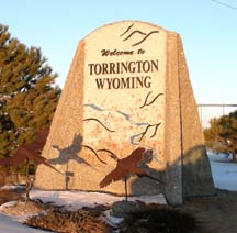
Sign welcoming visitors to Torrington (2006)
|
|
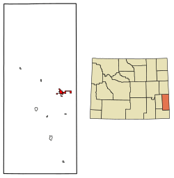
Location of Torrington in Goshen County, Wyoming.
|
|
| Country | |
| State | |
| County | |
| Named for | Torrington, Connecticut |
| Area | |
| • Total | 3.73 sq mi (9.65 km2) |
| • Land | 3.72 sq mi (9.64 km2) |
| • Water | 0.00 sq mi (0.01 km2) |
| Elevation | 4,104 ft (1,251 m) |
| Population
(2020)
|
|
| • Total | 6,119 |
| • Density | 1,640.48/sq mi (634.75/km2) |
| Time zone | UTC-7 (Mountain (MST)) |
| • Summer (DST) | UTC-6 (MDT) |
| ZIP code |
82240
|
| Area code | 307 |
| FIPS code | 56-77530 |
| GNIS ID | 1595642 |
Torrington is a city in Wyoming, United States. It is also the county seat of Goshen County. In 2020, about 6,119 people lived there.
Torrington is home to Eastern Wyoming College. It is also a main center for business in the area. The community is mostly about farming. You can find fertilizer plants, a sugar beet factory, and many shops and places for tourists here.
Contents
Discovering Torrington's Past
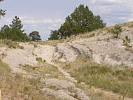
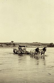
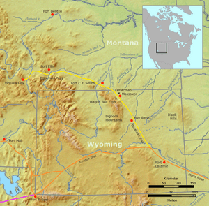
Torrington is located along the North Platte River. It sits on the historic Mormon Trail and close to the Oregon and California trails.
How Torrington Began
A man named W. G. Curtis started Torrington in 1900. He named it after his hometown, Torrington, Connecticut. The town first served as a stop for trains to get water and coal. The CB&Q Railroad started passenger service here in 1900. It quickly became a meeting spot for local farmers and ranchers. In 1905, the first bridge was built over the North Platte River.
A post office was set up in 1889 on Curtis's farm. He was the postmaster and later became mayor. In 1908, Torrington officially became a town. It had a bank, stores, a pharmacy, a land office, and two hotels. Soon, it became a key trading place for Goshen County and nearby areas.
Growing into a County Seat
The town's land was first mapped out in April 1900. People could buy plots of land for just one dollar. The Torrington Telegram, a local newspaper, started in 1911. The 1900 census showed only 71 people in the Torrington area. Most of them were ranchers or cowboys.
In 1911, Goshen County was formed. It was created from a part of Laramie County. Torrington and nearby Lingle both wanted to be the county seat. Torrington won because its residents raised enough money for a courthouse. The courthouse's first stone was laid in 1913.
Around this time, cars started appearing in town. The Goshen County Fair Association was also created. By 1915, Torrington had 443 people. In 1919, the Trail Hotel building was built. In 1925, the Union Pacific Railroad built a special train line to serve the Holly Sugar Corporation plant. This plant started working in 1926.
The large Holly Sugar factory still processes sugar beets today. It is a major employer in the Torrington area. The old Union Pacific Depot building now holds the Goshen County Homesteaders Museum.
Livestock and Trails Today
The Torrington Livestock Commission started in 1934. It still holds livestock auctions twice a week. It is the biggest livestock auction in Wyoming. It is also one of the largest in the United States. Cattle come from nine different states to be sold here. Buyers come from all over the country. In 2011, Goshen County had the most cattle in Wyoming.
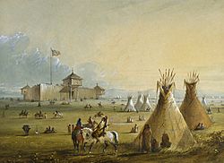
Today, if you travel between Torrington and Guernsey, Wyoming, you will follow historic trails. These include the Oregon and Mormon Trail. You will travel along the North Platte River. You will pass Fort Laramie National Historic Site, an old U.S. Army outpost.
Geography and Climate
Torrington is located at 42°4′0″N 104°10′57″W / 42.06667°N 104.18250°W. It covers about 4.62 square miles (11.97 square kilometers) of land. Its elevation is 4,104 feet (1,251 meters) above sea level.
Torrington's Weather
Torrington is on the North Platte River. It has a semi-arid climate. This means it is generally dry, but not a desert. It gets some rain, but not a lot.
| Climate data for Torrington, Wyoming | |||||||||||||
|---|---|---|---|---|---|---|---|---|---|---|---|---|---|
| Month | Jan | Feb | Mar | Apr | May | Jun | Jul | Aug | Sep | Oct | Nov | Dec | Year |
| Record high °F (°C) | 70 (21) |
75 (24) |
85 (29) |
91 (33) |
100 (38) |
105 (41) |
111 (44) |
105 (41) |
101 (38) |
92 (33) |
83 (28) |
77 (25) |
111 (44) |
| Mean daily maximum °F (°C) | 39.5 (4.2) |
45.0 (7.2) |
52.0 (11.1) |
61.2 (16.2) |
71.0 (21.7) |
82.4 (28.0) |
89.1 (31.7) |
87.3 (30.7) |
77.7 (25.4) |
65.4 (18.6) |
49.2 (9.6) |
41.0 (5.0) |
63.4 (17.5) |
| Daily mean °F (°C) | 24.9 (−3.9) |
30.0 (−1.1) |
37.5 (3.1) |
46.0 (7.8) |
56.2 (13.4) |
66.3 (19.1) |
72.3 (22.4) |
70.2 (21.2) |
59.8 (15.4) |
47.6 (8.7) |
34.0 (1.1) |
26.2 (−3.2) |
47.6 (8.7) |
| Mean daily minimum °F (°C) | 10.3 (−12.1) |
14.9 (−9.5) |
23.0 (−5.0) |
30.7 (−0.7) |
41.3 (5.2) |
50.2 (10.1) |
55.5 (13.1) |
53.1 (11.7) |
41.9 (5.5) |
29.7 (−1.3) |
18.8 (−7.3) |
11.3 (−11.5) |
31.7 (−0.2) |
| Record low °F (°C) | −39 (−39) |
−33 (−36) |
−26 (−32) |
−17 (−27) |
11 (−12) |
29 (−2) |
39 (4) |
32 (0) |
14 (−10) |
−9 (−23) |
−23 (−31) |
−43 (−42) |
−43 (−42) |
| Average precipitation inches (mm) | 0.31 (7.9) |
0.40 (10) |
0.70 (18) |
1.68 (43) |
2.54 (65) |
2.09 (53) |
1.78 (45) |
1.19 (30) |
1.27 (32) |
0.95 (24) |
0.57 (14) |
0.36 (9.1) |
13.84 (351) |
| Source 1: NOAA (normals, 1971–2000) | |||||||||||||
| Source 2: The Weather Channel (Records) NOAA NNDC Climate Data | |||||||||||||
People of Torrington
| Historical population | |||
|---|---|---|---|
| Census | Pop. | %± | |
| 1910 | 155 | — | |
| 1920 | 1,301 | 739.4% | |
| 1930 | 1,811 | 39.2% | |
| 1940 | 2,344 | 29.4% | |
| 1950 | 3,247 | 38.5% | |
| 1960 | 4,188 | 29.0% | |
| 1970 | 4,237 | 1.2% | |
| 1980 | 5,441 | 28.4% | |
| 1990 | 5,651 | 3.9% | |
| 2000 | 5,776 | 2.2% | |
| 2010 | 6,501 | 12.6% | |
| 2020 | 6,119 | −5.9% | |
| 2023 (est.) | 6,212 | −4.4% | |
| U.S. Decennial Census | |||
In 2010, Torrington had 6,501 people living in 2,527 households. Most residents (93.2%) were White. About 11.3% of the population was Hispanic or Latino. The average age in the city was 41.4 years old.
Education in Torrington
Public schools in Torrington are part of Goshen County School District#1.
- Lincoln Elementary School (grades K–2)
- Trail Elementary School (grades 3–5)
- Torrington Middle School (grades 6–8)
- Torrington High School (grades 9–12)
Other towns like Lingle and Yoder are also in this school district.
Eastern Wyoming College is a two-year college in Torrington. It helps students from several nearby counties. Torrington also has a public library, the Goshen County Library.
Getting Around Torrington
Major Roads
 U.S. Highway 26 East (Scottsbluff Road)
 U.S. Highway 26 West (Yellowstone Road)
 U.S. Highway 85 North (Lingle/Jay Em Road)
 U.S. Highway 85 South (Cheyenne Road)
State Roads
 WYO 92 (Huntley Highway)
 WYO 154 (Veteran Road)
 WYO 156 (Sugar Factory Road)
 WYO 159 (Van Tassell Road)
Airport and Public Transit
The Torrington Municipal Airport is located just east of the city. It is owned by the city and used by the public. The Goshen County Senior Friendship Center offers paratransit services in Torrington on weekdays.
Famous People from Torrington
- Edward Buchanan (born 1967), a former state lawmaker and lawyer.
- Stephanie Burns (born 1955), a chemist and businesswoman.
- William Curtis, who founded Torrington in 1889.
- Stanley Hathaway (1924–2005), who was the 27th Governor of Wyoming.
- Jerry Hill (born 1939), a former NFL football player for the Baltimore Colts.
- Michael Punke (born 1964), the author of the book The Revenant.
See also
 In Spanish: Torrington (Wyoming) para niños
 | Janet Taylor Pickett |
 | Synthia Saint James |
 | Howardena Pindell |
 | Faith Ringgold |


