Cache la Poudre River facts for kids
Quick facts for kids Cache la Poudre River |
|
|---|---|

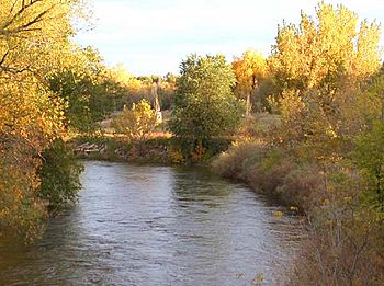
Cache La Poudre River as it flows through Fort Collins, Colorado.
|
|
| Country | United States |
| State | Colorado |
| Cities | Fort Collins, Greeley |
| Physical characteristics | |
| Main source | Rocky Mountains Rocky Mountain National Park 10,755 ft (3,278 m) 40°25′29″N 105°48′24″W / 40.42472°N 105.80667°W |
| River mouth | South Platte River Near Greeley 4,600 ft (1,400 m) 40°25′17″N 104°36′3″W / 40.42139°N 104.60083°W |
| Length | 126 mi (203 km) |
| Basin features | |
| Tributaries |
|
| Type: | Wild, Recreational |
| Designated: | October 30, 1986 |
The Cache la Poudre River (pronounced KASH-_-LƏ-_-POO-dər), often called the Poudre River, is a well-known river in the state of Colorado, United States. It's a popular spot for outdoor fun and is important to the local communities.
Contents
What's in a Name? The Poudre River's Story
The name of the river, Cache la Poudre, comes from a French phrase meaning "Hide the Powder." The original name was Cache à la Poudre, which means "cache of powder." This name comes from an interesting event that happened in the 1820s.
French trappers were traveling when a big snowstorm hit. They had to bury some of their gunpowder along the riverbanks to keep it safe and lighten their load. This clever act gave the river its unique name, which tells a piece of its history!
Where Does the Poudre River Flow?
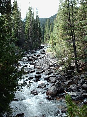
The Poudre River starts high up in the Rocky Mountains, specifically in the Front Range of Larimer County. Its main source is a beautiful spot called Poudre Lake, located inside Rocky Mountain National Park.
As the river flows eastward, it winds its way through the mountains, cutting through the Roosevelt National Forest in a deep valley known as Poudre Canyon. After leaving the mountains, it passes by the city of Fort Collins.
The river then continues across the flat Great Plains, going north of Greeley. Finally, about 5 miles east of Greeley, the Poudre River joins the larger South Platte River.
Fun and History Along the River
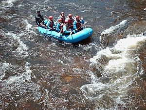
The Poudre River is a favorite place for many outdoor activities, especially in the summer. People love to come here for:
The canyon area has been home to people living there all year round since the 1930s. Even though it's a popular summer spot, it also has communities and churches that are active throughout the year.
Fish in the Poudre River
The river is home to several types of fish, including:
Floods and Fort Collins
The Poudre River can sometimes have sudden and powerful floods. In 1864, a big flood destroyed a military post called Camp Collins, which was located near the river. The military decided to move the camp to a new, safer spot and renamed it Fort Collins. Even though a fort was never actually built there, the city of Fort Collins grew from this new location. The city still experiences floods from the Poudre River from time to time.
Fishing for Trout in the Poudre River
From its start in the mountains all the way through Fort Collins, the Cache la Poudre River is full of wild trout. Most of these are brown trout. Many local anglers (people who fish) in Fort Collins love to fish for these brown trout. They look for all sizes, from small young fish to larger ones that can weigh five to eight pounds!
Anglers often use fly fishing techniques. Many special fly patterns have even been created just for fishing on the Poudre River.
Protecting the River
Many people in Fort Collins feel that the Poudre River is very important to their community. However, water rights (who owns and can use the water) have a long history here. Water is used for farming, drinking, and industry, which can change how much water flows in the river. This can affect the wildlife in and around the river.
Because of this, several groups have been formed to help protect and improve the river's natural state. Also, with more people coming to raft and fish, there's more pressure on the river's wildlife.
When to Fish
You can fish in the Cache la Poudre River all year round, as some parts of the water stay unfrozen even in winter.
- Winter: Anglers often try to catch shy trout using very tiny flies.
- Fall: Brown trout spawn (lay eggs) in the fall, making them more active and willing to bite.
- Spring: Rainbow trout spawn in the spring, also making them active.
- Spring, Summer, and Fall: These seasons see the most anglers. However, there's enough public access that you can usually find a quiet spot if you want to.
Special Fishing Rules
Because more and more people are fishing and rafting, special rules have been put in place for certain parts of the Poudre River by the Colorado Division of Wildlife. These rules help protect the trout populations.
- Flies and Lures Only: In some areas, you can only use flies and artificial lures.
- Catch and Release: In other areas, you must release any fish you catch back into the water unharmed. This helps make sure there are enough trout for the future.
These special areas include the Indian Meadows Section, the Hatchery Section, and a small part of the North Fork of the Cache la Poudre River. As the river leaves the canyon and flows through Fort Collins, the water quality can decrease. While trout still live in the lower Poudre, their numbers are smaller because of lower water flow and quality. Because of this, it's a good idea for all fishermen to release their catch in town to help keep the fishery healthy for years to come.
Many people believe that with the right water flow, good habitats, and smart rules, the Cache la Poudre River can become a world-class trout fishing spot. It continues to offer amazing fly fishing in a beautiful, wild setting.
A Special Place: National Heritage Area
The Cache La Poudre River Corridor National Heritage Area is a special area that includes the river's flood plain. This area stretches from where the river leaves the mountains all the way to where it meets the South Platte River. It's recognized for its important history and natural beauty.
Wild and Scenic River
On October 30, 1986, a large part of the Cache la Poudre River was given a special status. About 76 miles of the river were named a "Wild and Scenic River" under the National Wild and Scenic Rivers System. This designation helps protect the river's natural state.
The protected section starts at the river's headwaters in Cache la Poudre Lake within Rocky Mountain National Park and continues downstream along the south fork.
- Wild: 30 miles of the river are classified as "wild," meaning they are kept in a very natural, undeveloped state.
- Recreational: 46 miles are classified as "recreational," meaning they are still natural but allow for more public access and activities.
 | Precious Adams |
 | Lauren Anderson |
 | Janet Collins |


