North American Cordillera facts for kids
Quick facts for kids North American Cordillera |
|
|---|---|
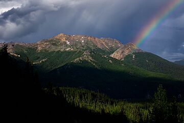
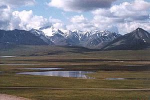
A mountain in Denali National Park
|
|
| Highest point | |
| Peak | Denali |
| Elevation | 6,168 m (20,236 ft) |
| Dimensions | |
| Length | 6,400 km (4,000 mi) |
| Geography | |
| Country |
|
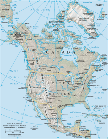
The North American Cordillera is a huge system of mountain ranges, valleys, and flat areas (called plateaus) in western North America. Think of it as a giant mountain chain that stretches along the Pacific coast of the Americas. It covers a large part of Western and Northwestern Canada, the Western United States, and Mexico.
This amazing mountain system is part of an even bigger chain called the American Cordillera. This larger chain runs all the way along the Pacific coast of both North and South America. The exact borders and names of its parts can change depending on the country or what scientists are studying.
Contents
Exploring the North American Cordillera's Main Features
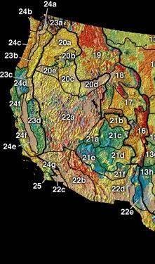
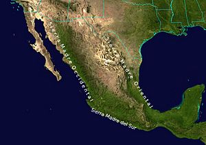
The North American Cordillera reaches from Alaska in the north all the way to the southern border of Mexico. It includes some of the tallest mountains on the continent. Its mountain ranges generally run from north to south.
These mountains are grouped into three main belts:
- The Pacific Coast Ranges in the west, right by the ocean.
- The Nevadan belt in the middle.
- The Laramide belt in the east, which includes the Rocky Mountains.
These mountain belts were formed by plate tectonics. This is when huge pieces of the Earth's outer layer (called tectonic plates) move and crash into each other. This movement pushes up the land, creating mountains. For example, the Laramide orogeny (a mountain-building event) changed the central Rocky Mountains about 80 million years ago. Before that, the area was a wide, flat basin.
Let's take a closer look at these belts, moving from west to east and north to south.
Mountains in Alaska and Canada
In Alaska, you'll find the Rocky Mountain System, then the Intermontane Basins and Ranges, and finally the Pacific Mountains and Valleys in the south. The mountains and islands in the Alaska panhandle are extensions of ranges further south.
In Canada, the Cordillera is usually split into three main areas:
- The western system (like the Coast Mountains).
- The interior system (like the Columbia Mountains).
- The eastern system (like the Canadian Rockies).
Cordillera's Width and Provinces
At its middle point, between San Francisco, California, and Denver, Colorado, the North American Cordillera is about 1,600 kilometers (1,000 miles) wide. If you travel from west to east at this point, you would cross:
- The Pacific Coast Ranges.
- The Central Valley.
- The Sierra Nevada.
- The Basin and Range Province (many narrow ranges and valleys).
- The Colorado Plateau.
- The Rocky Mountains.
Another important feature in the United States is the Columbia Plateau. It's located north of California, between the Cascade Range and the Rocky Mountains.
Mexican Mountain Ranges
In Mexico, the Sierra Madre Occidental and the Sierra Madre Oriental (further east) surround the Mexican Plateau. To the west of the Sierra Madre Occidental, the Peninsular Ranges are next to the Pacific Ocean. The Sierra Madre del Sur is a southern part of the Peninsular Ranges. "Sierra Madre" means "Mother Range" in Spanish.
The Nevadan belt runs through the middle of the North American Cordillera. This means the areas between the mountains (intermontane areas) can be found both east and west of the Nevadan belt.
Pacific Coast Belt: Mountains by the Ocean
The Pacific Coast Ranges run right next to the North American Pacific Coast. They are made up of several mountain systems. Along the coasts of British Columbia and Alaska, the mountains meet the sea in a complex way, forming many fjords and thousands of islands. Off the coast of Southern California, the Channel Islands are a group of islands that stretch for about 160 miles.
Southern Alaska's Coastal Mountains
In southern Alaska, the main mountain ranges include the Alaska Range, Wrangell Mountains, Saint Elias Mountains, Kenai Mountains, Chugach Mountains, and Talkeetna Mountains.
Canada's Western Mountain System
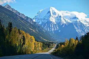
The Yukon Ranges cover mountains in southeastern Alaska and most of the Yukon, Canada. This area is about 364,710 square kilometers (140,815 square miles).
The Coast Mountains stretch northwest from the Fraser River. They separate the Interior Plateau from the Pacific Ocean. The side facing the coast has many fjords and islands, much like the coast of Norway. The inland side, however, changes into high plateaus with dry valleys and large lakes.
The Coast Mountains are divided into three main groups:
- The Pacific Ranges (between the Fraser and Bella Coola).
- The Kitimat Ranges (north of Bella Coola to the Nass River).
- The Boundary Ranges (from the Nass River to the Yukon Territory).
These mountains have a lot of glaciers and large icefields. The Pacific Ranges are the highest, with Mount Waddington as their peak. The Boundary Ranges have the largest icefields, like the Juneau Icefield. The Kitimat Ranges are lower but very rugged.
The Coast Mountains are made of igneous rock (formed from cooled magma) and metamorphic rock (rock changed by heat and pressure). These rocks formed about 100 million years ago due to volcanoes and the movement of tectonic plates.
The Insular Mountains are found from Vancouver Island in the south to Haida Gwaii in the north, along the British Columbia Coast. They include the Vancouver Island Ranges and the Queen Charlotte Mountains.
Pacific Border Province in the United States
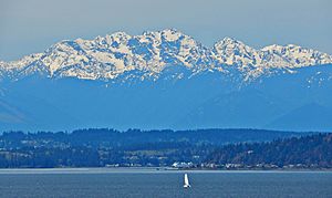
The Olympic Mountains are in western Washington, on the Olympic Peninsula. These mountains are part of the Pacific Coast Ranges. They are not extremely high (Mount Olympus is the tallest at 2,427 meters or 7,962 feet). However, their western slopes rise straight from the Pacific Ocean. This makes them the wettest place in the 48 connected states. Most of these mountains are protected within the Olympic National Park.
The Oregon Coast Range is part of the Coast Range system in Oregon. It is about 320 kilometers (200 miles) long. Its highest point is Marys Peak, at 1,250 meters (4,101 feet).
The California Coast Ranges are a group of mountain ranges along the California coast. They are one of the main landform areas of California.
Western Mountain Ranges of Mexico
The Sierra Madre del Sur mountains in southwestern Mexico are a southern part of the Peninsular Ranges of Baja California. These two ranges are separated by a stretch of ocean.
Nevadan Belt: The Middle Mountains
The Nevadan belt is located between the Pacific Coast belt and the Laramide belt. The word Nevada means "snow-covered" in Spanish.
Canada's Interior Mountain System
In Canada, the Northern Interior Mountains are a northern part of the Columbia Mountains. They include the Hazelton Mountains, Cassiar Mountains, Omineca Mountains, and Skeena Mountains.
The Columbia Mountains in British Columbia are a group of four ranges. They lie between the Rocky Mountain Trench (to the east) and the Interior Plateau (to the west). These ranges are:
- The Cariboo Mountains (the northernmost).
- The Selkirk Mountains.
- The Purcell Mountains.
- The Monashee Mountains.
Even though the Columbia Mountains are in Canada's interior system, they are an extension of mountains in the United States that are part of the Rocky Mountains. Because of this, the Columbia Mountains are often thought of as part of the Rockies.
The Selkirks and Purcells are entirely within the Columbia River basin. The Monashees are to the west of the river. The southern parts of the Selkirks, Purcells, and Monashees extend into the United States and are considered part of the Rocky Mountains there.
Cascade–Sierra Mountains in the United States
The Cascade Range (also called the Cascade Mountains in Canada) stretches from northern California to British Columbia. It has both non-volcanic and volcanic mountains. All known historic volcanic eruptions in the connected United States have happened from the volcanoes in the Cascade Range. The highest peak is Mount Rainier (4,392 meters or 14,409 feet), which is a stratovolcano (a cone-shaped volcano).
The northern part of the Cascades, called the North Cascades, is very rugged and alpine. The southern part, from Rainier south to Mount Shasta and Lassen Peak, has tall, cone-shaped volcanoes.
The Sierra Nevada forms a mountain spine in northern California. It runs from the end of the Cascade Range south along the east side of the Central Valley of California. It separates the Central Valley from the Great Basin to the east. The mountains in the Sierra Nevada get taller from north to south. The highest point is Mount Whitney (4,421 meters or 14,505 feet), which is the tallest point in the connected United States.
The Sierra Nevada is shaped like a wedge. The western slope rises gradually, while the eastern slope is very steep, especially in the south. The northern Sierra has mostly volcanic rocks. The southern Sierra has granite rocks that have been shaped by glaciers into dramatic U-shaped valleys.
Sierra Madre Occidental in Mexico
The Sierra Madre Occidental mountain range is a southern extension of the Sierra Nevada. This range goes from near the Arizona border down to the Sierra Madre del Sur, along the western mainland of Mexico. The high plateau formed by this range is cut by deep river valleys.
Laramide Belt: The Eastern Mountains
The Laramide belt is the part of the North American Cordillera furthest from the Pacific Coast. It is named after the Laramie Mountains in eastern Wyoming.
Alaska and Canada's Eastern System
The Brooks Range includes the northernmost major mountain systems of the North American Cordillera. It runs east to west across northern Alaska and into the northern Yukon Territory. Major parts include the British Mountains and Richardson Mountains. The Brooks Range forms the northern edge of the lower Yukon River basin, separating it from Alaska's North Slope region, which faces the Beaufort Sea. The Brooks Range is considered part of (or an extension of) the Rockies. South of the Brooks Range are the Mackenzie Mountains and the Canadian Rockies.
Rocky Mountain System in the United States
In the Rocky Mountains, the highest peak is Mount Elbert in Colorado, at 4,401 meters (14,407 feet) above sea level. The American Rockies rise steeply from the Interior Plains to the east and the Great Basin to the west. They extend south to the Rio Grande in New Mexico.
The United States includes the Cabinet and Salish Mountains of Idaho and Montana as part of the Rockies. However, their northern parts in Canada, the Columbia Mountains, are sometimes seen as a separate system.
Sierra Madre Oriental in Mexico
The Sierra Madre Oriental mountains in eastern Mexico are a southern extension of the Rocky Mountains. This range stretches for about 1,000 kilometers (620 miles). Mexico's Gulf Coastal Plain is to the east of the range, between the mountains and the Gulf of Mexico coast. The Mexican Plateau is to the west of the range.
Intermontane Areas: Valleys and Plateaus
The Nevadan belt runs through the middle of the North American Cordillera. This means there are intermontane areas (areas between mountains) both west and east of the Nevadan belt.
Canadian Intermontane Areas
The Interior Plateau is a northern continuation of the Columbia Plateau. It covers much of inland British Columbia. The Cariboo Mountains and Monashee Mountains are to its east. The Canadian Cascades are to the southwest, and the Hazelton Mountains and Coast Range are to the west and northwest.
Within the Interior Plateau, the Shuswap Highland is a hilly area between the Thompson Plateau and Bonaparte Plateau (to the west) and the Monashee Mountains and Cariboo Mountains (to the east and northeast).
Also in the Interior Plateau, the Thompson Plateau forms its southern part. It is bordered by the Canadian Cascades to the south and the Thompson River to the north.
The Okanagan Highland is east of the Thompson Plateau. It is bordered by the Okanagan River to the west, the Shuswap River to the north, and the Kettle River to the east. It is a hilly plateau found in southern British Columbia and northern Washington. Other parts of the Interior Plateau include the Quesnel Highland, Fraser Plateau, Nechako Plateau, and McGregor Plateau.
Intermontane Areas in the United States
California's Central Valley is a large, flat valley in central California. It stretches inland, parallel to the Pacific Ocean coast. Its northern half is called the Sacramento Valley, and its southern half is the San Joaquin Valley. These two halves meet at the huge Sacramento-San Joaquin River Delta. Rivers here drain most of the valley and flow into San Francisco Bay. The Central Valley is about 36,260 square kilometers (14,000 square miles). It is about 64 to 97 kilometers (40 to 60 miles) wide, with the Sierra Nevada to the east and the Coast Ranges to the west.
In northwestern Oregon, the fertile Willamette Valley lies between the Oregon Coast Range and the Cascades. This low area continues north into Washington as the Puget Trough.
Mexican Intermontane Areas
The Gulf of California is a body of water that separates the Peninsular Ranges from the Sierra Madre Occidental on the Mexican mainland. The Gulf of California is about 1,126 kilometers (700 miles) long and 48 to 241 kilometers (30 to 150 miles) wide.
Intermontane Areas Inland from the Nevadan Belt
Canadian Inland Areas
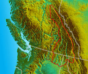
The Rocky Mountain Trench is a very long valley, about 1,600 kilometers (1,000 miles) long. It stretches from Flathead Lake, Montana, to the Liard River in the Yukon Territory. The bottom of the trench is 5 to 26 kilometers (3 to 16 miles) wide and is about 600 to 900 meters (2,000 to 3,000 feet) above sea level. This valley mostly runs north and south. Some parts were carved by glaciers, but it was mainly formed by faulting (cracks in the Earth's crust).
The Trench separates the Rocky Mountains to its east from the Columbia Mountains and the Cassiar Mountains to its west. It can be up to 25 kilometers (15 miles) wide if you measure from peak to peak. The Rocky Mountain Trench can be divided into northern and southern parts. This division shows where rivers flow either north to the Arctic Ocean or south and west to the Pacific Ocean.
Inland Areas in the United States
The Columbia Plateau is a large flat area (a flood basalt plateau) in parts of Washington, Oregon, and Idaho. It lies between the Cascade Range and the Rocky Mountains. The Columbia River flows through it.
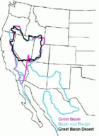
The Basin and Range province covers most of Nevada and parts of Arizona, California, Idaho, New Mexico, Oregon, Texas, Utah, and Wyoming, as well as northern Mexico. It is a very dry region known for its many narrow mountain ranges separated by flat valleys.
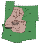
The Colorado Plateau is a high desert area in Arizona, New Mexico, Colorado, and Utah. The Colorado River flows westward through its southern part, and the Green River flows south from its northern part. The Green River joins the Colorado River.
Mexican Inland Areas
The Mexican Plateau is a large, dry to semi-dry flat area that covers much of northern and central Mexico. It is about 1,825 meters (5,988 feet) above sea level on average. It stretches from the United States border in the north to the Trans-Mexican Volcanic Belt in the south. It is surrounded by the Sierra Madre Occidental to the west and the Sierra Madre Oriental to the east.
A low east-west mountain range in the state of Zacatecas divides the plateau into northern and southern sections. These two parts, called the Northern Plateau and Central Plateau, are now generally seen by geographers as parts of one large plateau.
See also
 In Spanish: Cordillera norteamericana para niños
- List of ecoregions in North America (CEC): Western Cordillera
 | Isaac Myers |
 | D. Hamilton Jackson |
 | A. Philip Randolph |


