Canadian Rockies facts for kids
Quick facts for kids Canadian Rockies |
|
|---|---|
| Rocheuses canadiennes (French) | |
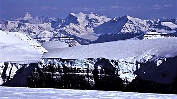
Snow Dome, Mt. Forbes, the Lyells, and others from Mt. Kitchener at the edge of the Columbia Icefield
|
|
| Highest point | |
| Peak | Mount Robson |
| Elevation | 3,954 m (12,972 ft) |
| Dimensions | |
| Length | 1,460 km (910 mi) |
| Width | 180 km (110 mi) |
| Area | 194,000 km2 (75,000 sq mi) |
| Geography | |
| Country | Canada |
| Parent range | Pacific Cordillera |
| Geology | |
| Orogeny | Sevier orogeny |
| Type of rock | Sedimentary rock |
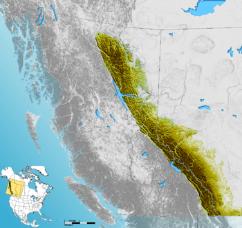
The Canadian Rockies are the Canadian part of the larger Rocky Mountains in North America. They stretch across the provinces of British Columbia and Alberta. These mountains are the eastern edge of the Canadian Cordillera, which is a huge system of mountain ranges in western Canada. This whole mountain system runs from Alaska all the way down to Mexico.
Canada officially sees the Rocky Mountains as the chains east of the Rocky Mountain Trench. This area goes from the Liard River valley in northern British Columbia down to New Mexico. The Canadian Rockies are the northern part of this chain. They sit between the flat lands of Alberta (called the Canadian Prairies) and other mountain ranges to the west. The Canadian Rockies are split into two main parts: the Northern Rockies and the Continental Ranges.
The southern end of the Canadian Rockies even reaches into the U.S. state of Montana. Places like Upper Waterton Lake are part of this connection.
The Canadian Rockies have many tall peaks. Some of the most famous are Mount Robson (3,954 meters or 12,972 feet) and Mount Columbia (3,747 meters or 12,293 feet). These mountains are mostly made of layered rocks like shale and limestone. Many parts of the Canadian Rockies are protected in national and provincial parks. Several of these parks together form a World Heritage Site, recognized for their amazing natural beauty.
Contents
Geography
The Canadian Rockies are the mountains furthest east in the Canadian Cordillera. This is a big group of mountains in Western Canada. They are also part of the American Cordillera, which is a continuous chain of mountains. This chain goes from Alaska down to the very tip of South America. The Cordillera itself is part of the Pacific Ring of Fire. This is a huge area around the Pacific Ocean where many earthquakes and volcanoes happen.
The Canadian Rockies have clear boundaries. To the east, they meet the flat Canadian Prairies. To the west, they are separated by a long valley called the Rocky Mountain Trench. To the north, they end at the Liard River. It's a common mistake to think the Rockies go into Yukon or Alaska, but they don't. North of the Liard River, you find the Mackenzie Mountains, which are a different mountain range. Also, the mountains west of the Rocky Mountain Trench in southern British Columbia are called the Columbia Mountains. Canadian geologists do not consider them part of the Rockies.
Highest Peaks
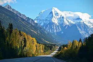
Mount Robson is the tallest mountain in the Canadian Rockies. It stands at 3,954 meters (12,972 feet) high. However, it's not the tallest in all of British Columbia. There are even higher mountains in the Coast Mountains and Saint Elias Mountains. Mount Robson is located near the Yellowhead Pass, which is one of the lowest mountain passes in the Canadian Rockies.
Mount Columbia is the second-tallest peak in the Canadian Rockies. It reaches 3,747 meters (12,293 feet) and is the highest mountain in the province of Alberta.
Snow Dome is a special mountain. It's one of only two places in North America where water flows into three different oceans! Water from Snow Dome goes to the Pacific Ocean, the Arctic Ocean, and the Atlantic Ocean (through Hudson Bay). It is 3,456 meters (11,339 feet) tall.
It's interesting to know that the Canadian Rockies are not the highest mountains in Canada. The Saint Elias Mountains have Mount Logan, which is Canada's tallest peak at 5,959 meters (19,551 feet). The Coast Mountains also have higher summits, like Mount Waddington at 4,016 meters (13,176 feet).
Mountain Ranges
The Canadian Rockies are divided into many smaller mountain ranges. These are grouped into two main parts: the Continental Ranges and the Northern Rockies. The Continental Ranges have three main sections: the Front Range, Park Ranges, and Kootenay Ranges. The Northern Rockies include the Hart Ranges and the Muskwa Ranges. These two main groups meet near Monkman Pass.
Rivers
The Canadian Rockies are very important because many major rivers start there. The mountains also form the Continental Divide. This means that rivers on the west side of the divide flow towards the Pacific Ocean. Rivers on the east side flow towards Hudson Bay and the Arctic Ocean. Only one river, the Peace River, actually cuts through the mountain range.
Some of the important rivers that begin in the Canadian Rockies include the Fraser, Columbia, North Saskatchewan, Bow, and Athabasca Rivers.
Geology
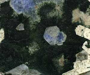
The Canadian Rockies look and are made quite differently from the American Rockies to the south. The Canadian Rockies are mostly made of layered sedimentary rocks like limestone and shale. In contrast, the American Rockies are mostly made of metamorphic rocks and igneous rocks, such as gneiss and granite.
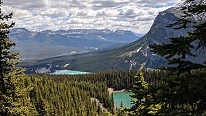
The Canadian Rockies generally have sharper, more jagged peaks. This is because they have been shaped more by glaciers. Glaciers carved out wide, U-shaped valleys between the mountains. The American Rockies tend to be more rounded, with V-shaped valleys carved by rivers. The Canadian Rockies are also cooler and wetter. This means they have moister soil, larger rivers, and more glaciers. The tree line (where trees stop growing due to cold) is much lower in the Canadian Rockies than in the American Rockies.
Parks
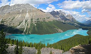
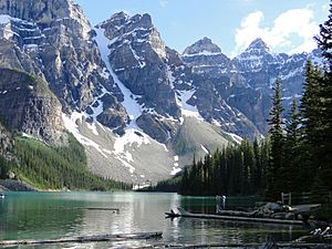
There are five national parks located within the Canadian Rockies. Four of these parks are next to each other and form the Canadian Rocky Mountain Parks. These four parks are Banff, Jasper, Kootenay, and Yoho.
The fifth national park is Waterton Lakes. It is located further south and crosses the Canada–US border. It is the Canadian part of the Waterton-Glacier International Peace Park. The four connected parks, along with three provincial parks in British Columbia, were named a UNESCO World Heritage Site in 1984. This was done because of their unique and beautiful mountain landscapes.
Many provincial parks are also found in the Canadian Rockies. These include Hamber, Mount Assiniboine, and Mount Robson parks.
Throughout the Rockies, especially in the national parks, the Alpine Club of Canada has many mountain huts. These huts are used by climbers and adventurers who explore the mountains.
Human History
The Rockies and the Canadian Pacific Railway
The Canadian Pacific Railway was built to connect the province of British Columbia with the eastern parts of Canada. Building this railway was very challenging because of the Rockies. There were dangerous mountain passes, fast rivers, and steep drops. These made the railway construction very difficult.
See also
 In Spanish: Montañas Rocosas de Canadá para niños
 | James B. Knighten |
 | Azellia White |
 | Willa Brown |


