Whitehorse facts for kids
Quick facts for kids
Whitehorse
|
|||||
|---|---|---|---|---|---|
|
City
|
|||||
| City of Whitehorse | |||||
|
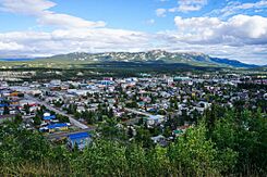
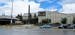
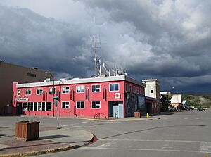
From top to bottom; left to right: View of Central Whitehorse in 2019, northern lights viewed from Riverdale, buildings in Downtown Whitehorse, Yukon Legislative Building
|
|||||
|
|||||
| Nickname(s):
"The Wilderness City"
|
|||||
| Motto(s):
Our People, Our Strength
|
|||||
| Country | Canada | ||||
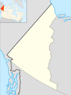
| Territory | Yukon | ||||
| Established | 1898 | ||||
| Area | |||||
| • City | 416.54 km2 (160.83 sq mi) | ||||
| • Urban | 34.95 km2 (13.49 sq mi) | ||||
| • Metro | 8,488.91 km2 (3,277.59 sq mi) | ||||
| Elevation | 670–1,702 m (2,200–5,584 ft) | ||||
| Population
(2021)
|
|||||
| • City | 28,201 | ||||
| • Density | 60.2/km2 (156/sq mi) | ||||
| • Urban | 21,732 | ||||
| • Urban density | 621/km2 (1,610/sq mi) | ||||
| Demonym(s) | Whitehorser | ||||
| Time zone | UTC−07:00 (MST) | ||||
| Forward sortation area |
Y1A
|
||||
| Area code(s) | 867 | ||||
| NTS Map | 105D11 Whitehorse | ||||
Whitehorse is the capital city of the Yukon territory in Canada. It is the largest city in Northern Canada. The city was officially created in 1950. It is located on the Alaska Highway in southern Yukon.
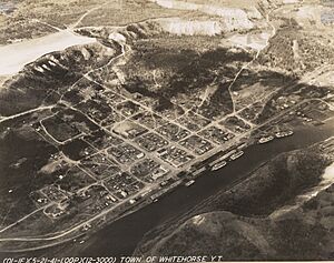
Whitehorse is built on both sides of the Yukon River. This river starts in British Columbia and flows all the way to the Bering Sea in Alaska. The city got its name from the White Horse Rapids. These rapids looked like the flowing mane of a white horse before a dam was built on the river.
Because Whitehorse is in a valley and close to the Pacific Ocean, its weather is milder than other northern cities like Yellowknife. In winter, the days are short, but in summer, there can be up to 19 hours of daylight! Guinness World Records even says Whitehorse has the cleanest air in the world.
In 2021, about 28,201 people lived within the city limits. This means Whitehorse is home to about 70% of all the people in Yukon.
Contents
History of Whitehorse
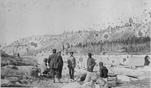
Long ago, Indigenous peoples used the area where Whitehorse is now. They had fishing camps there for thousands of years. In 1883, a traveler named Frederick Schwatka saw a trail used to go around Miles Canyon. Different tribes used to travel through this area during different seasons.
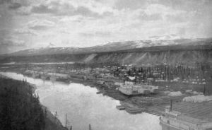
A big change happened in August 1896 when gold was found in the Klondike. This discovery was made by Skookum Jim, Tagish Charlie, and George Washington Carmack. Many people, called prospectors, came to the area. By 1897, many were camping at a place called "White Horse." In 1898, so many people were at Canyon City that it became crowded. Some boats were lost in the rapids, and five people died.
While looking for gold, prospectors also found copper in the hills west of Whitehorse. The first copper claims were made in 1898 and 1899. Two tram lines were built to carry the copper.
A narrow-gauge railway, the White Pass and Yukon Route, started being built in 1898. It connected Skagway to Whitehorse. The railway was finished in 1900, making it easier to travel and move goods.
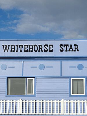
By 1901, the local newspaper, the Whitehorse Star, was already reporting on how much cargo was being moved. Even though everyone called the city Whitehorse, some railway builders tried to change the name to Closeleigh. But the Yukon Commissioner, William Ogilvie, said no.
On May 23, 1905, a small fire started in a barber shop. It spread quickly because the fire engine ran out of water. The fire caused a lot of damage, but luckily, no one died. Robert Service, a famous poet, was working in a bank there and helped fight the fire.
In 1920, the first airplanes landed in Whitehorse. Air mail started in 1927. For many years, trains, boats, and planes were the only ways to get to Whitehorse. But in 1942, during World War II, the US military built the Alaska Highway. This huge road, about 2500 km long, was built in just eight months! It helped move troops and supplies. After the war, Canada took over the Canadian part of the highway. The Canol pipeline was also built to bring oil to the north.
In 1950, Whitehorse officially became a city. By 1951, its population had doubled. On April 1, 1953, Whitehorse became the capital of the Yukon Territory. The capital used to be Dawson City. On March 21, 1957, the city's name was officially changed from White Horse to Whitehorse.
Geography and Climate

Whitehorse is located along the Alaska Highway. It is surrounded by three mountains: Grey Mountain to the east, Mount Sumanik to the northwest, and Golden Horn Mountain to the south. The famous White Horse Rapids, which gave the city its name, are now covered by Miles Canyon and Schwatka Lake. This happened when a dam was built in 1958 to create electricity. Whitehorse is the 64th largest city in Canada by land area.
City Layout
Whitehorse has special rules to protect its natural beauty. These rules limit where vehicles can go in certain "Protected Areas" to keep the environment healthy. Many of these areas are close to the city center.
In 1999, the city planned how different areas would be used. Some land was set aside for homes, businesses, and industries. Recent growth has led to more discussions about how the city should be planned. In the 1970s, plans included parks and green spaces to ensure a good quality of life.
Whitehorse Weather
Whitehorse has a subarctic climate. This means it has long, cold winters and short, cool summers. The city is in the "rain shadow" of the Coast Mountains, so it doesn't get much rain or snow.
Because Whitehorse is in a valley, its climate is milder than other northern cities like Yellowknife. However, temperatures can still drop below -40°C in winter. Whitehorse is the warmest place in the Yukon, with an average yearly temperature of 0.2°C.
In winter, days are short, but in summer, there are over 19 hours of daylight. The average high temperature in July is 20.6°C, and the average low in January is -19.2°C. The hottest temperature ever recorded was 35.6°C in June 1969. The coldest was -56.2°C in January 1906.
Whitehorse doesn't get much precipitation. It averages about 141.8 cm of snow and 160.9 mm of rain each year. It is known as Canada's driest city.
| Climate data for Whitehorse (Erik Nielsen Whitehorse International Airport) WMO ID: 71964; coordinates 60°42′34″N 135°04′07″W / 60.70944°N 135.06861°W; elevation: 706.2 m (2,317 ft); 1991–2020 normals, extremes 1900–present |
|||||||||||||
|---|---|---|---|---|---|---|---|---|---|---|---|---|---|
| Month | Jan | Feb | Mar | Apr | May | Jun | Jul | Aug | Sep | Oct | Nov | Dec | Year |
| Record high humidex | 9.5 | 11.1 | 16.6 | 21.6 | 33.6 | 33.3 | 33.6 | 31.9 | 25.2 | 19.0 | 11.1 | 9.2 | 33.6 |
| Record high °C (°F) | 10.9 (51.6) |
11.7 (53.1) |
16.8 (62.2) |
21.8 (71.2) |
34.1 (93.4) |
34.4 (93.9) |
33.2 (91.8) |
31.6 (88.9) |
26.7 (80.1) |
19.3 (66.7) |
13.3 (55.9) |
10.6 (51.1) |
34.4 (93.9) |
| Mean daily maximum °C (°F) | −11.1 (12.0) |
−7.1 (19.2) |
−1.1 (30.0) |
7.1 (44.8) |
14.2 (57.6) |
19.3 (66.7) |
20.5 (68.9) |
18.5 (65.3) |
12.3 (54.1) |
4.3 (39.7) |
−5.4 (22.3) |
−9.1 (15.6) |
5.2 (41.4) |
| Daily mean °C (°F) | −15.0 (5.0) |
−11.9 (10.6) |
−6.7 (19.9) |
1.6 (34.9) |
7.9 (46.2) |
12.8 (55.0) |
14.5 (58.1) |
12.9 (55.2) |
7.5 (45.5) |
0.9 (33.6) |
−8.6 (16.5) |
−12.8 (9.0) |
0.2 (32.4) |
| Mean daily minimum °C (°F) | −18.9 (−2.0) |
−16.6 (2.1) |
−12.4 (9.7) |
−4.0 (24.8) |
1.6 (34.9) |
6.2 (43.2) |
8.5 (47.3) |
7.2 (45.0) |
2.7 (36.9) |
−2.8 (27.0) |
−11.8 (10.8) |
−16.5 (2.3) |
−4.7 (23.5) |
| Record low °C (°F) | −56.2 (−69.2) |
−51.1 (−60.0) |
−42.2 (−44.0) |
−30.6 (−23.1) |
−12.9 (8.8) |
−6.1 (21.0) |
−2.2 (28.0) |
−8.3 (17.1) |
−19.4 (−2.9) |
−31.1 (−24.0) |
−47.2 (−53.0) |
−48.3 (−54.9) |
−56.2 (−69.2) |
| Record low wind chill | −61.3 | −62.4 | −47.5 | −35.0 | −18.6 | −6.8 | 0.0 | −6.4 | −21.4 | −45.3 | −51.4 | −59.2 | −62.4 |
| Average precipitation mm (inches) | 22.3 (0.88) |
14.7 (0.58) |
11.5 (0.45) |
8.4 (0.33) |
15.4 (0.61) |
35.2 (1.39) |
39.2 (1.54) |
39.0 (1.54) |
30.9 (1.22) |
23.1 (0.91) |
23.5 (0.93) |
16.4 (0.65) |
279.6 (11.01) |
| Average rainfall mm (inches) | 0.1 (0.00) |
0.0 (0.0) |
0.0 (0.0) |
1.2 (0.05) |
12.9 (0.51) |
34.4 (1.35) |
37.5 (1.48) |
40.4 (1.59) |
26.8 (1.06) |
9.9 (0.39) |
0.9 (0.04) |
0.2 (0.01) |
164.3 (6.47) |
| Average snowfall cm (inches) | 28.8 (11.3) |
18.3 (7.2) |
16.1 (6.3) |
7.0 (2.8) |
2.8 (1.1) |
0.2 (0.1) |
0.0 (0.0) |
0.0 (0.0) |
3.6 (1.4) |
17.2 (6.8) |
28.4 (11.2) |
25.3 (10.0) |
147.6 (58.1) |
| Average precipitation days (≥ 0.2 mm) | 12.7 | 9.2 | 7.2 | 5.1 | 7.3 | 11.1 | 13.0 | 12.0 | 12.2 | 10.7 | 13.0 | 11.3 | 124.7 |
| Average rainy days (≥ 0.2 mm) | 0.17 | 0.06 | 0.0 | 1.1 | 6.9 | 10.8 | 13.0 | 12.3 | 11.6 | 5.4 | 0.88 | 0.37 | 62.7 |
| Average snowy days (≥ 0.2 cm) | 12.4 | 8.8 | 7.6 | 3.4 | 1.4 | 0.05 | 0.0 | 0.0 | 1.5 | 7.1 | 11.9 | 12.1 | 66.2 |
| Average relative humidity (%) (at 1500 LST) | 74.9 | 65.9 | 49.7 | 40.2 | 36.2 | 40.0 | 46.3 | 48.2 | 54.0 | 64.9 | 77.1 | 77.8 | 56.3 |
| Mean monthly sunshine hours | 43.8 | 105.5 | 163.2 | 238.5 | 251.1 | 266.7 | 247.6 | 226.5 | 132.7 | 84.9 | 39.8 | 26.8 | 1,827.1 |
| Percent possible sunshine | 21.4 | 41.6 | 44.8 | 54.4 | 46.8 | 46.9 | 43.8 | 46.4 | 34.1 | 27.0 | 17.8 | 14.9 | 36.7 |
| Average ultraviolet index | 0 | 1 | 1 | 3 | 4 | 5 | 5 | 4 | 2 | 1 | 0 | 0 | 2 |
| Source 1: Environment and Climate Change Canada (1991–2020), (1981–2010), (1900–1960), (extreme minimum), (January maximum) | |||||||||||||
| Source 2: Weather Atlas | |||||||||||||
| Climate data for Whitehorse (Riverdale) Climate ID: 2101400; coordinates 60°42′36″N 135°01′38″W / 60.71000°N 135.02722°W; elevation: 640.1 m (2,100 ft); 1981–2010 normals, extremes 1959–present |
|||||||||||||
|---|---|---|---|---|---|---|---|---|---|---|---|---|---|
| Month | Jan | Feb | Mar | Apr | May | Jun | Jul | Aug | Sep | Oct | Nov | Dec | Year |
| Record high °C (°F) | 10.0 (50.0) |
12.8 (55.0) |
13.5 (56.3) |
23.5 (74.3) |
34.5 (94.1) |
35.6 (96.1) |
34.5 (94.1) |
31.7 (89.1) |
26.7 (80.1) |
20.0 (68.0) |
12.2 (54.0) |
9.5 (49.1) |
35.6 (96.1) |
| Mean daily maximum °C (°F) | −12.1 (10.2) |
−6.6 (20.1) |
0.3 (32.5) |
8.5 (47.3) |
15.3 (59.5) |
20.4 (68.7) |
21.6 (70.9) |
19.5 (67.1) |
12.8 (55.0) |
4.3 (39.7) |
−6.2 (20.8) |
−9.1 (15.6) |
5.7 (42.3) |
| Daily mean °C (°F) | −16.2 (2.8) |
−11.8 (10.8) |
−6 (21) |
1.8 (35.2) |
8.0 (46.4) |
13.1 (55.6) |
15.1 (59.2) |
13.1 (55.6) |
7.5 (45.5) |
0.5 (32.9) |
−9.8 (14.4) |
−13.2 (8.2) |
0.2 (32.4) |
| Mean daily minimum °C (°F) | −20.4 (−4.7) |
−17.0 (1.4) |
−12.3 (9.9) |
−4.9 (23.2) |
0.7 (33.3) |
5.9 (42.6) |
8.5 (47.3) |
6.6 (43.9) |
2.1 (35.8) |
−3.4 (25.9) |
−13.4 (7.9) |
−17.3 (0.9) |
−5.4 (22.3) |
| Record low °C (°F) | −48.3 (−54.9) |
−51.1 (−60.0) |
−42.8 (−45.0) |
−31.7 (−25.1) |
−15.0 (5.0) |
−4.4 (24.1) |
−1.7 (28.9) |
−5.6 (21.9) |
−17.5 (0.5) |
−29.5 (−21.1) |
−41.7 (−43.1) |
−47.8 (−54.0) |
−51.1 (−60.0) |
| Average precipitation mm (inches) | 19.2 (0.76) |
13.6 (0.54) |
11.7 (0.46) |
6.8 (0.27) |
16.3 (0.64) |
33.4 (1.31) |
39.6 (1.56) |
36.5 (1.44) |
35.3 (1.39) |
26.1 (1.03) |
22.7 (0.89) |
20.3 (0.80) |
281.6 (11.09) |
| Average rainfall mm (inches) | 0.2 (0.01) |
0.1 (0.00) |
0.1 (0.00) |
2.2 (0.09) |
15.1 (0.59) |
33.4 (1.31) |
39.6 (1.56) |
36.2 (1.43) |
29.7 (1.17) |
9.9 (0.39) |
0.8 (0.03) |
0.1 (0.00) |
167.2 (6.58) |
| Average snowfall cm (inches) | 19.0 (7.5) |
13.5 (5.3) |
11.9 (4.7) |
4.6 (1.8) |
1.2 (0.5) |
0.0 (0.0) |
0.0 (0.0) |
0.4 (0.2) |
5.6 (2.2) |
16.3 (6.4) |
21.9 (8.6) |
20.2 (8.0) |
114.6 (45.1) |
| Average precipitation days (≥ 0.2 mm) | 9.7 | 7.3 | 5.7 | 4.5 | 8.0 | 11.4 | 13.6 | 12.4 | 10.1 | 11.2 | 10.3 | 10.1 | 114.3 |
| Average rainy days (≥ 0.2 mm) | 0.20 | 0.13 | 0.09 | 1.9 | 7.7 | 11.4 | 13.6 | 12.4 | 9.6 | 5.2 | 0.44 | 0.12 | 62.7 |
| Average snowy days (≥ 0.2 cm) | 9.5 | 7.3 | 5.7 | 2.7 | 0.54 | 0.0 | 0.0 | 0.10 | 1.1 | 7.0 | 10.0 | 10.0 | 53.8 |
| Source: Environment and Climate Change Canada | |||||||||||||
Neighbourhoods
Whitehorse's neighbourhoods are often separated by natural features like hills and valleys. The main downtown area is on the west bank of the Yukon River. Two other areas, Riverdale and another subdivision, are at the same height as the river.
If you cross the bridge to the east side of the river, you'll find Riverdale, one of the city's oldest neighbourhoods. From Riverdale, a road goes up Grey Mountain to a cemetery and a radio antenna.
Most of Whitehorse is located on higher ground. After climbing "Two Mile Hill," you'll see older residential areas like Takhini West, Takhini North, and Takhini East. Many homes there were once army barracks. Yukon University, the Yukon Arts Centre, and the Whitehorse Correctional Centre are in Takhini. Further north are Range Point, Porter Creek, Crestview, and the newest neighbourhood, Whistle Bend, which is growing fast.
West of downtown are Valleyview, Hillcrest (also with old military buildings), and the Erik Nielsen Whitehorse International Airport. Beyond the Canada Games Centre are neighbourhoods like McIntyre, Ingram, Arkell, Logan, Granger, and the quickly expanding Copper Ridge.
Whitehorse also has "Country Residential" areas. These are rural subdivisions farther from downtown, with different rules. They include Hidden Valley, MacPherson, McCrae, Wolf Creek, Mary Lake, Cowley Creek, Spruce Hill, Pineridge, and Fox Haven Estates. The Mt. Sima Service Industrial Subdivision is also in the south.
Construction of Whistle Bend, the newest subdivision, began in 2010.
Attractions
- MacBride Copperbelt Mining Museum
- MacBride Museum of Yukon History
- Miles Canyon
- SS Klondike sternwheeler
- Yukon Beringia Interpretive Centre
- Yukon Transportation Museum
Population and People
| Federal census population history of Whitehorse | ||
|---|---|---|
| Year | Pop. | ±% |
| 1911 | 727 | — |
| 1921 | 331 | −54.5% |
| 1931 | 541 | +63.4% |
| 1941 | 754 | +39.4% |
| 1951 | 2,594 | +244.0% |
| 1956 | 2,570 | −0.9% |
| 1961 | 5,031 | +95.8% |
| 1966 | 4,771 | −5.2% |
| 1971 | 11,217 | +135.1% |
| 1976 | 13,311 | +18.7% |
| 1981 | 14,814 | +11.3% |
| 1986 | 15,199 | +2.6% |
| 1991 | 17,925 | +17.9% |
| 1996 | 19,157 | +6.9% |
| 2001 | 19,058 | −0.5% |
| 2006 | 20,461 | +7.4% |
| 2011 | 23,276 | +13.8% |
| 2016 | 25,085 | +7.8% |
| 2021 | 28,201 | +12.4% |
| Source: Statistics Canada |
||
In 2021, the population of Whitehorse was 28,201 people. This was a 12.4% increase from 2016. The city has a land area of about 413.94 square kilometers.
Many people in Whitehorse were born outside Canada. In 2021, about 15.1% of the population were immigrants. The largest groups came from the Philippines, the United Kingdom, and the United States. Most residents (91.0%) are Canadian citizens.
Different Backgrounds
Whitehorse is a diverse city. Most of its residents (66.9%) are of European background. A significant number (16.3%) are Indigenous, including First Nations, Métis, and Inuit. There are also many people from other backgrounds (16.8%). The largest groups are from the Philippines (6.6%), South Asia (3.5%), and China (1.9%).
Languages Spoken
Yukon is officially bilingual, meaning both English and French are official languages. In 2021, most Whitehorse residents (82.3%) spoke English as their first language. About 6.1% spoke French as their first language. Another 14.4% spoke a different language. The most common non-official languages were Tagalog, German, and Punjabi.
Religions
According to the 2021 census, many people in Whitehorse (58.3%) do not follow a specific religion. About 36.7% of residents are Christian. Other religions practiced include Sikhism, Hinduism, Buddhism, and Islam.
Sports and Recreation
Whitehorse is a great place for people who love being active outdoors. The city has a huge network of trails, about 850 km long! These trails are used for walking, biking, skiing, and other activities. The Yukon River is also perfect for kayaking and canoeing.

The city has many sports fields, including grass, sand, and ice surfaces. There are also three baseball diamonds. The Canada Games Centre is a big sports complex with pools, ice rinks, a fitness center, and a running track. Other facilities include the Takhini Arena and Mount McIntyre Recreation Centre. Private companies run Mount Sima, which offers downhill skiing in winter and mountain biking in summer. There are also golf courses, a bowling alley, and gyms.
Whitehorse is famous for hosting the start of the Yukon Quest, a 1,000-mile sled dog race to Fairbanks, Alaska. It's known as one of the toughest races in the world. The city has also hosted many big sports events, including:
- The 2007 Canada Winter Games (which led to the building of the Canada Games Centre)
- The Canadian Junior Freestyle Championships in 2006
- The Arctic Winter Games (multiple times, including 2000, 2012, and upcoming in 2026)
- The International Curling Bonspiel
- The Dustball International Slowpitch Tournament
- Junior Men's Softball World Championships (2008 and 2014)
- Women's Softball World Championship (2012)
- Men's Softball World Championship (2017)
Even though there are no junior league teams, local businesses support many teams for sports like volleyball, baseball, basketball, hockey, soccer, and squash. High school teams are very active and compete with schools in Alaska. Some local athletes have even become famous in Canadian sports. Whitehorse also has a swimming club called the Whitehorse Glacier Bears.
Education
Whitehorse has several schools that are part of the Yukon Government's public school system. Each school has a council made up of elected members from the community and parents. Teachers are hired by the Department of Education, and there are no tuition fees for elementary and secondary schools. The Wood Street School offers special programs in science and arts for high school students. Yukon schools follow British Columbia's school curriculum.
Elementary Schools (Kindergarten to Grade 7)
- Christ the King Elementary (Catholic)
- Elijah Smith Elementary
- Golden Horn Elementary
- Hidden Valley Elementary
- Holy Family Elementary (Catholic)
- Jack Hulland Elementary
- Selkirk Elementary (French and English Immersion)
- Takhini Elementary
- École Whitehorse Elementary (French and late French Immersion)
High Schools
- Vanier Catholic Secondary School (Catholic)
- F.H. Collins Secondary School (English and French Immersion)
- Porter Creek Secondary School
French First Language School (Kindergarten to Grade 12)
- École Émilie-Tremblay
Special Programs
- Wood St. School (specialized programs for high school students)
- Individual Learning Centre (for students who need a different learning environment)
Higher Education
- Yukon University is the only university in Northern Canada. It offers bachelor's degrees, diplomas, certificates, and training for trades.
Media
Whitehorse has several radio stations and local television channels.
Radio Stations
| Frequency | Call sign | Branding | Format | Owner | Notes |
|---|---|---|---|---|---|
| FM 92.5 | CJUC-FM | The Juice | Community Radio | Utilities Consumers Group | |
| FM 94.5 | CFWH-FM | CBC Radio One | Talk radio, public radio | Canadian Broadcasting Corporation | Part of CBC North |
| FM 96.1 | CKRW-FM | The Rush | Hot adult contemporary | Klondike Broadcasting | Also has an AM rebroadcaster on 610 |
| FM 98.1 | CHON-FM | – | Community radio | Northern Native Broadcasting | First Nations community radio |
| FM 100.3 | VF2356 | Golden Horn | Community radio | Whitehorse Chamber of Commerce | Tourist information radio service |
| FM 100.7 | CIAY-FM | Life 100.7 | Religious broadcasting | New Life FM | |
| FM 102.1 | CFWY-FM | Ici Radio-Canada Première | Talk radio, public radio | Association Franco-Yukonnaise | Community-owned rebroadcaster of CBUF-FM (Vancouver) |
| FM 104.5 | CBU-FM-8 | CBC Music | Assorted music, public radio | Canadian Broadcasting Corporation | Rebroadcaster of CBU-FM (Vancouver) |
Whitehorse also has a Weatheradio Canada station at 162.400 MHz, which broadcasts weather information.
Television
The local cable company, NorthwesTel, offers three local TV channels: Community Cable 9, an advertisement channel, and a public service channel.
Newspapers and Magazines
Whitehorse has two main English newspapers: the Whitehorse Daily Star (published three times a week) and the Yukon News (published twice a week). There's also What's Up Yukon, a free weekly magazine about local music, arts, and events. For French speakers, there's L'Aurore boréale.
The quarterly magazine Yukon, North of Ordinary started in 2007.
City Services
Emergency Services
The Royal Canadian Mounted Police (RCMP) provides police services in Whitehorse. The main police station is downtown. Ambulance services are run by the Yukon Government's Emergency Medical Services. They have full-time paramedics. Search and Rescue (SAR) is a team effort between the RCMP, the government's Emergency Measures Organization, and volunteer SAR teams.
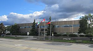
Whitehorse has its own fire department, the City of Whitehorse Fire Department (WHFD), with two fire stations. Station #1 is downtown, and Station #2 is on the west side of the city. The original fire hall is now a historic building and cultural center. The fire department has full-time staff and volunteers. They respond to car accidents, rescues, and other emergencies.
Wildland fire crews also work in the summer to fight forest fires across the territory. They sometimes help other areas like British Columbia and Alberta.
Energy
Yukon Energy provides most of the electricity for Whitehorse. They use four hydroelectric power plants, which get energy from water. They also have diesel generators for backup power.
Two wind turbines near Whitehorse were taken down in 2018. Four new ones are being built and should start providing electricity in late 2023 or early 2024.
Transportation
Air Travel
Whitehorse is served by the Erik Nielsen Whitehorse International Airport. As of 2022, you can fly from Whitehorse to cities like Vancouver, Calgary, Edmonton, and Frankfurt, Germany. The airport was built in 1941–42 during wartime. Air North, a local airline, is based in Whitehorse and flies Boeing 737 jets. Alkan Air offers charter flights and medical services.
Roads
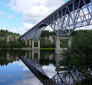
You can reach Whitehorse by a network of highways, including the international Alaska Highway. This highway connects Yukon with Alaska, British Columbia, and Alberta.
Whitehorse's neighborhoods are spread out along the main roads, with undeveloped land in between. The Alaska Highway is the main road. Other roads branch off it to reach different areas. One important branch road, called "Highway 1A," leads to downtown, Riverdale, and the Marwell Industrial Area.
The city's road system works well, but it can get busy during rush hours.
Public Transit
Whitehorse Transit provides bus service on weekdays and weekends. There's also a Handy Bus Service for people who have trouble using regular buses.
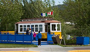
There used to be a waterfront tram, called the "trolley," that ran along the Yukon River in the summer. It was for fun and tourists, not part of the regular bus system. It ran on old railway tracks. Whitehorse currently does not have active railway service for regular travel.
The White Pass Railway offers seasonal train rides between Skagway, Alaska and Carcross, which is south of Whitehorse.
Water Travel
The Yukon River is mostly navigable from Whitehorse all the way to the Bering Sea. At 640 meters above sea level, the river at Whitehorse is the highest point on Earth that boats can reach from the sea. However, no passenger or freight services currently use the river in Whitehorse.
Sister Cities
Whitehorse has special partnerships with other cities around the world. These are called "sister cities":
- Juneau, Alaska, United States
- Lancieux, France, since 2000.
- Ushiku, Japan, since 1985.
Some past sister city partnerships included:
Famous People from Whitehorse
Many interesting people have connections to Whitehorse:
- Byron Baltimore, a hockey player in the National Hockey League.
- Dahria Beatty, an Olympic cross-country skier.
- Zachary Bell, an Olympic cyclist born in Whitehorse.
- Pierre Berton, a famous author and TV host, born in Whitehorse.
- Ivan E. Coyote, a spoken word performer and writer, born in Whitehorse.
- Dylan Cozens, a professional hockey player for the Buffalo Sabres.
- Stéphanie Dixon, a para-athlete.
- Randy Hahn, a sports commentator for the San Jose Sharks.
- Stephen Kozmeniuk, a musician and music producer who has worked with famous artists.
- Jeane Lassen, an Olympic weightlifter.
- Paul Lucier, Yukon's first senator.
- Audrey McLaughlin, the first woman to lead a major political party in Canada (the NDP).
- Sarah MacDougall, a Swedish/Canadian singer-songwriter who lives in Whitehorse.
- Scott Moffatt, a singer and guitarist.
- Aaron Olson, a basketball player.
- Gurdeep Pandher, a Bhangra dancer.
- Tahmoh Penikett, an actor known for shows like Battlestar Galactica.
- Tony Penikett, a mediator and negotiator who was the premier of Yukon from 1985 to 1992.
- Jim Robb, a watercolor painter.
- Robert W. Service, a famous poet known as "The Bard of the Yukon." He wrote about the Gold Rush. Whitehorse has monuments dedicated to him.
- Amy Sloan, a television actress.
- Peter Sturgeon, a National Hockey League player.
- Frederick Trump, a co-founder of the Whitehorse Hotel and the grandfather of Donald Trump.
- Martyn S. Williams, a mountain guide who led expeditions to the North Pole, South Pole, and Mount Everest.
- Greg Wiltjer, a basketball player.
Also, Ione Christensen was the first female mayor of Whitehorse in 1975.
See also
 In Spanish: Whitehorse para niños
 | Toni Morrison |
 | Barack Obama |
 | Martin Luther King Jr. |
 | Ralph Bunche |


