Cape Chidley facts for kids
Quick facts for kids
Cape Chidley
Cape Chudleigh
|
|
|---|---|
| Country | Canada |
| Province | Newfoundland and Labrador |
| Elevation | 350 m (1,150 ft) |
| Time zone | UTC−04:00 (AST) |
| • Summer (DST) | UTC−03:00 (ADT) |
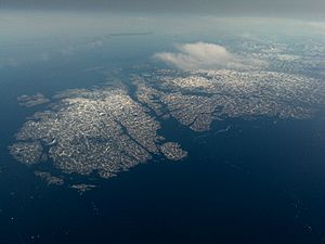
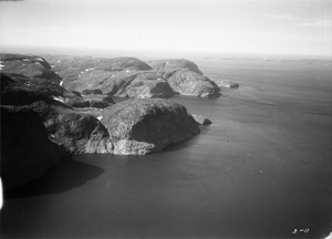
Cape Chidley is a special piece of land, like a pointy finger, found on the eastern side of Killiniq Island in Canada. It's right at the very top, or northeastern tip, of the Labrador Peninsula.
This important cape was named by an English explorer named John Davis. He named it on August 1, 1587, after his friend and fellow explorer, John Chidley.
During World War II, on October 22, 1943, a German submarine landed just south of Cape Chidley. They set up a secret weather station called "Weather Station Kurt" to gather important weather information.
Cape Chidley was also once planned to be the site for a long-range radar station. This station, called "N-30," was part of a bigger plan called the Pinetree Line. This line was a series of radar stations built across Canada. Supplies for the station were brought by ship in 1951 and 1952. However, the plan changed, and the station was moved to Resolution Island in late 1952 or early 1953.
Exploring Cape Chidley's Location
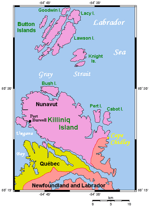
Cape Chidley sits right on the border between two parts of Canada. These are the province of Newfoundland and Labrador and the territory of Nunavut. It marks the very northernmost point of Labrador.
Understanding the Boundaries
Sometimes you might see Cape Chidley spelled Cape Chudleigh. There can be some confusion about its exact location. Some maps might incorrectly show it on the border between Quebec and Newfoundland and Labrador. However, its true location is on the border between Newfoundland and Labrador and Nunavut.
This is because when Canada's Arctic islands were divided, the Dominion of Newfoundland was a separate country. Its territory of Labrador included all the land and islands where water flowed into the Atlantic Ocean. This included parts of Killiniq Island.
The northern and western parts of Killiniq Island are now part of Nunavut. Water from these areas flows into Ungava Bay and the Hudson Strait. Cape Chidley is also where the Laurentian Divide ends. This divide is like an invisible line that separates where water flows. On one side, water flows towards the Arctic Ocean. On the other side, it flows towards the Atlantic Ocean. Cape Chidley also marks the southern entrance to the Hudson Strait, directly across from Resolution Island.
Nearby Features and Landscape
The closest community to Cape Chidley used to be Port Burwell, Nunavut. However, this community was emptied out in 1978. Killiniq Island itself is separated from the main North American land by a narrow waterway called the McLelan Strait.
The Torngat Mountains are a mountain range that runs along the coast of Labrador. They end at Killiniq Island. The highest point of the land at Cape Chidley is about 350 meters (1,150 feet) high. This makes the cape much taller than the two pieces of land on either side of it.
Just off the northern end of the cape are small land masses known as the Cape Chidley Islands.
 | Lonnie Johnson |
 | Granville Woods |
 | Lewis Howard Latimer |
 | James West |


