
Image: Capecod oli 2020055

Size of this preview: 600 × 600 pixels. Other resolutions: 240 × 240 pixels | 720 × 720 pixels.
Original image (720 × 720 pixels, file size: 145 KB, MIME type: image/jpeg)
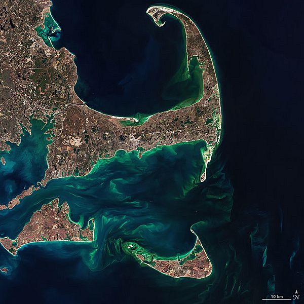
Description: The image below—a closeup of Cape Cod, Martha’s Vineyard, Nantucket, and the shoals between them—was acquired by the Operational Land Imager (OLI) on the Landsat 8 satellite on February 24, 2020.
Title: Capecod oli 2020055
Credit: https://earthobservatory.nasa.gov/images/146412/hints-of-spring-in-the-atlantic
Author: NASA Earth Observatory images by Joshua Stevens and Norman Kuring, using Landsat data from the U.S. Geological Survey
Usage Terms: Public domain
License: Public domain
Attribution Required?: No
Image usage
The following page links to this image:

All content from Kiddle encyclopedia articles (including the article images and facts) can be freely used under Attribution-ShareAlike license, unless stated otherwise.