
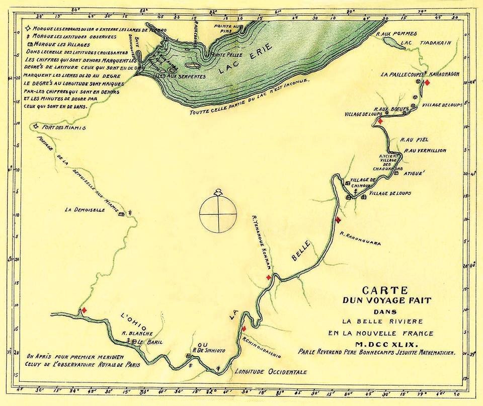
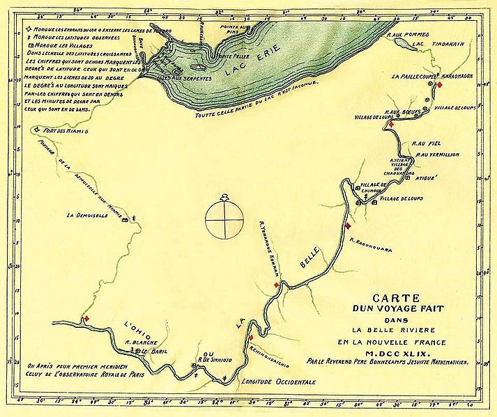
Image: Carte d un voyage fait dans la Belle Riviere en la Nouvelle France M.DCC XLIX. Par le Reverend Pere Bonnecamps Jesuite Mathematicien
Size of this preview: 713 × 599 pixels. Other resolutions: 286 × 240 pixels | 960 × 807 pixels.
Original image (960 × 807 pixels, file size: 241 KB, MIME type: image/jpeg)
Description: Father Bonnecamp's 1749 map showing where lead plates were buried.
Title: Carte d un voyage fait dans la Belle Riviere en la Nouvelle France M.DCC XLIX. Par le Reverend Pere Bonnecamps Jesuite Mathematicien
Credit: facebook.com
Author: Joseph-Pierre de Bonnécamps
Usage Terms: Public domain
License: Public domain
Attribution Required?: No
Image usage
The following 3 pages link to this image:

All content from Kiddle encyclopedia articles (including the article images and facts) can be freely used under Attribution-ShareAlike license, unless stated otherwise.