
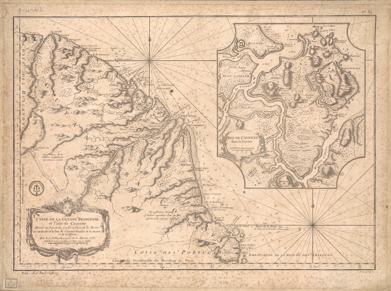
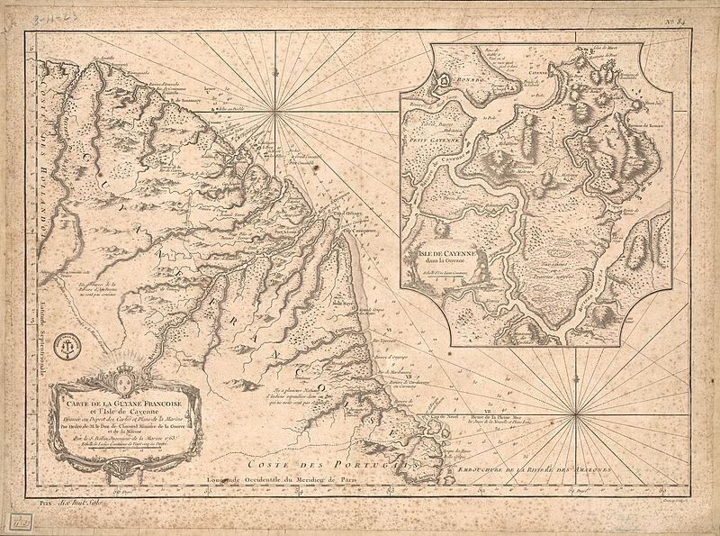
Image: Carte de la Guyane françoise et l'isle de Cayenne (Bellin, 1763)
Size of this preview: 800 × 595 pixels. Other resolutions: 320 × 238 pixels | 1,267 × 943 pixels.
Original image (1,267 × 943 pixels, file size: 1.08 MB, MIME type: image/jpeg)
Description: This map of French Guiana and the island of Cayenne was made in 1763 by Jacques Bellin (1703-72), a prolific cartographer assigned the Ministry of the French Navy.
Title: Carte de la Guyane françoise et l'isle de Cayenne (Bellin, 1763)
Credit: Bibliothèque numérique mondiale
Author: Jacques-Nicolas Bellin
Usage Terms: Public domain
License: Public domain
Attribution Required?: No
Image usage
The following 2 pages link to this image:

All content from Kiddle encyclopedia articles (including the article images and facts) can be freely used under Attribution-ShareAlike license, unless stated otherwise.
.jpg)