
Image: Casa Grande-Corona Satellite Calibration Target-Montgomery-Cornman-survey mark-1

Size of this preview: 800 × 600 pixels. Other resolutions: 320 × 240 pixels | 3,264 × 2,448 pixels.
Original image (3,264 × 2,448 pixels, file size: 2.01 MB, MIME type: image/jpeg)
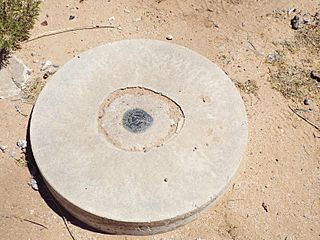
Description: The Corona Satellite Calibration Target U.S. Corps of Engineers 1967 survey mark on the southeast corner of South Montgomery and West Cornman Roads.
Title: Casa Grande-Corona Satellite Calibration Target-Montgomery-Cornman-survey mark-1
Credit: Own work
Author: Marine 69-71
Usage Terms: Creative Commons Attribution-Share Alike 4.0
License: CC BY-SA 4.0
License Link: http://creativecommons.org/licenses/by-sa/4.0
Attribution Required?: Yes
Image usage
The following page links to this image:

All content from Kiddle encyclopedia articles (including the article images and facts) can be freely used under Attribution-ShareAlike license, unless stated otherwise.