
List of historic properties in Casa Grande, Arizona facts for kids
Quick facts for kids
List of historic properties
in Casa Grande, Arizona |
|
|---|---|

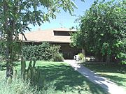
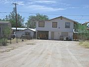
View of Florence Street in Old Casa Grande
|
|

Location in Pinal County and the state of Arizona
|

Welcome to Casa Grande, Arizona! This article will show you some of the amazing old buildings and cool spots that have a special history in this town. You'll see pictures of buildings made from natural stones by a local builder, Michael Sullivan. Many of these places are so important that they are listed on the National Register of Historic Places (NRHP) or the Casa Grande Historic Register.
We'll also explore two secret targets built in the 1960s in the desert near Casa Grande. These were used to help spy satellites from the Corona program work correctly.
And get ready to learn about the mysterious Casa Grande Domes! These strange buildings, which look like flying saucers or giant caterpillars, were started in the 1970s for a computer company but were never finished. They're now abandoned and have even been featured on the Travel Channel show "Ghost Adventures"!
Contents
Discovering Casa Grande's Past
Casa Grande means "big house" in Spanish. This city in Pinal County started in 1879 during Arizona's mining boom. It was first called Terminus because it was the end of the railroad line for a while. Later, it was named after the famous Casa Grande Ruins National Monument, which is actually in Coolidge. The arrival of the Southern Pacific Railroad helped the town grow a lot.
The Casa Grande Valley Historical Society began in 1964. Its goal is to save and share the history of the Casa Grande area.
Protecting Historic Places
Casa Grande has many historic buildings. Some are listed on the National Register of Historic Places (NRHP). Others are recognized by the Casa Grande Historic Preservation Program. This program works to find and list important properties.
However, even if a building is historic, its owner can still choose to tear it down. This means some special old buildings have been lost over time. Here are a few examples of historic homes that were once listed but are no longer standing:
- The John C. Loss House: Built in 1880.
- The Shonessy Building/Don Chun Wo Store: Built in 1913.
- The Souva—Cruz House: A historic home.
Historic Properties at Risk
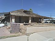
The Arizona Preservation Foundation helps find important historical places that are in danger. In 2012, they pointed out two properties in Casa Grande that were at risk:
- The Fisher Memorial Home.
- The Meehan/Gaar House.
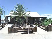
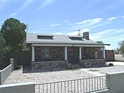
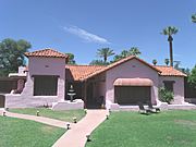
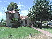
Amazing Historic Buildings
Let's take a closer look at some of the cool historic buildings in Casa Grande.
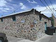
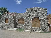
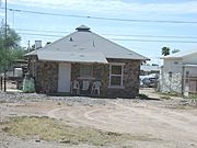
Buildings Made of Fieldstone

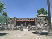
Michael Sullivan was a skilled stonemason in Casa Grande during the 1920s. He built many buildings using fieldstone. Fieldstones are natural stones found on the surface of fields. Sullivan's last project was the Pvt. Matthew B. Juan monument in Sacaton, Arizona. Sadly, he passed away in 1928 before it was dedicated.
Here are some of the unique buildings he created:
- The Emil and Caroline Meyer House: Built in 1920.
- The House at 320 West Eighth Street (also known as The Stone Barber Shop): Built in 1920.
- The Stone Bungalow: Built in 1921.
- The Stone Warehouse: Built in 1922.
- The Casa Grande Woman's Club Building: Built in 1924.
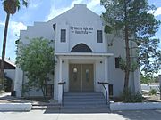
- The Casa Grande Stone Church: Built in 1927.
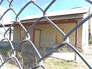
- The Fisher Memorial Home: Built in 1927.
- The Vasquez House: Built in 1927.
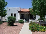
Historic Churches and Places of Worship
Casa Grande is home to several beautiful old churches that are listed on the NRHP:
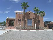
- The Casa Grande Stone Church (also called Heritage Hall): Built in 1927.
- Saint Anthony's Church: Built in 1935.
- Saint Anthony's Church Rectory: Built in 1935.
- The First Baptist Church: Built in 1938.
- The Church of the Nazarene: Built in 1949.
- Historic houses of religious worship in Casa Grande
-
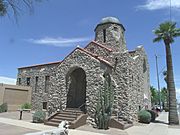
The Casa Grande Stone Church (Heritage Hall).
-
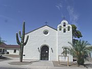
Saint Anthony's Church.
-
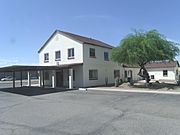
Saint Anthony's Church Rectory.
-
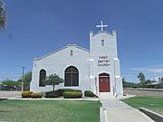
The First Baptist Church.
-
The Church of the Nazarene.


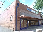
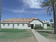
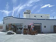
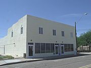
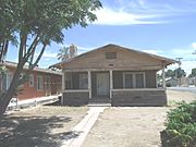
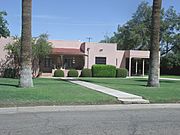
Shops, Schools, and Other Historic Buildings
Casa Grande has many other important historic buildings, from old stores to schools. Here are some of them:
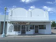
- The Cruz Trading Post: Built in 1888.
- The Casa Grande Hotel: Built in 1898.
- Johnston's Grocery Store: Built in 1907.
- Ward's Variety Store: Built in 1914.
- The Central Creditors Association Building: Built in 1914.
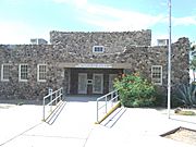
- The Casa Grande Union High School: Built in 1920. This building is now the Casa Grande City Hall.
- The Casa Grande Garage: Built in 1922.
- The Pioneer Market: Built in 1922.
- The Stone Warehouse: Built in 1922.
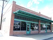
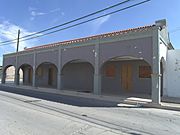
- The Building at 121 North Florence Street: Built in 1923.
- The Casa Grande Woman's Club Building: Built in 1924.
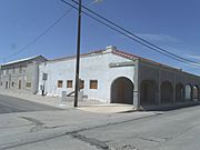
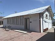
- The Southern Pacific Railroad Depot: Built in 1925.
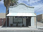
- The Fisher Memorial Home: A house and funeral home built in 1927. Sadly, it was destroyed by fire in 2017.
- The Casa Grande Hospital: Built in 1928.
- The Prettyman's Meat Market and Grocery/Brigg's Jeweler: Built in 1929.
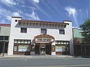
- The Paramount Theatre: Built in 1929.
- The Casa Grande Dispatch Building: Built in 1929.
- The Southside Elementary School: Built in 1930.
- The Rebecca Dalis School House: Built in 1934.
- The Mandell and Meyer Building: Built in 1937.
- The Lincoln Hospital: Built in 1940.
- The S.S. Blinky Jr. Building: Built in 1946.
- The V.W. Kilcrease Building: Built in 1948.
- The William Cox Building: Built in 1948.
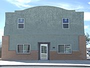
- The Valley National Bank building: Built in 1950.
- The Building at 400 East Third Street (once the Church of Christ): Built in 1950.
- Historic buildings
NRHP
-
The Cruz Trading Post.
-
The Casa Grande Hotel.
-
Johnston's Grocery Store.
-
Ward's Variety Store.
-
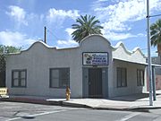
The Central Creditors Association Building.
-
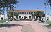
The Casa Grande Union High School.
-
The Casa Grande Garage.
-
The Pioneer Market.
-
The Stone Warehouse.
-
The Building at 121 North Florence Street.
-
The Casa Grande Woman's Club Building.
-
The Southern Pacific Railroad Depot.
-
The Fisher Memorial Home.
-
The Casa Grande Hospital.
-
The Prettyman's Meat Market and Grocery/Brigg's Jeweler.
-
The Paramount Theatre.
-
The Casa Grande Dispatch Building.
-
The Southside Elementary School.
-
The Rebecca Dalis School House.
-
The Mandell and Meyer Building.
-
Lincoln Hospital.
-
The S.S. Blinky Jr. Building.
-
The V.W. Kilcrease Building.
-
The William Cox Building.
-
Valley National Bank.
-
The Building at 400 East Third Street (once the Church of Christ).


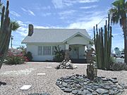
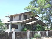
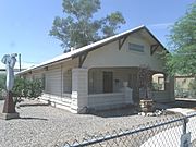
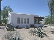
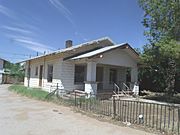
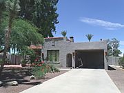
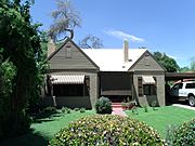
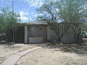
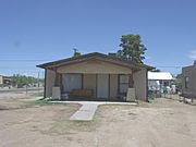
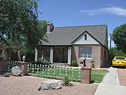
Historic Homes in Casa Grande
Many old houses in Casa Grande are also considered historic. Here are some of them:
- The Bien/McNatt House: Built in 1880.
- The Judge William T. Day House: Built in 1886.
- The Shonessy House: Built in 1900.
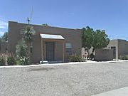
- The Meehan/Gaar House: Built in 1903. Fanne Gaar, who later became the first woman mayor in Arizona, lived here.
- The BeDillions House: Built in 1917.
- The House at 323 West Eighth St.: Built in 1918.
- The House at 736 North Center Avenue: Built in 1919.
- The House at 320 West Eighth Street (also known as The Stone Barber Shop): Built in 1920.
- The Wilbur O. Bayless/Grasty House: Built in 1920.
- The Gus Kratzka House (now the Casa Grande Art Museum): Built in 1929.
- The Henry and Anna Kochsmeier House: Built in 1929.
- The Stone Bungalow: Built in 1921.
- The Earl Bayless House: Built in 1922.
- Extension of the Earl Bayless House: Used as a store.
- The House at North Lehmberg Avenue (also known as Spanish Eclectic House): Built in 1925.
- The Period Revival House: Built in 1927.
- The Vasquez House: Built in 1927.
- The House at 59 North Brown Avenue (also known as Fieldstone House): Built in 1928.
- The Benjamin Templeton House: Built in 1929.
- The House at 317 East Eighth Street: Built in 1929.
- The Emil and Caroline Meyer House: Built in 1920.
- The Dr. H. B. Lehmberg House: Built in 1929.
- The White House: Built in 1929.
- The C. J. (Blinky) Wilson House: Built in 1929.
- The Walter Wilbur House: Built in 1939.
- Historic houses in Casa Grande
NRHP
-
The Bien/McNatt House.
-
The Judge William T. Day House.
-
The Shonessy House.
-
The Meehan/Gaar House.
-
The BeDillions House.
-
The House at 323 West Eighth St..
-
The House at 736 North Center Avenue.
-
The House at 320 West Eighth Street a.k.a. The Stone Barber Shop.
-
The Wilbur O. Bayless/Grasty House.
-
The Gus Kratzka House (now the Casa Grande Art Museum).
-
The Henry and Anna Kochsmeier House.
-
The Stone Bungalow.
-
The Earl Bayless House.
-
Extension of the Earl Bayless House.
-
The House at North Lehmberg Avenue a.k.a. Spanish Eclectic House.
-
The Period Revival House.
-
The Vasquez House.
-
The House at 59 North Brown Avenue a.k.a. Fieldstone House.
-
The Benjamin Templeton House.
-
The House at 317 East Eighth Street.
-
The Emil and Caroline Meyer House.
-
The Dr. H. B. Lehmberg House.
-
The White House.
-
The C. J. (Blinky) Wilson House.
-
The Walter Wilbur House.


-1929.JPG)


_Wilson_House-1929-2.JPG)

A Historic Fire Truck
- The historic Casa Grande Fire Department Engine #1 is a 1928 American LaFrance fire truck. You can see it on display at the Casa Grande Historical Society Museum.
- Fire truck
-
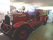
Historic Casa Grande Fire Department Engine #1.

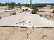
The Secret Corona Satellite Targets
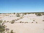
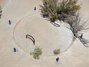
The Corona Satellite Calibration Targets are a super cool piece of history! In the 1960s, 272 concrete markers were built in the empty Arizona desert around Casa Grande, Arizona. These markers helped to set up and check the Corona spy satellites.
Imagine giant concrete crosses on the ground, looking a bit like a Maltese Cross. You could only see them if you walked right up to them or flew high above, like from space!
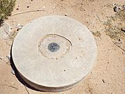
Each target has a secret manhole with a cement cover and handles. This manhole is on the west side of the cross. Some people think the metal bars sticking out around the manhole were used to hold laser lights. These lights would have helped the satellites get a super accurate fix on each target.
The targets were no longer needed after the Corona program ended in 1972. About half of them have been destroyed. But some still remain! Below are pictures of two of these surviving targets.
- Two Corona Satellite Calibration Targets in Casa Grande, Arizona.
-
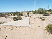
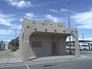
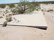
First target (Y4-7) is located on the southeast corner of South Montgomery Road and West Cornman Road.
-
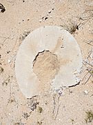
Manhole, with cement cover and rebar handles of the first Corona Satellite Calibration Target.
-
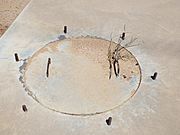
Manhole cover. Around the cover protrudes 6 equal distant pieces of rebar.
-
The first Corona Satellite Calibration Target U.S. Corps of Engineers 1967 survey mark.
-
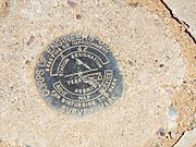
Close-up view of the first Corona Satellite Calibration Target U.S. Corps of Engineers 1967 survey mark.
-
Second Target (Y4-) is located on the northeast corner of West Corman Road and Carmel Blvd.
-
The second Corona Satellite Calibration Target manhole cover.
-
Close-up view of the second Corona Satellite Calibration Target manhole cover.
-
The survey mark of the U.S. Corps of Engineers was once located here.


The Mysterious Casa Grande Domes
The Casa Grande Domes are a very unique and somewhat spooky place! They were built in 1982 for a company called InnerConn Technology Inc. This company made electronics and planned to use the domes as their new main office.
At the start of construction in 1982, the owner, Patricia Zebb, said:
InnerConn opened one office in the domes, but they never started making anything. The company couldn't pay back a loan, and the bank took over the property. So, the domes were left unfinished and abandoned.
Over the years, these strange, crumbling buildings became a popular spot for people to explore, including graffiti artists. Some domes look like flying saucers, while others look like giant caterpillars! They even appeared on the Travel Channel show "Ghost Adventures" in Season 12, Episode 9.
Sadly, in 2017, local officials decided the old domes were too dangerous. Demolition of the domes began on January 9, 2023.

-
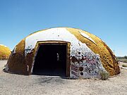
Round dome.
-
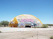
Another round dome.
-
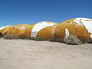
Some domes resembled caterpillars.
-
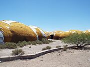
Caterpillar domes.
-
Inside one of the domes.
-
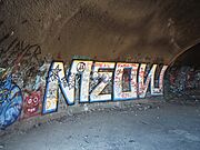
Graffiti inside a dome.


See also
