
Image: Cascadia 1700 tsunami layer Oregon
No higher resolution available.
Cascadia_1700_tsunami_layer_Oregon.jpg (700 × 256 pixels, file size: 96 KB, MIME type: image/jpeg)
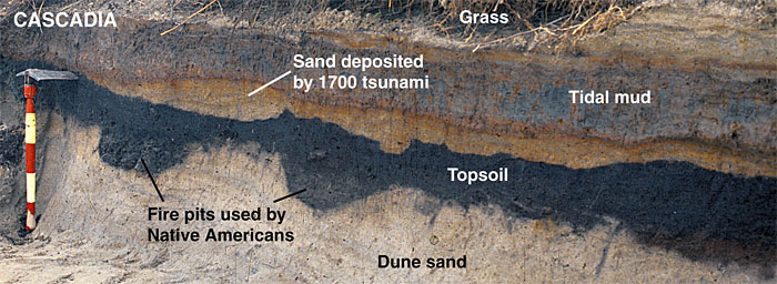
Description: Sand layer from the 1700 Cascadia tsunami covering the remains of a Native American fishing camp exposed in a bank of Oregon's Salmon River. Source: U.S. Geological Survey (taken from the original caption on the source webpage). The date was automatically generated during the upload
Usage Terms: Public domain
Image usage
The following page links to this image:

All content from Kiddle encyclopedia articles (including the article images and facts) can be freely used under Attribution-ShareAlike license, unless stated otherwise.