
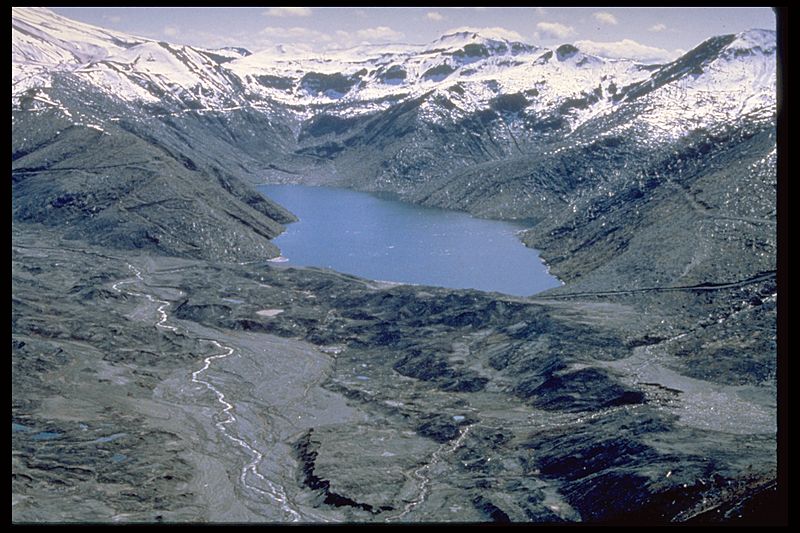
Image: Castle Creek and Castle Lake, Washington

Size of this preview: 800 × 533 pixels. Other resolutions: 320 × 213 pixels | 3,072 × 2,048 pixels.
Original image (3,072 × 2,048 pixels, file size: 3.96 MB, MIME type: image/jpeg)
Description: Aerial view of Castle Creek and Castle Lake, Washington. Part of Mount St. Helens is visible in the upper left corner of the image.
Title: Castle Creek and Castle Lake, Washington
Credit: Smaller image with author notes at https://volcanoes.usgs.gov/volcanoes/st_helens/st_helens_geo_hist_107.html Full-resolution image at https://volcanoes.usgs.gov/vsc/images/image_mngr/500-599/img553.jpg
Author: Credited to Dr. Robert L. Schuster, US Geological Survey
Usage Terms: Public domain
License: Public domain
Attribution Required?: No
Image usage
The following page links to this image:

All content from Kiddle encyclopedia articles (including the article images and facts) can be freely used under Attribution-ShareAlike license, unless stated otherwise.