
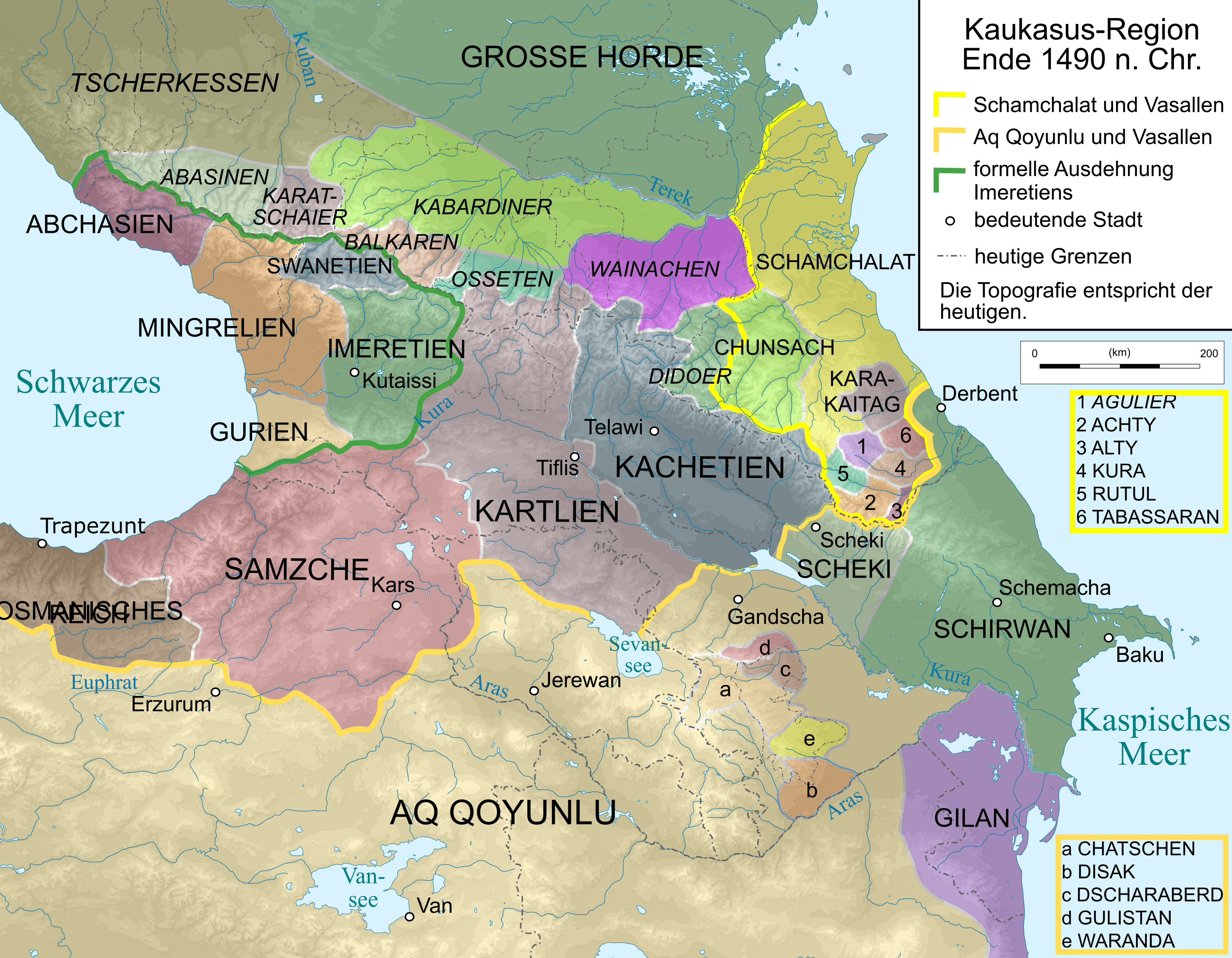
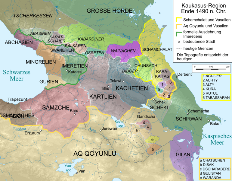
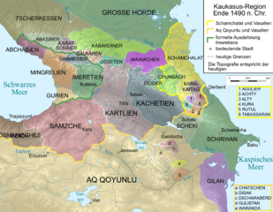
Image: Caucasus 1490 map de
Size of this preview: 771 × 600 pixels. Other resolutions: 309 × 240 pixels | 2,995 × 2,329 pixels.
Original image (2,995 × 2,329 pixels, file size: 1.42 MB, MIME type: image/png)
Description: Map of Caucasus Region 1460 in German.
Title: Caucasus 1490 map de
Credit: Own work, derivate of File:Caucasus_topographic_map-fr.svg
Author: File:Caucasus topographic map-fr.svg by Bourrichon - fr:Bourrichon * This derivative by Don-kun and WajWohu
Usage Terms: Creative Commons Attribution-Share Alike 3.0
License: CC BY-SA 3.0
License Link: https://creativecommons.org/licenses/by-sa/3.0
Attribution Required?: Yes
Image usage
The following page links to this image:

All content from Kiddle encyclopedia articles (including the article images and facts) can be freely used under Attribution-ShareAlike license, unless stated otherwise.