
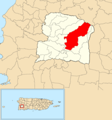
Image: Caín Alto, San Germán, Puerto Rico locator map

Size of this preview: 559 × 600 pixels. Other resolutions: 224 × 240 pixels | 1,100 × 1,180 pixels.
Original image (1,100 × 1,180 pixels, file size: 55 KB, MIME type: image/png)
Description: Caín Alto, San Germán, Puerto Rico locator map
Title: Caín Alto, San Germán, Puerto Rico locator map
Credit: PR GIS data from http://www.gis.pr.gov/Pages/default.aspx Downloaded version, once unzipped reads, "barrios_2015_geold_corrected_16_nov17" using gvSIG desktop 2.4.0.2850 final Own work
Author: The Eloquent Peasant
Usage Terms: Creative Commons Attribution-Share Alike 4.0
License: CC BY-SA 4.0
License Link: https://creativecommons.org/licenses/by-sa/4.0
Attribution Required?: Yes
Image usage
The following page links to this image:

All content from Kiddle encyclopedia articles (including the article images and facts) can be freely used under Attribution-ShareAlike license, unless stated otherwise.