
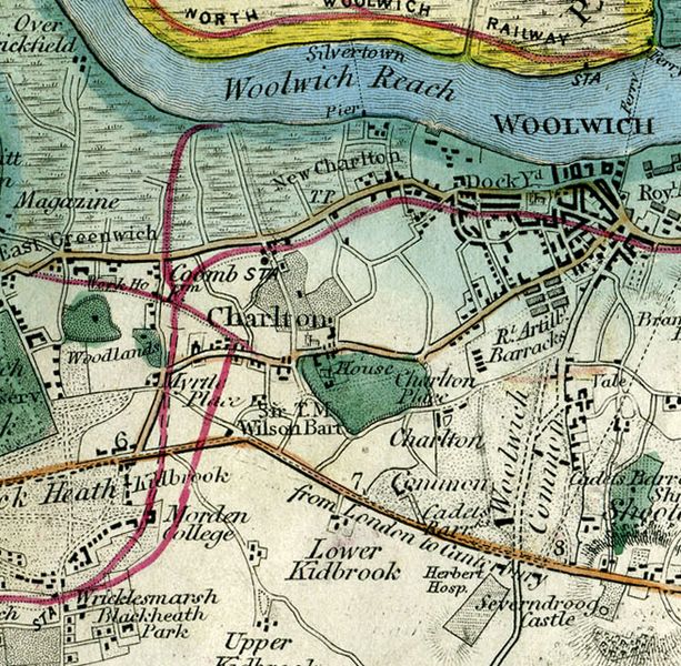
Image: Charlton, London (Wyld, 1872)

Size of this preview: 613 × 600 pixels. Other resolutions: 245 × 240 pixels | 655 × 641 pixels.
Original image (655 × 641 pixels, file size: 787 KB, MIME type: image/jpeg)
Description: The area of Charlton from James Wyld's A New Topographical Map Of The Country In The Vicinity Of London, Describing All The New Improvements, Metropolitan Boroughs And Parish Boundaries of 1872
Title: Charlton, London (Wyld, 1872)
Credit: http://www.ph.ucla.edu/epi/snow/1872map/4_8c.htm
Author: James Wyld
Usage Terms: Public domain
License: Public domain
Attribution Required?: No
Image usage
The following page links to this image:

All content from Kiddle encyclopedia articles (including the article images and facts) can be freely used under Attribution-ShareAlike license, unless stated otherwise.
.jpg)