
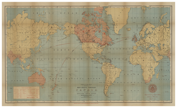
Image: Chart of the World showing New Route through Canada between England, China, Japan, Australasia and the East. By J. Johnston. Department of Agriculture, Ottawa, Canada, 1886 CTASC
Description: French map of New France and Atlantic Canada, published around 1799. Some of Ontario (including Lake Ontario) is visible, as is some of New England. Cities, towns, provinces, territories, regions, and bodies of water are named. An inset map in the lower left shows the Great Lakes. The locations of Indigenous communities are noted throughout the map, including the Iroquois, Inuit, Wyandot, Oneida, Algonquin, and Montagnais peoples (may be listed on the map by sub-group names or incorrect names). Relief shown pictorially.
Title: Chart of the World showing New Route through Canada between England, China, Japan, Australasia and the East. By J. Johnston. Department of Agriculture, Ottawa, Canada, 1886
Credit: York University Libraries, Clara Thomas Archives & Special Collections, Historical map collection, HMC0002. http://digital.library.yorku.ca/islandora/object/yul:1153557
Author: Johnson, George, 1837-1911 and Johnston, J. (John)
Usage Terms: Public domain
License: Public domain
Attribution Required?: No
Image usage
The following page links to this image:
