
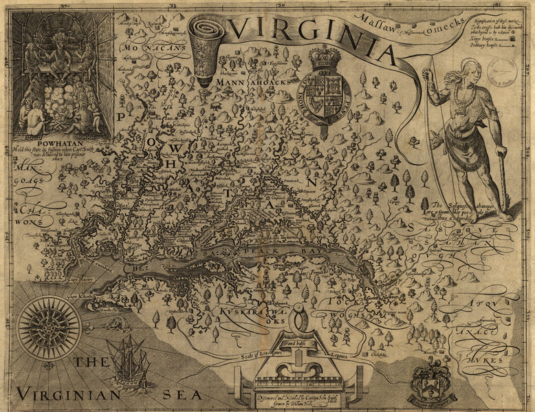
Image: Chesapeake Bay Map 1612
Size of this JPG preview of this TIF file: 778 × 599 pixels. Other resolution: 312 × 240 pixels.
Original image (4,993 × 3,847 pixels, file size: 54.97 MB, MIME type: image/tiff)
Description: A map produced in 1612 by Captain John Smith and engraved by William Hole that describes the Chesapeake Bay and its tributaries, as well as local native people. The map is oriented with West at the top.
Title: Chesapeake Bay Map 1612
Credit: https://www.loc.gov/resource/g3880.ct000377
Author: John Smith - (1580 - 1631) William Hole - (? - 1624)
Usage Terms: Public domain
License: Public domain
Attribution Required?: No
Image usage
The following page links to this image:

All content from Kiddle encyclopedia articles (including the article images and facts) can be freely used under Attribution-ShareAlike license, unless stated otherwise.