
Image: Chichimecas
Size of this preview: 445 × 600 pixels. Other resolutions: 178 × 240 pixels | 713 × 961 pixels.
Original image (713 × 961 pixels, file size: 58 KB, MIME type: image/png)
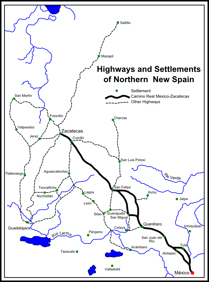
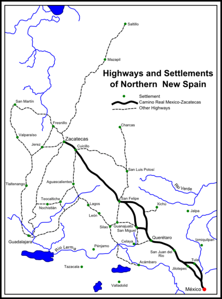
Description: Map of the of northern Viceroyalty of New Spain (Colonial Mexico). With the late sixteenth century settlement of the 'Gran Chichimeca'. Credits Inspired from a map used in Phillip Wayne Powell, Soldiers, Indians, and Silver: The Northward Advance of New Spain 1550-1600. University of California Press, 1952. p. 20
Title: Chichimecas
Credit: Own work
Author: Grin20
Usage Terms: Creative Commons Attribution-Share Alike 3.0
License: CC BY-SA 3.0
License Link: https://creativecommons.org/licenses/by-sa/3.0
Attribution Required?: Yes
Image usage
The following page links to this image:

All content from Kiddle encyclopedia articles (including the article images and facts) can be freely used under Attribution-ShareAlike license, unless stated otherwise.