
Image: Chicxulub seismic & borehole map
Size of this preview: 702 × 600 pixels. Other resolutions: 281 × 240 pixels | 2,379 × 2,032 pixels.
Original image (2,379 × 2,032 pixels, file size: 964 KB, MIME type: image/png)
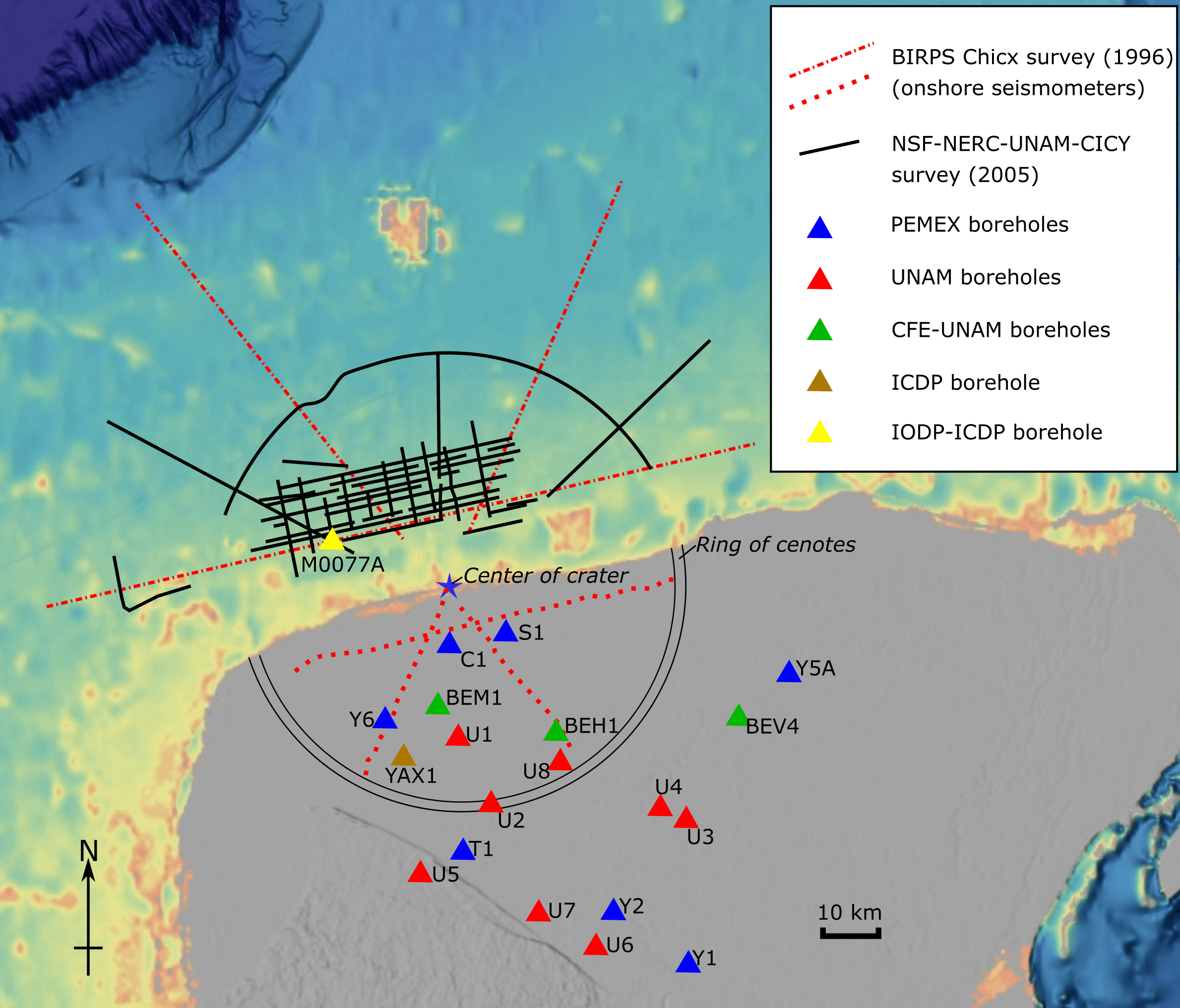
Description: Map showing the location of offshore seismic profiles (acquired in 1996 and 2005) and boreholes drilled around the Chicxulub impact structure, Yucatan Peninsula, Mexico. Base is taken from the NCEI Bathymetric Data Viewer
Title: Chicxulub seismic & borehole map
Credit: Own work
Author: Mikenorton
Usage Terms: Creative Commons Attribution-Share Alike 4.0
License: CC BY-SA 4.0
License Link: https://creativecommons.org/licenses/by-sa/4.0
Attribution Required?: Yes
Image usage
The following page links to this image:

All content from Kiddle encyclopedia articles (including the article images and facts) can be freely used under Attribution-ShareAlike license, unless stated otherwise.