
Image: China's 2009 nine-dash line map submission to the UN.pdf
Size of this JPG preview of this PDF file: 463 × 599 pixels. Other resolution: 185 × 240 pixels.
Original image (1,275 × 1,650 pixels, file size: 412 KB, MIME type: application/pdf)
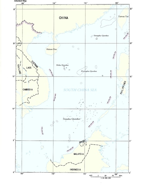
Description: Document “CML/17/2009” May 7, 2009, submitted by the People's Republic of China to the United Nations Commission on the Limits of the Continental Shelf. The map here is the second page in a two-page document. The first page is a text addressed to the UN Secretary General, noting China's sovereignty claim to the "islands in the South China Sea and the adjacent waters", however, the document remains ambiguous by being silent as to the precise meaning of the map enclosed, and the meaning of the nine-dash line on it
Usage Terms: Public domain
Image usage
The following page links to this image:

All content from Kiddle encyclopedia articles (including the article images and facts) can be freely used under Attribution-ShareAlike license, unless stated otherwise.