Image: Chumar-Chepzi-claim-lines-LSIB

Size of this preview: 800 × 550 pixels. Other resolutions: 320 × 220 pixels | 954 × 656 pixels.
Original image (954 × 656 pixels, file size: 60 KB, MIME type: image/jpeg)
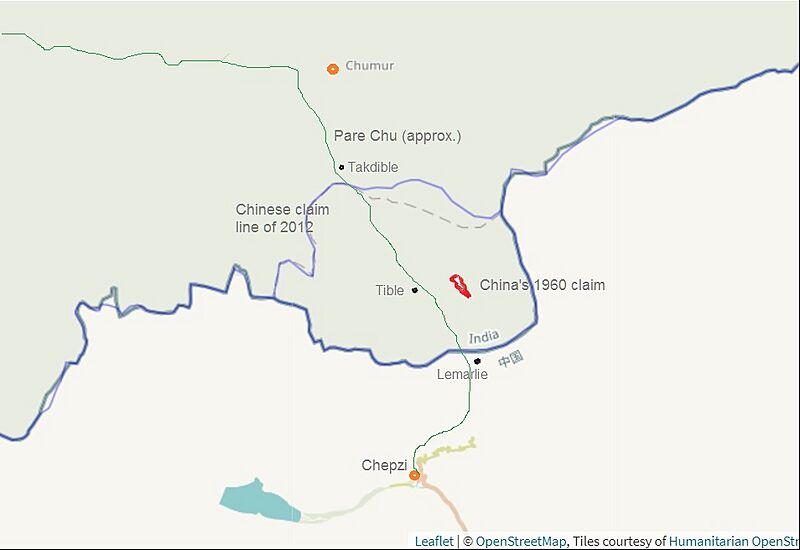
Description: The map depicts the Line of Actual Control (LAC) between Ladakh and Tibet across the Pare Chu river (in green), the Indian and Chinese claim lines as marked by the US Office of Geographer in 2012 (in blue), annotated with approximate locations of other locations and features.
Title: Chumar-Chepzi-claim-lines-LSIB
Credit: https://earthworks.stanford.edu/catalog/stanford-jd523yw3613
Author: US Office Geographer, Stanford University, OpenStreetMap, annotates by User:Kautilya3
Usage Terms: Public domain
License: Public domain
Attribution Required?: No
Image usage
The following page links to this image:

All content from Kiddle encyclopedia articles (including the article images and facts) can be freely used under Attribution-ShareAlike license, unless stated otherwise.
