
Image: Cincinnati-canal-map

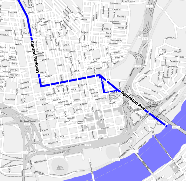
Description: A map showing the former location of the Miami and Erie Canal in downtown Cincinnati. The canal followed modern day Central Parkway until it reached the intersection of Eggleston Ave, at which point it followed Eggleston Ave and cut through Sawyer point and ended in the Ohio River. 1838 bridges at Liberty, 12th, Elm, Race, Vine, Walnut, Main, Sycamore, Court, Broadway, 3rd, and East Front (which no longer exist and is now a part of Sawyer Point) Streets are shown on the map. This map was derived from a free openstreetmap.org map. The location of the bridges and canal was determined from Image:Cincinnati-map-1838.jpg. The triangular section of the canal allowed boats to more easily turn around.
Title: Cincinnati-canal-map
Credit: Derived from http://www.openstreetmap.org/ and Image:Cincinnati-map-1838.jpg
Author: Wholtone
Usage Terms: Creative Commons Attribution 3.0
License: CC BY 3.0
License Link: https://creativecommons.org/licenses/by/3.0
Attribution Required?: Yes
Image usage
The following page links to this image:
