
Image: Close up of Earthquake House, Comrie. - geograph.org.uk - 242045

Size of this preview: 450 × 600 pixels. Other resolutions: 180 × 240 pixels | 480 × 640 pixels.
Original image (480 × 640 pixels, file size: 80 KB, MIME type: image/jpeg)
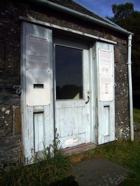
Description: Close up of Earthquake House, Comrie. Lying on the Highland Boundary Fault, Comrie has experienced many tremors in the past, hence its nickname, "Shaky Town". The World's first seismometer was set up here in 1840 and housed in this building in 1869.
Title: Close up of Earthquake House, Comrie. - geograph.org.uk - 242045
Credit: From geograph.org.uk
Author: Bill Cresswell
Usage Terms: Creative Commons Attribution-Share Alike 2.0
License: CC BY-SA 2.0
License Link: http://creativecommons.org/licenses/by-sa/2.0
Attribution Required?: Yes
Image usage
The following page links to this image:

All content from Kiddle encyclopedia articles (including the article images and facts) can be freely used under Attribution-ShareAlike license, unless stated otherwise.